Login
Register


HPT
Hampton Municipal Airport
Official FAA Data Effective 2026-02-19 0901Z
Chart Supplement

VFR Chart of KHPT
Sectional Charts at SkyVector.com
IFR Chart of KHPT
Enroute Charts at SkyVector.com
Location Information for KHPT
Coordinates: N42°43.42' / W93°13.58'Located 02 miles SW of Hampton, Iowa on 78 acres of land. View all Airports in Iowa.
Surveyed Elevation is 1176 feet MSL.
Operations Data
|
|
Airport Communications
| AWOS-3: | 121.025 Tel. 641-456-4055 |
|---|---|
| UNICOM: | 122.700 |
| CTAF: | 122.700 |
| AWOS-3 at IFA (15.4 S): | 120.425 641-648-2469 |
| AWOS-3 at CAV (23.5 W): | 126.575 515-532-3515 |
| ASOS at MCW (26.5 N): | 120.300 641-255-0381 |
- APCH/DEP SVC PRVDD BY MINNEAPOLIS ARTCC ON FREQS 134.0/288.3 (FORT DODGE RCAG).
Nearby Navigation Aids
|
| ||||||||||||||||||||||||||||||||||||||||||||||||


Runway 17/35
| Dimensions: | 4020 x 75 feet / 1225 x 23 meters | |
|---|---|---|
| Surface: | Concrete in Good Condition | |
| Weight Limits: | 6 /R/D/W/U, S-12 | |
| Edge Lighting: | Medium Intensity | |
| Runway 17 | Runway 35 | |
| Coordinates: | N42°43.75' / W93°13.58' | N42°43.09' / W93°13.58' |
| Elevation: | 1176.3 | 1159.2 |
| Traffic Pattern: | Left | Left |
| Runway Heading: | 180° True | 0 |
| Markings: | Non-Precision Instrument in good condition. | Non-Precision Instrument in good condition. |
| Glide Slope Indicator | P2L (3.00° Glide Path Angle) | P2L (3.00° Glide Path Angle) |
| REIL: | Yes | Yes |
Services Available
| Fuel: | 100LL (blue), Jet-A |
|---|---|
| Transient Storage: | Hangars,Tiedowns |
| Airframe Repair: | MINOR |
| Engine Repair: | MINOR |
| Bottled Oxygen: | NONE |
| Bulk Oxygen: | NONE |
Ownership Information
| Ownership: | Publicly owned | |
|---|---|---|
| Owner: | CITY OF HAMPTON | |
| 122 1ST AVE. NW | ||
| HAMPTON, IA 50441 | ||
| 641-456-4853 | ||
| Manager: | JAY SCHUMANN | SCHUMANN AVIATION |
| 1274 B OLIVE AVE | ||
| HAMPTON, IA 50441 | ||
| 641-456-4102 | ||
Other Remarks
- FOR CD CTC MINNEAPOLIS ARTCC AT 651-463-5588.
- ACTVT REIL RWY 17 & 35; PAPI RWY 17 & 35; MIRL RWY 17/35 - CTAF.
Weather Minimums

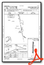
Instrument Approach Procedure (IAP) Charts


Nearby Airports with Instrument Procedures
| ID | Name | Heading / Distance | ||
|---|---|---|---|---|
 |
KIFA | Iowa Falls Municipal Airport | 187° | 15.3 |
|
KCAV | Clarion Municipal Airport | 272° | 23.6 |
|
KMCW | Mason City Municipal Airport | 349° | 26.4 |
|
KEAG | Eagle Grove Municipal Airport | 268° | 30.5 |
|
C25 | Waverly Municipal Airport | 087° | 31.8 |
|
KEBS | Webster City Municipal Airport | 239° | 33.3 |
|
KCCY | Northeast Iowa Regional Airport | 052° | 34.3 |
|
KFXY | Forest City Municipal/Trimble Field Airport | 330° | 35.3 |
|
KALO | Waterloo Regional Airport | 104° | 37.9 |
|
KMIW | Marshalltown Municipal Airport | 159° | 39.1 |
|
KFOD | Fort Dodge Regional Airport | 256° | 44.0 |
|
KAMW | Ames Municipal Airport | 201° | 47.3 |
Airport Images
Do you have a recent image of this airport? Upload it here!


