Login
Register


K82
Smith Center Municipal Airport
Official FAA Data Effective 2026-02-19 0901Z
Chart Supplement

VFR Chart of K82
Sectional Charts at SkyVector.com
IFR Chart of K82
Enroute Charts at SkyVector.com
Location Information for K82
Coordinates: N39°45.76' / W98°47.67'Located 01 miles SW of Smith Center, Kansas on 200 acres of land. View all Airports in Kansas.
Surveyed Elevation is 1799 feet MSL.
Operations Data
|
|
Airport Communications
| AWOS-3PT: | 118.450 Tel. 785-282-8326 |
|---|---|
| UNICOM: | 122.800 |
| CTAF: | 122.800 |
| AWOS-2 at K75 (20.5 S): | 120.025 785-345-4998 |
| AWOS-3PT at PHG (24.2 W): | 119.125 785-543-8960 |
| AWOS-3PT at RCP (34.4 SW): | 120.075 785-425-7042 |
- APCH/DEP SVC PRVDD BY MINNEAPOLIS ARTCC ON FREQS 119.4/278.8 (HASTINGS RCAG).
Nearby Navigation Aids
|
| ||||||||||||||||||||||||||||||||||||||||||||||||||||||||||||


Runway 14/32
| Dimensions: | 4400 x 75 feet / 1341 x 23 meters | |
|---|---|---|
| Surface: | Concrete in Good Condition | |
| Weight Limits: | 11 /R/C/X/U, S-30, D-30 | |
| Edge Lighting: | Medium Intensity | |
| Runway 14 | Runway 32 | |
| Coordinates: | N39°46.12' / W98°47.93' | N39°45.49' / W98°47.47' |
| Elevation: | 1785.7 | 1799.5 |
| Traffic Pattern: | Left | Left |
| Runway Heading: | 151° True | 331° True |
| Markings: | Non-Precision Instrument in good condition. | Non-Precision Instrument in good condition. |
| Glide Slope Indicator | P4L (3.00° Glide Path Angle) | P4L (3.00° Glide Path Angle) |
| REIL: | Yes | Yes |
| Obstacles: | 32 ft Trees 840 ft from runway, 83 ft left of center | |
Services Available
| Fuel: | 100LL (blue) |
|---|---|
| Transient Storage: | Tiedowns |
| Airframe Repair: | NOT AVAILABLE |
| Engine Repair: | NOT AVAILABLE |
| Bottled Oxygen: | NONE |
| Bulk Oxygen: | NONE |
| Other Services: | CROP DUSTING SERVICES |
Ownership Information
| Ownership: | Publicly owned | |
|---|---|---|
| Owner: | CITY OF SMITH CENTER | |
| 119 W COURT | ||
| SMITH CENTER, KS 66967 | ||
| 785-282-3812 | ||
| Manager: | RICK HILEMAN | |
| 119 WEST COURT | ||
| SMITH CENTER, KS 66967 | ||
| 785-282-5833 | ||
Other Remarks
- FOR CD CTC MINNEAPOLIS ARTCC AT 651-463-5588.
- NO LINE OF SIGHT BETWEEN RWY ENDS.
- 0LL FUEL 24 HR SELF SERVE.
- ACTVT REIL RWY 14 & 32; PAPI RWY 14 & 32; MIRL RWY 14/32 - CTAF.
Weather Minimums

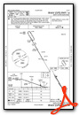
Instrument Approach Procedure (IAP) Charts

Nearby Airports with Instrument Procedures
| ID | Name | Heading / Distance | ||
|---|---|---|---|---|
 |
7V7 | Red Cloud Municipal Airport | 031° | 22.4 |
|
KPHG | Phillipsburg Municipal Airport | 266° | 24.3 |
|
4D9 | Alma Municipal Airport | 309° | 33.0 |
|
KRCP | Rooks County Regional Airport | 223° | 34.4 |
|
K61 | Moritz Memorial Airport | 119° | 35.5 |
|
12K | Superior Municipal Airport | 063° | 37.9 |
|
0V3 | Pioneer Village Field Airport | 351° | 45.6 |
|
KHDE | Brewster Field Airport | 329° | 48.3 |
|
KNRN | Norton Municipal Airport | 276° | 51.1 |
|
KRPB | Belleville Municipal Airport | 086° | 52.6 |
|
KHLC | Hill City Municipal Airport | 244° | 53.3 |
|
KHSI | Hastings Municipal Airport | 018° | 53.3 |
Airport Images
Do you have a recent image of this airport? Upload it here!


