Login
Register


CCB
Cable Airport
Official FAA Data Effective 2026-01-22 0901Z
Chart Supplement

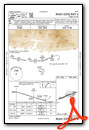
VFR Chart of KCCB
Sectional Charts at SkyVector.com
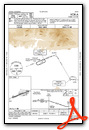
IFR Chart of KCCB
Enroute Charts at SkyVector.com
Location Information for KCCB
Coordinates: N34°6.70' / W117°41.24'Located 02 miles NW of Upland, California on 95 acres of land. View all Airports in California.
Surveyed Elevation is 1443 feet MSL.
Operations Data
|
|
Airport Communications
| AWOS-3P: | 119.525 Tel. 909-985-4731 |
|---|---|
| SOCAL APPROACH: | 125.5 ;SW-NORTH 349.0 ;SW-NORTH |
| SOCAL DEPARTURE: | 125.5 ;SW-NORTH 349.0 ;SW-NORTH |
| CTAF: | 123.000 |
| UNICOM: | 123.000 |
| AWOS-3PT at POC (4.7 W): | 909-962-5407 |
| D-ATIS at POC (4.8 W): | 124.4 |
| D-ATIS at ONT (5.4 SE): | 124.25 |
Nearby Navigation Aids
|
| ||||||||||||||||||||||||||||||||||||||||||


Runway 06/24
| Dimensions: | 3863 x 75 feet / 1177 x 23 meters | |
|---|---|---|
| Surface: | Asphalt in Good Condition | |
| Weight Limits: | S-20
GROSS PAVEMENT STRENGTH PRVDD BY ARPT OPERATOR 12500 LBS.
| |
| Edge Lighting: | Medium Intensity | |
| Runway 06 | Runway 24 | |
| Coordinates: | N34°6.58' / W117°41.60' | N34°6.81' / W117°40.89' |
| Elevation: | 1393.0 | 1443.5 |
| Traffic Pattern: | Left | Left |
| Runway Heading: | 69° True | 249° True |
| Displaced Threshold: | 106 Feet | 157 Feet |
| Markings: | Non-Precision Instrument in good condition. | Basic in good condition. |
| Glide Slope Indicator | V2L (4.00° Glide Path Angle) | V2R (4.00° Glide Path Angle) UNUSBL BYD 5 DEG LEFT AND 2 DEG RIGHT OF RWY CNTRLN. |
| Obstacles: | 9 ft Road 200 ft from runway APCH RATIO TO DSPLCD THR OVER +9 FT ROAD 220 FT FROM DSPLCD THR; 24:1. +6 FT FENCE WITH RED LGTS 50 FT FROM THLD. |
|
Helipad H1
| Dimensions: | 65 x 65 feet / 20 x 20 meters | |
|---|---|---|
| Surface: | Asphalt in Good Condition | |
| Edge Lighting: | Perimeter | |
| Coordinates: | N34°6.76' / W117°40.94' | N0°0.00' / E0°0.00' |
| Elevation: | 1430.0 | |
Helipad H2
| Dimensions: | 65 x 65 feet / 20 x 20 meters | |
|---|---|---|
| Surface: | Asphalt-Concrete in Good Condition | |
| Coordinates: | N34°6.77' / W117°40.92' | N0°0.00' / E0°0.00' |
| Elevation: | 1433.0 | |
Services Available
| Fuel: | 100LL (blue), Jet-A |
|---|---|
| Transient Storage: | Tiedowns |
| Airframe Repair: | MAJOR |
| Engine Repair: | MAJOR |
| Bottled Oxygen: | HIGH/LOW |
| Bulk Oxygen: | HIGH/LOW |
| Other Services: | AVIONICS,PILOT INSTRUCTION,AIRCRAFT RENTAL,AIRCRAFT SALES |
Ownership Information
| Ownership: | Privately Owned | |
|---|---|---|
| Owner: | CABLE LAND CO - A PARTNERSHIP | |
| 1749 WEST 13TH STREET | ||
| UPLAND, CA 91786-2199 | ||
| 909-982-6021 | ||
| Manager: | BOB CABLE | SDUNN@CABLEAIRPORT.COM |
| 1749 WEST 13TH STREET | ||
| UPLAND, CA 91786-2199 | ||
| 909-573-5558 | ||
Other Remarks
- FOR CD CTC SOCAL APCH AT 800-448-3724.
- 0LL SELF SERVICE 24 HOUR
- ACTVT HELIPAD H1 PERIMETER LGTS - CTAF. MIRL RWY 06/24 PRESET ON LOW INTST SS-SR ACTVT HIGH INTST - CTAF.
Weather Minimums
Instrument Approach Procedure (IAP) Charts
Nearby Airports with Instrument Procedures
| ID | Name | Heading / Distance | ||
|---|---|---|---|---|
 |
KPOC | Brackett Field Airport | 255° | 4.9 |
|
KONT | Ontario International Airport | 127° | 5.4 |
|
KCNO | Chino Airport | 162° | 8.6 |
|
KAJO | Corona Municipal Airport | 161° | 13.5 |
|
KRAL | Riverside Airport | 128° | 15.4 |
|
KRIR | Flabob Airport | 117° | 15.7 |
|
KEMT | San Gabriel Valley Airport | 265° | 17.4 |
|
KFUL | Fullerton Municipal Airport | 225° | 20.5 |
|
KSBD | San Bernardino International Airport | 092° | 22.6 |
|
KRIV | March Arb Airport | 122° | 25.4 |
|
KSLI | Los Alamitos AAF Airport | 223° | 26.5 |
|
KREI | Redlands Municipal Airport | 093° | 27.0 |
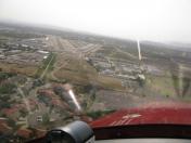
Airport Images

By: Dave
By: myrv9.com


Comments
Controlled Airspaces
Be wary of ONT's Class C airspace.
Call POC Tower for a transition when arriving or departing west.