Login
Register


RIR
Flabob Airport
Official FAA Data Effective 2026-01-22 0901Z
Chart Supplement

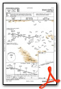
VFR Chart of KRIR
Sectional Charts at SkyVector.com
IFR Chart of KRIR
Enroute Charts at SkyVector.com
Location Information for KRIR
Coordinates: N33°59.33' / W117°24.59'Located 03 miles NW of Riverside/Rubidoux/, California on 127 acres of land. View all Airports in California.
Estimated Elevation is 767 feet MSL.
NIGHT TPA 1000 FT AGL AROUND THE MOUNTAIN.
Operations Data
|
|
Airport Communications
| SOCAL APPROACH: | 135.4 377.125 |
|---|---|
| SOCAL DEPARTURE: | 135.4 377.125 |
| CTAF: | 122.800 |
| UNICOM: | 122.800 |
| CLASS C: | 135.4 ;SOUTH-SW 377.125 ;SOUTH-SW |
| ATIS at RAL (2.8 SW): | 128.8 |
| ASOS at RAL (2.8 SW): | 128.8 951-352-4392 |
| ATIS at RIV (9.9 SE): | 134.75 |
Nearby Navigation Aids
|
| ||||||||||||||||||||||||||||||||||||||||||


Runway 06/24
| Dimensions: | 3190 x 50 feet / 972 x 15 meters | |
|---|---|---|
| Surface: | Asphalt in Good Condition | |
| Edge Lighting: | Medium Intensity RWY 06/24 NSTD MIRL GTR THAN 10 FT FROM RWY EDGE. | |
| Runway 06 | Runway 24 | |
| Coordinates: | N33°59.27' / W117°24.90' | N33°59.39' / W117°24.29' |
| Elevation: | 750.3 | 766.8 |
| Traffic Pattern: | Left | Left |
| Runway Heading: | 77° True | 257° True |
| Markings: | Non-Precision Instrument in good condition. | Non-Precision Instrument in good condition. |
| Obstacles: | 25 ft Trees 310 ft from runway | |
Services Available
| Fuel: | 100LL (blue) |
|---|---|
| Transient Storage: | Tiedowns |
| Airframe Repair: | MAJOR |
| Engine Repair: | MAJOR |
| Bottled Oxygen: | NONE |
| Bulk Oxygen: | NONE |
| Other Services: | PILOT INSTRUCTION |
Ownership Information
| Ownership: | Privately Owned | |
|---|---|---|
| Owner: | FLABOB AIRPORT, LLC | |
| 4130 MENNES AVE | ||
| RIVERSIDE, CA 92509 | ||
| 951-683-2309 | ||
| Manager: | COLEMAN FAIT | |
| 4130 MENNES AVE | ||
| RIVERSIDE, CA 92509 | ||
| 951-683-2309 | ||
Other Remarks
- MTN 1340 FT MSL 3/4 MILE SE OF ARPT +20 FT CROSS ON TOP.
- DEPARTURES TO THE SOUTH CTC RIVERSIDE ATCT.
- RY 24 AFT TKOF TURN LEFT 10 DEG; STAY NORTH OF RIVERBED.
- RY 24 CALM WIND RY.
- FOR CD CTC SOCAL APCH AT 800-448-3724.
- DUSK-DAWN. ACTVT MIRL RY 06/24 - CTAF.
- NIGHT TPA 1000 FT AGL AROUND THE MOUNTAIN.
Weather Minimums
Instrument Approach Procedure (IAP) Charts
Nearby Airports with Instrument Procedures
| ID | Name | Heading / Distance | ||
|---|---|---|---|---|
 |
KRAL | Riverside Airport | 218° | 2.8 |
|
KRIV | March Arb Airport | 130° | 9.9 |
|
KONT | Ontario International Airport | 292° | 10.4 |
|
KSBD | San Bernardino International Airport | 053° | 10.8 |
|
KAJO | Corona Municipal Airport | 240° | 11.1 |
|
KCNO | Chino Airport | 265° | 11.3 |
|
KREI | Redlands Municipal Airport | 066° | 14.4 |
|
KCCB | Cable Airport | 298° | 15.7 |
|
KPOC | Brackett Field Airport | 288° | 19.5 |
|
KHMT | Hemet-Ryan Airport | 128° | 24.7 |
|
F70 | French Valley Airport | 150° | 28.5 |
|
KFUL | Fullerton Municipal Airport | 256° | 29.3 |
Airport Images

By: Barnstormers Bi...

By: Barnstormers Bi...
- 1 of 2
- next ›


