Login
Register


CEY
Kyle-Oakley Field Airport
Official FAA Data Effective 2026-02-19 0901Z
Chart Supplement

VFR Chart of KCEY
Sectional Charts at SkyVector.com
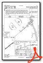
IFR Chart of KCEY
Enroute Charts at SkyVector.com
Location Information for KCEY
Coordinates: N36°39.87' / W88°22.37'Located 04 miles NW of Murray, Kentucky on 300 acres of land. View all Airports in Kentucky.
Surveyed Elevation is 577 feet MSL.
Operations Data
|
|
Airport Communications
| AWOS-3: | 119.975 Tel. 270-489-2424 |
|---|---|
| UNICOM: | 122.700 |
| CTAF: | 122.700 |
| AWOS-3 at M25 (12.0 NW): | 120.625 270-247-2094 |
| AWOS-3 at PHT (19.7 S): | 118.825 731-644-0451 |
| ASOS at PAH (31.0 NW): | 118.375 270-366-0642 |
- APCH/DEP SVC PRVDD BY MEMPHIS ARTCC ON FREQS 133.65/292.15 (PADUCAH RCAG).
Nearby Navigation Aids
|
| ||||||||||||||||||||||||||||||||||||||||||||||||||||||||||||


Runway 05/23
| Dimensions: | 6202 x 100 feet / 1890 x 30 meters | |
|---|---|---|
| Surface: | Asphalt / Aggregate Friction Seal Coated in Fair Condition | |
| Weight Limits: | 37 /F/C/X/T, S-95, D-131 | |
| Edge Lighting: | Medium Intensity | |
| Runway 05 | Runway 23 | |
| Coordinates: | N36°39.55' / W88°22.85' | N36°40.20' / W88°21.88' |
| Elevation: | 577.3 | 567.1 |
| Runway Heading: | 50° True | 230° True |
| Markings: | Non-Precision Instrument in good condition. | Non-Precision Instrument in good condition. |
| Glide Slope Indicator | P4L (3.00° Glide Path Angle) | P4L (3.50° Glide Path Angle) |
| Approach Lights: | ODALS Omnidirectional Approach Lighting System | |
| REIL: | Yes | |
Services Available
| Fuel: | 100LL (blue), Jet A+ |
|---|---|
| Transient Storage: | Hangars,Tiedowns |
| Airframe Repair: | MAJOR |
| Engine Repair: | MAJOR |
| Bottled Oxygen: | NONE |
| Bulk Oxygen: | NOT AVAILABLE |
| Other Services: | PILOT INSTRUCTION,AIRCRAFT RENTAL |
Ownership Information
| Ownership: | Publicly owned | |
|---|---|---|
| Owner: | MURRAY CITY-CALLOWAY CO BOARD | |
| 544 AIRFIELD LN. | ||
| MURRAY, KY 42071 | ||
| 270-489-2414 | ||
| Manager: | ANTHONY YOUNG | |
| 544 AIRFIELD LN. | ||
| MURRAY, KY 42071 | ||
| (270) 978-0345 | ||
Other Remarks
- FOR CD CTC MEMPHIS ARTCC AT 901-368-8453/8449.
- ACTVT ODALS RWY 23; REIL RWY 05; PAPI RWY 05 & 23; MIRL RWY 05/23 - CTAF.
Weather Minimums

Instrument Approach Procedure (IAP) Charts

Nearby Airports with Instrument Procedures
| ID | Name | Heading / Distance | ||
|---|---|---|---|---|
 |
M25 | Mayfield Graves County Airport | 301° | 12.0 |
|
KPHT | Henry County Airport | 181° | 19.7 |
|
M34 | Kentucky Dam State Park Airport | 009° | 21.0 |
|
1M7 | Fulton Airport | 252° | 27.6 |
|
KPAH | Barkley Regional Airport | 321° | 30.6 |
|
KUCY | Everett-Stewart Regional Airport | 240° | 34.2 |
|
KHZD | Sgt Lee Russell Carroll County Airport | 187° | 34.7 |
|
2M0 | Princeton-Caldwell County Airport | 042° | 36.7 |
|
0M4 | Benton County Airport | 162° | 41.0 |
|
KGDA | Marion-Crittenden County James C Johnson Regional Airport | 017° | 42.2 |
|
KHOP | Campbell AAF (Fort Campbell) Airport | 089° | 42.5 |
|
0M5 | Humphreys County Airport | 136° | 45.0 |
Airport Images
Do you have a recent image of this airport? Upload it here!


