Login
Register


CKP
Cherokee County Regional Airport
Official FAA Data Effective 2026-02-19 0901Z
Chart Supplement

VFR Chart of KCKP
Sectional Charts at SkyVector.com
IFR Chart of KCKP
Enroute Charts at SkyVector.com
Location Information for KCKP
Coordinates: N42°43.90' / W95°33.35'Located 01 miles S of Cherokee, Iowa on 155 acres of land. View all Airports in Iowa.
Estimated Elevation is 1227 feet MSL.
Operations Data
|
|
Airport Communications
| AWOS-3: | 119.225 Tel. 712-225-1088 |
|---|---|
| CTAF: | 122.800 |
| UNICOM: | 122.800 |
| AWOS-3 at SLB (16.1 SE): | 118.525 712-732-2301 |
| AWOS-3P at LRJ (28.3 W): | 120.975 712-546-8439 |
| ASOS at SPW (30.3 NE): | 126.625 712-262-8885 |
- APCH/DEP SVC PRVDD BY MINNEAPOLIS ARTCC ON FREQS 125.025/235.625 (SIOUX CITY RCAG).
Nearby Navigation Aids
|
| ||||||||||||||||||||||||||||||||||||||||||||||||||||||||||||


Runway 18/36
| Dimensions: | 4001 x 75 feet / 1220 x 23 meters | |
|---|---|---|
| Surface: | Concrete in Fair Condition | |
| Weight Limits: | 9 /R/C/W/U, S-15 | |
| Edge Lighting: | Medium Intensity | |
| Runway 18 | Runway 36 | |
| Coordinates: | N42°44.18' / W95°33.32' | N42°43.52' / W95°33.36' |
| Elevation: | 1211.8 | 1226.4 |
| Traffic Pattern: | Left | Left |
| Runway Heading: | 183° True | 3° True |
| Markings: | Non-Precision Instrument in good condition. | Non-Precision Instrument in good condition. |
| Glide Slope Indicator | P4L (3.00° Glide Path Angle) | P4L (3.00° Glide Path Angle) |
| REIL: | Yes | Yes |
| Obstacles: | 40 ft Trees 749 ft from runway, 193 ft right of center | 69 ft Tree 2189 ft from runway, 287 ft right of center |
Runway 01/19
CLSD NOV-APR. | ||
| Dimensions: | 1941 x 120 feet / 592 x 37 meters | |
|---|---|---|
| Surface: | Turf in Fair Condition | |
| Runway 01 | Runway 19 | |
| Coordinates: | N42°43.83' / W95°33.42' | N42°44.14' / W95°33.35' |
| Elevation: | 1215.4 | 1213.8 |
| Runway Heading: | 11° True | 191° True |
| Obstacles: | 29 ft Railroad 211 ft from runway, 125 ft left of center APCH SLOPE 27:1 APCH SLOPE TO DSPLCD THLD. |
51 ft Trees 1755 ft from runway, 61 ft left of center |
Services Available
| Fuel: | 100LL (blue), Jet-A |
|---|---|
| Transient Storage: | Hangars,Tiedowns |
| Airframe Repair: | MAJOR |
| Engine Repair: | MAJOR |
| Bottled Oxygen: | NOT AVAILABLE |
| Bulk Oxygen: | NOT AVAILABLE |
| Other Services: | PILOT INSTRUCTION,AIRCRAFT RENTAL |
Ownership Information
| Ownership: | Publicly owned | |
|---|---|---|
| Owner: | CITY OF CHEROKEE | |
| 1201 SOUTH 2ND STREET | ||
| CHEROKEE, IA 51012 | ||
| 712-225-2810 | ||
| Manager: | SAVANNAH NELSON | |
| MUNI ARPT 1201 S 2ND ST | ||
| CHEROKEE, IA 51012 | ||
| 712-225-2810 | ||
Other Remarks
- WATERFOWL ON & INVOF ARPT.
- FOR CD CTC MINNEAPOLIS ARTCC AT 651-463-5588.
- RWY 1/19 CLSD WHEN SNOW CONDITIONS EXIST.
- RY 01/19 THLDS & SIDES MARKED WITH YELLOW CONES.
- 0LL FOR FUEL AFT HRS CALL 712-225.2810.
- ACTVT MIRL RWY 18/36; REIL & PAPI RWYS 18 & 36 - CTAF.
Weather Minimums


Instrument Approach Procedure (IAP) Charts


Nearby Airports with Instrument Procedures
| ID | Name | Heading / Distance | ||
|---|---|---|---|---|
 |
KSLB | Storm Lake Municipal Airport | 119° | 16.1 |
|
KLRJ | Le Mars Municipal Airport | 275° | 28.3 |
|
KSPW | Spencer Municipal Airport | 030° | 30.3 |
|
KSXK | Sioux County Regional Airport | 299° | 30.8 |
|
KSHL | Sheldon Regional Airport | 336° | 31.1 |
|
KSKI | Sac City Municipal Airport | 129° | 33.2 |
|
KMEY | James G Whiting Memorial Field Airport | 197° | 34.8 |
|
KISB | Sibley Municipal Airport | 346° | 39.3 |
|
KPOH | Pocahontas Municipal Airport | 088° | 40.2 |
|
4D8 | Fuller Airport | 025° | 40.1 |
|
KSUX | Sioux Gateway/Brig General Bud Day Field Airport | 241° | 41.7 |
|
KEGQ | Emmetsburg Municipal Airport | 059° | 43.6 |
Airport Images
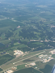
By: busterscv


