Login
Register


MEY
James G Whiting Memorial Field Airport
Official FAA Data Effective 2026-01-22 0901Z
Chart Supplement

VFR Chart of KMEY
Sectional Charts at SkyVector.com
IFR Chart of KMEY
Enroute Charts at SkyVector.com
Location Information for KMEY
Coordinates: N42°10.70' / W95°47.62'Located 01 miles N of Mapleton, Iowa on 164 acres of land. View all Airports in Iowa.
Surveyed Elevation is 1116 feet MSL.
Operations Data
|
|
Airport Communications
| SIOUX CITY APPROACH: | 124.6 307.0 |
|---|---|
| SIOUX CITY DEPARTURE: | 124.6 307.0 |
| CTAF: | 122.800 |
| UNICOM: | 122.800 |
| AWOS-3 at DNS (21.7 SE): | 119.95 712-263-6558 |
| ATIS at SUX (29.5 NW): | 270.8 |
| ASOS at SUX (29.5 NW): | 119.45 712-317-9924 |
- APCH/DEP SVC PRVDD BY MINNEAPOLIS ARTCC ON FREQS 119.6/290.4 (OMAHA RCAG) WHEN SIOUX CITY ATCT CLSD.
Nearby Navigation Aids
|
| ||||||||||||||||||||||||||||||||||||||||||||||||||||||


Runway 02/20
| Dimensions: | 2801 x 60 feet / 854 x 18 meters | |
|---|---|---|
| Surface: | Concrete in Fair Condition | |
| Weight Limits: | 9 /R/C/W/U, S-28, D-48 | |
| Edge Lighting: | Medium Intensity | |
| Runway 02 | Runway 20 | |
| Coordinates: | N42°10.49' / W95°47.75' | N42°10.91' / W95°47.49' |
| Elevation: | 1116.0 | 1116.0 |
| Traffic Pattern: | Left | Left |
| Runway Heading: | 24° True | 204° True |
| Markings: | Non-Precision Instrument in fair condition. | Non-Precision Instrument in fair condition. |
| Glide Slope Indicator | P2L (3.75° Glide Path Angle) | P2L (3.75° Glide Path Angle) |
| REIL: | Yes | |
| Obstacles: | 36 ft Tree 1014 ft from runway, 77 ft left of center | |
Services Available
| Fuel: | 100 (green) |
|---|---|
| Transient Storage: | Hangars,Tiedowns |
| Airframe Repair: | MAJOR |
| Engine Repair: | MAJOR |
| Bottled Oxygen: | NONE |
| Bulk Oxygen: | NONE |
Ownership Information
| Ownership: | Publicly owned | |
|---|---|---|
| Owner: | CITY OF MAPLETON | |
| 513 MAIN | ||
| MAPLETON, IA 51034 | ||
| 712-881-1351 | ||
| Manager: | KARLA UHL | |
| 513 MAIN STREET | ||
| MAPLETON, IA 51034 | ||
| 712-881-1890 | ||
Other Remarks
- THIS AIRPORT HAS BEEN SURVEYED BY THE NATIONAL GEODETIC SURVEY.
- RY 20 IS CALM WIND RY.
- FOR CD CTC SIOUX CITY ATCT ON 124.6 OR CALL 712-293-2482.
- RWY 20 PAPI UNUSBL BYD 7 DEGS LEFT OF CNTRLN.
- ACTVT REIL RWY 20; PAPI RWY 02 & 20; MIRL RWY 02/20 - CTAF.
Weather Minimums

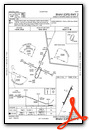
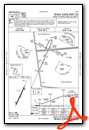
Instrument Approach Procedure (IAP) Charts
Nearby Airports with Instrument Procedures
| ID | Name | Heading / Distance | ||
|---|---|---|---|---|
 |
KDNS | Denison Municipal Airport | 121° | 21.8 |
|
KSUX | Sioux Gateway/Brig General Bud Day Field Airport | 297° | 29.5 |
|
KTQE | Tekamah Municipal Airport | 214° | 30.2 |
|
KCKP | Cherokee County Regional Airport | 017° | 34.8 |
|
KSLB | Storm Lake Municipal Airport | 044° | 35.2 |
|
KSKI | Sac City Municipal Airport | 071° | 38.2 |
|
KLRJ | Le Mars Municipal Airport | 333° | 40.1 |
|
KHNR | Harlan Municipal Airport | 150° | 41.0 |
|
0C4 | Pender Municipal Airport | 264° | 41.9 |
|
KCIN | Arthur N Neu Airport | 099° | 45.6 |
|
KBTA | Blair Exec Airport | 197° | 47.9 |
|
KADU | Audubon County Airport | 125° | 48.4 |
Airport Images
Do you have a recent image of this airport? Upload it here!


