Login
Register


EHR
Henderson City-County Airport
Official FAA Data Effective 2026-02-19 0901Z
Chart Supplement

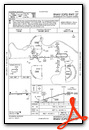
VFR Chart of KEHR
Sectional Charts at SkyVector.com
IFR Chart of KEHR
Enroute Charts at SkyVector.com
Location Information for KEHR
Coordinates: N37°48.47' / W87°41.14'Located 04 miles W of Henderson, Kentucky on 80 acres of land. View all Airports in Kentucky.
Surveyed Elevation is 386 feet MSL.
Operations Data
|
|
Airport Communications
| AWOS-3PT: | 118.85 Tel. 270-826-0511 |
|---|---|
| EVANSVILLE APPROACH: | 124.025 257.8 |
| EVANSVILLE DEPARTURE: | 124.025 257.8 |
| UNICOM: | 122.800 |
| CTAF: | 122.800 |
| ASOS at EVV (15.7 NE): | 120.2 812-200-0105 |
| ATIS at EVV (15.8 NE): | 120.2 |
| AWOS-3 at TWT (20.5 SW): | 118.775 270-333-2967 |
- APCH/DEP SVC PRVDD BY INDIANAPOLIS ARTCC (ZID) ON FREQS 128.3/291.625 (EVANSVILLE RCAG) WHEN EVANSVILLE APCH CTL CLSD.
Nearby Navigation Aids
|
| ||||||||||||||||||||||||||||||||||||||||||||||||||||||||||||


Runway 09/27
| Dimensions: | 5503 x 100 feet / 1677 x 30 meters | |
|---|---|---|
| Surface: | Asphalt in Good Condition | |
| Weight Limits: | 13 /F/D/X/T, S-34, D-46, ST-130 | |
| Edge Lighting: | Medium Intensity | |
| Runway 09 | Runway 27 | |
| Coordinates: | N37°48.46' / W87°41.71' | N37°48.48' / W87°40.57' |
| Elevation: | 384.2 | 386.1 |
| Traffic Pattern: | Left | Left |
| Runway Heading: | 88° True | 268° True |
| Markings: | Non-Precision Instrument in fair condition. | Non-Precision Instrument in fair condition. |
| Glide Slope Indicator | P4L (3.00° Glide Path Angle) | P4L (3.00° Glide Path Angle) |
| REIL: | Yes | Yes |
| Obstacles: | 16 ft Road 596 ft from runway, 312 ft right of center | |
Services Available
| Fuel: | 100LL (blue), Jet A+ |
|---|---|
| Transient Storage: | Hangars,Tiedowns |
| Airframe Repair: | MAJOR |
| Engine Repair: | MINOR |
| Bottled Oxygen: | HIGH |
| Bulk Oxygen: | NOT AVAILABLE |
| Other Services: | AVIONICS,CHARTER SERVICE,PILOT INSTRUCTION,AIRCRAFT RENTAL,AIRCRAFT SALES |
Ownership Information
| Ownership: | Publicly owned | |
|---|---|---|
| Owner: | HENDERSON CITY-COUNTY AIRPORT BOARD | AIRPORT CHAIRMAN- DR. RICHARD WHAM. |
| 2154 HWY 136W SUITE 1 | ||
| HENDERSON, KY 42420 | ||
| (270) 860-6901 | ||
| Manager: | EMILY HERRON | |
| 2154 HWY 136 W. | ||
| HENDERSON, KY 42420 | ||
| 270-724-3040 | ADDL PHONE 270-577-1444 | |
Other Remarks
- THIS AIRPORT HAS BEEN SURVEYED BY THE NATIONAL GEODETIC SURVEY.
- FOR CD CTC EVANSVILLE APCH AT 812-436-4690, WHEN APCH CLSD CTC INDIANAPOLIS ARTCC AT 317-247-2411.
- 0LL FOR SVC AFTER HRS CALL 270-826-6000.
- MIRL RY 09/27 PRESET LOW INTST; TO INCR INTST & ACTVT REIL RY 09/27; PAPI RY 09/ 27; MIRL RY 9/27- CTAF.
Weather Minimums

Instrument Approach Procedure (IAP) Charts


Nearby Airports with Instrument Procedures
| ID | Name | Heading / Distance | ||
|---|---|---|---|---|
 |
KEVV | Evansville Regional Airport | 028° | 15.8 |
|
KTWT | Sturgis Municipal Airport | 218° | 20.4 |
|
KOWB | Owensboro/Daviess County Regional Airport | 099° | 25.0 |
|
KCUL | Carmi Municipal Airport | 309° | 26.8 |
|
2I0 | Madisonville Regional Airport | 153° | 30.4 |
|
KGDA | Marion-Crittenden County James C Johnson Regional Airport | 215° | 34.8 |
|
KY8 | Hancock County/Ron Lewis Field Airport | 077° | 40.4 |
|
KHSB | Harrisburg-Raleigh Airport | 270° | 41.1 |
|
2M0 | Princeton-Caldwell County Airport | 191° | 42.3 |
|
M21 | Muhlenberg County Airport | 143° | 43.0 |
|
KHNB | Huntingburg Airport | 052° | 43.7 |
|
KJQD | Ohio County Airport | 117° | 45.0 |
Airport Images

By: Big Orange Bird

By: 2flaps


