Login
Register


LDM
Mason County Airport
Official FAA Data Effective 2026-01-22 0901Z
Chart Supplement

VFR Chart of KLDM
Sectional Charts at SkyVector.com
IFR Chart of KLDM
Enroute Charts at SkyVector.com
Location Information for KLDM
Coordinates: N43°57.75' / W86°24.47'Located 02 miles NE of Ludington, Michigan on 238 acres of land. View all Airports in Michigan.
Surveyed Elevation is 646 feet MSL.
Operations Data
|
|
Airport Communications
| AWOS-3: | 119.925 Tel. 231-843-0459 |
|---|---|
| UNICOM: | 123.000 |
| CTAF: | 123.000 |
| AWOS-AV at C04 (19.5 S): | 122.7 231-861-7415 |
| AWOS-3PT at MBL (19.9 N): | 118.825 231-723-6073 |
| AWOS-3P at FFX (36.1 SE): | 118.775 231-928-0715 |
- APCH/DEP SVC PRVDD BY MINNEAPOLIS ARTCC ON FREQS 120.85/322.35 (WHITE CLOUD RCAG).
Nearby Navigation Aids
|
| ||||||||||||||||||||||||||||||||||||||||||||||||||||||||||||


Runway 08/26
| Dimensions: | 5003 x 75 feet / 1525 x 23 meters | |
|---|---|---|
| Surface: | Asphalt in Excellent Condition | |
| Weight Limits: | S-25, D-41 | |
| Edge Lighting: | Medium Intensity | |
| Runway 08 | Runway 26 | |
| Coordinates: | N43°57.56' / W86°24.81' | N43°57.82' / W86°23.73' |
| Elevation: | 641.5 | 646.4 |
| Traffic Pattern: | Left | Left |
| Runway Heading: | 71° True | 251° True |
| Markings: | Non-Precision Instrument in good condition. | Non-Precision Instrument in good condition. |
| Glide Slope Indicator | P2L (3.00° Glide Path Angle) | P4L (3.00° Glide Path Angle) |
| REIL: | Yes | |
| Obstacles: | 59 ft Tree 1375 ft from runway, 421 ft left of center | |
Runway 01/19
| Dimensions: | 3503 x 75 feet / 1068 x 23 meters | |
|---|---|---|
| Surface: | Asphalt / Porous Friction Course in Good Condition | |
| Weight Limits: | S-19 | |
| Edge Lighting: | Medium Intensity | |
| Runway 01 | Runway 19 | |
| Coordinates: | N43°57.55' / W86°24.78' | N43°58.13' / W86°24.76' |
| Elevation: | 641.2 | 636.9 |
| Traffic Pattern: | Left | Left |
| Runway Heading: | 2° True | 182° True |
| Markings: | Basic in good condition. | Basic in good condition. |
| Glide Slope Indicator | P2L (3.00° Glide Path Angle) | P2L (3.00° Glide Path Angle) |
| Obstacles: | 68 ft Tree 1363 ft from runway, 265 ft left of center | |
Services Available
| Fuel: | 100LL (blue), Jet A+ |
|---|---|
| Transient Storage: | Hangars,Tiedowns |
| Airframe Repair: | NONE |
| Engine Repair: | NONE |
| Bottled Oxygen: | NOT AVAILABLE |
| Bulk Oxygen: | NOT AVAILABLE |
Ownership Information
| Ownership: | Publicly owned | |
|---|---|---|
| Owner: | COUNTY OF MASON | |
| COURTHOUSE, 304 E LUDINGTON AVE | ||
| LUDINGTON, MI 49431-2121 | ||
| 231-843-8202 | ||
| Manager: | JOHN L O'CONNOR | |
| 5300 W US HIGHWAY 10 | ||
| LUDINGTON, MI 49431-8704 | ||
| 231-843-2049 | ||
Other Remarks
- DEER, LRG BIRDS, & WILDLIFE ON & INVOF ARPT.
- FOR CD IF UNA TO CTC ON FSS FREQ, CTC MINNEAPOLIS ARTCC AT 651-463-5588.
- ACTVT REIL RWY 26; PAPI RWY 08, 26, 01, & 19; MIRL RWY 08/26 & 01/19 - CTAF.
Weather Minimums

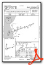
Instrument Approach Procedure (IAP) Charts

Nearby Airports with Instrument Procedures
| ID | Name | Heading / Distance | ||
|---|---|---|---|---|
 |
C04 | Oceana County Airport | 169° | 19.6 |
|
KMBL | Manistee County/Blacker Airport | 020° | 19.9 |
|
7D3 | Baldwin Municipal Airport | 101° | 25.1 |
|
KFFX | Fremont Municipal Airport | 150° | 36.2 |
|
KFKS | Frankfort Dow Memorial Field Airport | 012° | 40.7 |
|
KRQB | Roben-Hood Airport | 109° | 41.8 |
|
KCAD | Wexford County Airport | 065° | 46.7 |
|
KMKG | Muskegon County Airport | 170° | 48.3 |
|
KMTW | Manitowoc County Airport | 280° | 56.0 |
|
3GM | Grand Haven Memorial Airpark Airport | 170° | 56.4 |
|
13C | Lakeview/Griffith Field Airport | 121° | 58.4 |
|
KTVC | Cherry Capital Airport | 036° | 58.7 |
Airport Images
Do you have a recent image of this airport? Upload it here!


