Login
Register
MRC
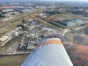
Maury County Regional Airport
Official FAA Data Effective 2025-12-25 0901Z
VFR Chart of KMRC
Sectional Charts at SkyVector.com
IFR Chart of KMRC
Enroute Charts at SkyVector.com
Location Information for KMRC
Coordinates: N35°33.26' / W87°10.75'Located 02 miles NE of Columbia/Mount Pleasant, Tennessee on 188 acres of land. View all Airports in Tennessee.
Surveyed Elevation is 681 feet MSL.
Operations Data
|
|
Airport Communications
| AWOS-3: | 128.625 Tel. 931-379-0844 |
|---|---|
| CTAF: | 122.800 |
| UNICOM: | 122.800 |
| AWOS-3 at LUG (18.5 E): | 135.775 931-270-1014 |
| AWOS-3 at 2M2 (19.5 S): | 120.175 931-766-1585 |
| AWOS-3 at GZS (24.8 S): | 118.275 931-363-6760 |
- APCH/DEP SVC PRVDD BY MEMPHIS ARTCC ON FREQS 125.85/379.25 (CENTERVILLE RCAG).
Nearby Navigation Aids
|
| ||||||||||||||||||||||||||||||||||||||||||||||||||||||||||||
Runway 06/24
| Dimensions: | 6000 x 100 feet / 1829 x 30 meters | |
|---|---|---|
| Surface: | Asphalt in Good Condition | |
| Weight Limits: | 12 /F/C/X/T, S-33, D-50, ST-70 | |
| Edge Lighting: | Medium Intensity | |
| Runway 06 | Runway 24 | |
| Coordinates: | N35°33.02' / W87°11.23' | N35°33.60' / W87°10.25' |
| Elevation: | 664.0 | 681.1 |
| Traffic Pattern: | Left | Left |
| Runway Heading: | 54° True | 234° True |
| Declared Distances: | TORA:6000 TODA:6000 ASDA:6000 LDA:6000 | TORA:6000 TODA:6000 ASDA:6000 LDA:6000 |
| Markings: | Non-Precision Instrument in fair condition. | Non-Precision Instrument in fair condition. |
| Glide Slope Indicator | P4R (3.00° Glide Path Angle) | P4L (3.00° Glide Path Angle) |
| Approach Lights: | ODALS Omnidirectional Approach Lighting System | |
| REIL: | Yes | Yes |
| Obstacles: | 49 ft Tree 1296 ft from runway, 206 ft left of center | 52 ft Tree 1270 ft from runway, 348 ft left of center |
Runway 17/35
| Dimensions: | 1941 x 95 feet / 592 x 29 meters | |
|---|---|---|
| Surface: | Turf in Good Condition | |
| Runway 17 | Runway 35 | |
| Coordinates: | N35°33.26' / W87°10.75' | N35°32.94' / W87°10.80' |
| Elevation: | 666.7 | 659.2 |
| Traffic Pattern: | Left | Left |
| Runway Heading: | 187° True | 7° True |
| Obstacles: | 81 ft Pole 1379 ft from runway, 194 ft right of center | |
Helipad H1
| Dimensions: | 25 x 25 feet / 8 x 8 meters | |
|---|---|---|
| Surface: | Concrete in Fair Condition | |
| Coordinates: | N35°33.30' / W87°10.92' | N0°0.00' / E0°0.00' |
| Elevation: | 665.0 | |
| Markings: | Basic in fair condition. | |
Services Available
| Fuel: | 100LL (blue), Jet A+ |
|---|---|
| Transient Storage: | Hangars,Tiedowns |
| Airframe Repair: | MINOR |
| Engine Repair: | MINOR |
| Bottled Oxygen: | NOT AVAILABLE |
| Bulk Oxygen: | NOT AVAILABLE |
| Other Services: | AIR AMBULANCE SERVICES,AVIONICS,PILOT INSTRUCTION,AIRCRAFT RENTAL |
Ownership Information
| Ownership: | Publicly owned | |
|---|---|---|
| Owner: | MAURY CO REG ARPT AUTH | |
| 1200 N MAIN ST | ||
| MT PLEASANT, TN 38474 | ||
| 931-379-5511 | ||
| Manager: | PAUL TURNER | |
| 1200 NORTH MAIN ST | ||
| MT PLEASANT, TN 38474 | ||
| 931-379-5511 | ||
Other Remarks
- 330 FT LGTD ANT 1.9 NM SW.
- FOR CD CTC MEMPHIS ARTCC AT 901-368-8453/8449.
- ACTVT ODALS RWY 24; REIL RWY 24 - CTAF.
Weather Minimums
Instrument Approach Procedure (IAP) Charts
Nearby Airports with Instrument Procedures
| ID | Name | Heading / Distance | ||
|---|---|---|---|---|
 |
KLUG | Ellington Airport | 098° | 18.6 |
 |
2M2 | Lawrenceburg/Lawrence County (Fleeman Field) Airport | 191° | 19.6 |
 |
0M3 | Paul Bridges Field Airport | 268° | 20.5 |
 |
KGHM | Centerville Municipal Airport | 322° | 21.4 |
 |
KGZS | Abernathy Field Airport | 165° | 24.7 |
 |
KSYI | Bomar Field/Shelbyville Municipal Airport | 089° | 36.1 |
 |
M02 | Dickson Municipal Airport | 340° | 36.5 |
 |
KJWN | John C Tune Airport | 020° | 40.3 |
 |
KBNA | Nashville International Airport | 035° | 42.0 |
 |
KMQY | Smyrna Airport | 049° | 42.2 |
 |
KFYM | Fayetteville Municipal Airport | 134° | 42.3 |
 |
0M5 | Humphreys County Airport | 321° | 43.3 |


