Login
Register


RJD
Gooden Airpark Airport
Official FAA Data Effective 2026-01-22 0901Z
Chart Supplement

VFR Chart of KRJD
Sectional Charts at SkyVector.com
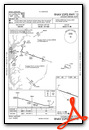
IFR Chart of KRJD
Enroute Charts at SkyVector.com
Location Information for KRJD
Coordinates: N38°58.21' / W75°51.98'Located 02 miles NE of Ridgely, Maryland on 76 acres of land. View all Airports in Maryland.
Surveyed Elevation is 64 feet MSL.
Operations Data
|
|
Airport Communications
| POTOMAC APPROACH: | 124.55 317.425 132.425 ;RWY 30 257.875 257.875 ;RWY 30 |
|---|---|
| POTOMAC DEPARTURE: | 124.55 317.425 132.425 ;RWY 30 257.875 257.875 ;RWY 30 |
| UNICOM: | 122.800 |
| CTAF: | 122.800 |
| ATIS at ESN (13.7 SW): | 124.475 |
| AWOS-3PT at ESN (13.7 SW): | 124.475 410-822-2817 |
| AWOS-3 at 33N (19.4 NE): | 120.125 302-571-6012 |
Nearby Navigation Aids
|
| ||||||||||||||||||||||||||||||||||||||||||||||||||||||||||||


Runway 12/30
| Dimensions: | 3214 x 50 feet / 980 x 15 meters | |
|---|---|---|
| Surface: | Asphalt in Good Condition | |
| Weight Limits: | S-28, D-39 | |
| Edge Lighting: | Low Intensity | |
| Runway 12 | Runway 30 | |
| Coordinates: | N38°58.33' / W75°52.43' | N38°58.15' / W75°51.79' |
| Elevation: | 63.5 | 63.6 |
| Traffic Pattern: | Left | Right |
| Runway Heading: | 109° True | 289° True |
| Markings: | Non-Standard in fair condition. | Non-Standard in fair condition. |
| REIL: | Yes | Yes |
| Obstacles: | 27 ft Power Line 1170 ft from runway | 34 ft Trees 769 ft from runway, 191 ft left of center |
Services Available
| Fuel: | NONE |
|---|---|
| Transient Storage: | Tiedowns |
| Airframe Repair: | MAJOR |
| Engine Repair: | MAJOR |
| Bottled Oxygen: | NOT AVAILABLE |
| Bulk Oxygen: | NOT AVAILABLE |
| Other Services: | CROP DUSTING SERVICES,PARACHUTE JUMP ACTIVITY |
Ownership Information
| Ownership: | Privately Owned | |
|---|---|---|
| Owner: | AIR-LAND LLC | |
| 3532 TURKEY POINT ROAD | ||
| VIOLA, DE 19979 | ||
| 302-270-2227 | ||
| Manager: | JOHN GOODEN | |
| 3532 TURKEY POINT ROAD | ||
| VIOLA, DE 19979 | ||
| 302-270-2227 | ||
Other Remarks
- FOR CD CTC DOVER APCH AT 302-677-3940.
- TURF AREAS ADJACENT TO ACFT MOVEMENT AREAS SOFT WHEN WET.
- UNLIMITED VEHICLE ACCESS TO ACFT MOVEMENT AREAS.
- BIRDS, DEER & WILDLIFE ON & INVOF ARPT.
- TWY/APN PAVEMENTS ARE FAILING WITH LOOSE AGGREGATE AND ALLIGATOR CRACKING.
- FADED, CRACK SEAL THRU MRKGS.
- THR BARS AND RWY NRS ARE HALF SIZE.
- FADED, CRACK SEAL THRU MRKGS.
- THR BARS AND RWY NRS ARE HALF SIZE.
- ACTIVATE REIL RWY 12 & 30; LIRL RWY 12/30 - CTAF.
- ACTVT ARPT BEACON - CTAF.
- UNICOM UNMON.
Weather Minimums
Instrument Approach Procedure (IAP) Charts

Nearby Airports with Instrument Procedures
| ID | Name | Heading / Distance | ||
|---|---|---|---|---|
 |
KESN | Easton/Newnam Field Airport | 223° | 13.8 |
|
33N | Delaware Airpark Airport | 039° | 19.4 |
|
KDOV | Dover AFB Airport | 062° | 21.0 |
|
W29 | Bay Bridge Airport | 271° | 21.7 |
|
KCGE | Cambridge-Dorchester Regional Airport | 196° | 26.9 |
|
N06 | Laurel Airport | 153° | 28.7 |
|
KGED | Delaware Coastal Airport | 125° | 29.2 |
|
KANP | Lee Airport | 267° | 32.9 |
|
KMTN | Martin State Airport | 310° | 33.3 |
|
KEVY | Summit Airport | 011° | 33.7 |
|
58M | Claremont Airport | 359° | 36.2 |
|
0W3 | Harford County Airport | 336° | 39.2 |


