Login
Register


RVN
Hawkins County Airport
Official FAA Data Effective 2026-02-19 0901Z
Chart Supplement

VFR Chart of KRVN
Sectional Charts at SkyVector.com
IFR Chart of KRVN
Enroute Charts at SkyVector.com
Location Information for KRVN
Coordinates: N36°27.45' / W82°53.10'Located 06 miles NE of Rogersville, Tennessee on 56 acres of land. View all Airports in Tennessee.
Surveyed Elevation is 1254 feet MSL.
Operations Data
|
|
Airport Communications
| TRI CITY APPROACH: | 128.05 317.5 |
|---|---|
| TRI CITY DEPARTURE: | 128.05 317.5 |
| CTAF: | 122.800 |
| UNICOM: | 122.800 |
| AWOS-3 at GCY (16.3 S): | 128.425 423-639-5081 |
| AWOS-3 at 0VG (19.9 NW): | 120.125 276-346-3333 |
| ATIS at TRI (23.1 E): | 118.25 |
- APCH/DEP SVC PRVDD BY ATLANTA ARTCC ON FREQS 127.85/269.3 (GLADE SPRINGS RCAG) WHEN TRI CITY APCH CTL CLSD.
Nearby Navigation Aids
|
| ||||||||||||||||||||||||||||||||||||||||||||||||||||||||||||


Runway 07/25
| Dimensions: | 3504 x 75 feet / 1068 x 23 meters | |
|---|---|---|
| Surface: | Asphalt in Fair Condition | |
| Weight Limits: | S-25 | |
| Edge Lighting: | Medium Intensity | |
| Runway 07 | Runway 25 | |
| Coordinates: | N36°27.33' / W82°53.42' | N36°27.58' / W82°52.78' |
| Elevation: | 1254.5 | 1229.8 |
| Traffic Pattern: | Left | Left |
| Runway Heading: | 64° True | 244° True |
| Markings: | Non-Precision Instrument in fair condition. | Non-Precision Instrument in fair condition. |
| Glide Slope Indicator | P2L (4.00° Glide Path Angle) PAPI UNUSBL BYD 7 DEGS LEFT OF CNTRLN. | P2L (3.00° Glide Path Angle) |
| REIL: | Yes | Yes |
| Obstacles: | 24 ft Trees 637 ft from runway, 144 ft right of center | 72 ft Trees 1025 ft from runway, 225 ft right of center |
Services Available
| Fuel: | 100LL (blue) |
|---|---|
| Transient Storage: | Hangars,Tiedowns |
| Airframe Repair: | MAJOR |
| Engine Repair: | MAJOR |
| Bottled Oxygen: | NOT AVAILABLE |
| Bulk Oxygen: | NOT AVAILABLE |
| Other Services: | PILOT INSTRUCTION |
Ownership Information
| Ownership: | Publicly owned | |
|---|---|---|
| Owner: | HAWKINS COUNTY | |
| COURTHOUSE, 150 WASHINGTON ST | ||
| ROGERSVILLE, TN 37857 | ||
| 423-272-7359 | ||
| Manager: | MARK FINLEY | |
| 675 MAIN ST | ||
| SURGOINSVILLE, TN 37873 | ||
| 423-345-0219 | ||
Other Remarks
- DEER ON & INVOF ARPT.
- FOR CD CTC ATLANTA ARTCC AT 770-210-7692.
- 3118 FT MT RIDGE SE OF ARPT WI 9 NM.
- 0LL H24 SELF SVC FUEL AVBL.
- ACTVT RWY 7 & 25 REILS; PAPIS 7 & 25; MIRLS RWY 7/25 - CTAF.
Weather Minimums

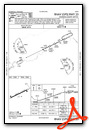
Instrument Approach Procedure (IAP) Charts

Nearby Airports with Instrument Procedures
| ID | Name | Heading / Distance | ||
|---|---|---|---|---|
 |
KGCY | Greeneville Municipal Airport | 167° | 16.1 |
|
0VG | Lee County Airport | 306° | 19.9 |
|
KTRI | Tri-Cities Airport | 087° | 23.1 |
|
KMOR | Moore-Murrell Airport | 235° | 29.0 |
|
3A2 | New Tazewell Municipal Airport | 265° | 32.7 |
|
I35 | Tucker-Guthrie Memorial Airport | 316° | 33.2 |
|
0A9 | William B Greene Jr Regional Airport | 098° | 34.9 |
|
KLNP | Lonesome Pine Airport | 028° | 36.1 |
|
1A6 | Middlesboro/Bell County Airport | 282° | 42.2 |
|
KVJI | Virginia Highlands Airport | 071° | 43.3 |
|
KGKT | Gatlinburg-Pigeon Forge Airport | 221° | 47.6 |
|
6A4 | Johnson County Airport | 092° | 51.4 |
Airport Images

By: Big Orange Bird


