Login
Register


SGU
St George Regional Airport
Official FAA Data Effective 2025-12-25 0901Z
Chart Supplement

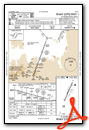
VFR Chart of KSGU
Sectional Charts at SkyVector.com
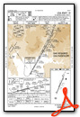
IFR Chart of KSGU
Enroute Charts at SkyVector.com
Location Information for KSGU
Coordinates: N37°2.18' / W113°30.62'Located 05 miles SE of St George, Utah on 1204 acres of land. View all Airports in Utah.
Surveyed Elevation is 2883 feet MSL.
Operations Data
|
|
Airport Communications
| AWOS-3PT: | 135.075 Tel. 435-634-0940 |
|---|---|
| UNICOM: | 123.075 |
| CTAF: | 123.075 |
| AWOS-3PT at AZC (24.2 E): | 118.375 928-875-8045 |
| AWOS-2 at 67L (28.8 SW): | 118.525 702-345-7634 |
| ASOS at CDC (44.8 NE): | 119.025 435-867-0278 |
- APCH/DEP CTL SVC PRVDD BY LOS ANGELES ARTCC (ZLA) ON FREQS 124.2/343.6 (CEDAR CITY RCAG).
- CLNC DEL PRVDD BY LOS ANGELES ARTCC ON FREQ 133.3.
Nearby Navigation Aids
|
| ||||||||||||||||||||||||||||||||||||


Runway 01/19
| Dimensions: | 9300 x 150 feet / 2835 x 46 meters | |
|---|---|---|
| Surface: | Asphalt / Grooved in Good Condition | |
| Weight Limits: | S-75, D-150
PCR VALUE: 300/F/D/X/T
| |
| Edge Lighting: | High Intensity | |
| Runway 01 | Runway 19 | |
| Coordinates: | N37°1.48' / W113°30.99' | N37°2.89' / W113°30.24' |
| Elevation: | 2831.7 | 2883.6 |
| Runway Heading: | 23° True | 203° True |
| Declared Distances: | TORA:9300 TODA:9300 ASDA:9300 LDA:9300 | TORA:9300 TODA:9300 ASDA:9300 LDA:9300 |
| Markings: | Precision Instrument in good condition. | Precision Instrument in good condition. |
| Glide Slope Indicator | P4L (3.00° Glide Path Angle) | P4L (3.10° Glide Path Angle) |
| Approach Lights: | MALSR 1,400 Foot Medium-intensity Approach Lighting System with runway alignment indicator lights. | |
| REIL: | Yes | |
Services Available
| Fuel: | 100LL (blue), Jet-A |
|---|---|
| Transient Storage: | Hangars,Tiedowns |
| Airframe Repair: | MAJOR |
| Engine Repair: | MAJOR |
| Bottled Oxygen: | NOT AVAILABLE |
| Bulk Oxygen: | LOW |
| Other Services: | AIR FREIGHT SERVICES,AIR AMBULANCE SERVICES,AVIONICS,PILOT INSTRUCTION,AIRCRAFT RENTAL,AIRCRAFT SALES |
Ownership Information
| Ownership: | Publicly owned | |
|---|---|---|
| Owner: | CITY OF ST GEORGE | |
| 175 E 200 N | ||
| ST GEORGE, UT 84770 | ||
| 435-627-4000 | ||
| Manager: | DUSTIN WARREN | |
| 4508 S. AIRPORT PKWY #1 | ||
| ST GEORGE, UT 84790 | ||
| 435-627-4087 | ||
Other Remarks
- PPR OVR 150000 LB - AMGR.
- COLD TEMPERATURE AIRPORT. ALTITUDE CORRECTION REQUIRED AT OR BELOW -5C.
- NO ACFT TKOFS/LNDGS ON UNPAVED/DIRT RWY SAFETY AREAS ADJ TO ALL RWYS.
- CALM WIND RWY.
- ACTVT MALSR RWY 19; REIL RWY 01; HIRL RWY 01/19 - CTAF. PAPI RWY 01 & 19 ON CONSLY.
Weather Minimums
Instrument Approach Procedure (IAP) Charts

Departure Procedure (DP) Charts

Departure Procedure Obstacles (DPO) Charts
Nearby Airports with Instrument Procedures
| ID | Name | Heading / Distance | ||
|---|---|---|---|---|
 |
KAZC | Colorado City Municipal Airport | 100° | 24.3 |
|
67L | Mesquite Airport | 245° | 28.9 |
|
KCDC | Cedar City Regional Airport | 026° | 44.4 |
|
KKNB | Kanab Municipal Airport | 091° | 47.1 |
|
U55 | Panguitch Municipal Airport | 047° | 72.1 |
|
KBCE | Bryce Canyon Airport | 057° | 76.6 |
|
U52 | Beaver Municipal Airport | 028° | 81.9 |
|
KMLF | Milford Municipal/Ben and Judy Briscoe Field Airport | 015° | 86.6 |
|
KLSV | Nellis AFB Airport | 237° | 87.8 |
|
KBVU | Boulder City Municipal Airport | 225° | 92.4 |
|
KGCN | Grand Canyon Ntl Park Airport | 134° | 92.6 |
|
KVGT | North Las Vegas Airport | 239° | 95.2 |
Fuel Providers

Airport Images
Do you have a recent image of this airport? Upload it here!


