Login
Register


L92
Alamo Landing Field Airport
Official FAA Data Effective 2026-02-19 0901Z
Chart Supplement

VFR Chart of L92
Sectional Charts at SkyVector.com
IFR Chart of L92
Enroute Charts at SkyVector.com
Location Information for L92
Coordinates: N37°21.81' / W115°11.73'Located 02 miles W of Alamo, Nevada on 640 acres of land. View all Airports in Nevada.
Surveyed Elevation is 3757 feet MSL.
Operations Data
|
|
Airport Communications
| CTAF: | 122.900 |
|---|---|
| ATIS at INS (52.1 SW): | 290.45 |
| AWOS-3 at 67L (63.1 SE): | 118.525 702-345-7634 |
| AWOS-2 at BTY (81.9 W): | 119.275 775-553-2741 |
Nearby Navigation Aids
|
| ||||||||||||||||||||||||||||||||||||


Runway 14/32
| Dimensions: | 4362 x 60 feet / 1330 x 18 meters | |
|---|---|---|
| Surface: | Asphalt in Good Condition | |
| Weight Limits: | S-12 | |
| Edge Lighting: | High Intensity | |
| Runway 14 | Runway 32 | |
| Coordinates: | N37°22.11' / W115°11.97' | N37°21.50' / W115°11.49' |
| Elevation: | 3757.2 | 3709.4 |
| Traffic Pattern: | Right | |
| Runway Heading: | 148° True | 328° True |
| Markings: | Non-Precision Instrument in good condition. | Non-Precision Instrument in good condition. |
| Glide Slope Indicator | P2L (3.25° Glide Path Angle) UNUSBL BYD 4 NM. | P2L (2.75° Glide Path Angle) |
| REIL: | Yes | Yes |
Services Available
| Fuel: | NONE |
|---|---|
| Transient Storage: | Buoys |
| Airframe Repair: | NOT AVAILABLE |
| Engine Repair: | NOT AVAILABLE |
| Bottled Oxygen: | NOT AVAILABLE |
| Bulk Oxygen: | NOT AVAILABLE |
Ownership Information
| Ownership: | Publicly owned | |
|---|---|---|
| Owner: | LINCOLN COUNTY | LEASED TO LINCOLN COUNTY FROM US BUREAU OF LAND MANAGEMENT |
| PO BOX 90, 181 N. MAIN ST | ||
| PIOCHE, NV 89043-0416 | ||
| 702-449-2418 | ||
| Manager: | WENDY RUDDER | |
| P.O. BOX 509 | ||
| ALAMO, NV 89001 | ||
| (702) 449-2418 | ||
Other Remarks
- FOR CD CTC NELLIS APP AT 702-652-4172.
- ACTVT REIL RWY 14 & 32; PAPI RWY 14 & 32; HIRL RWY 14/32; TWY LGTS - CTAF.
Nearby Airports with Instrument Procedures
| ID | Name | Heading / Distance | ||
|---|---|---|---|---|
 |
67L | Mesquite Airport | 119° | 63.3 |
|
KLSV | Nellis AFB Airport | 173° | 68.0 |
|
KVGT | North Las Vegas Airport | 179° | 69.1 |
|
KLAS | Harry Reid International Airport | 178° | 76.9 |
|
KTNX | Tonopah Test Range Airport | 289° | 80.0 |
|
KSGU | St George Regional Airport | 103° | 83.1 |
|
KHND | Henderson Exec Airport | 177° | 83.4 |
|
KBVU | Boulder City Municipal Airport | 169° | 86.4 |
|
KTPH | Tonopah Airport | 295° | 99.2 |
|
KCDC | Cedar City Regional Airport | 077° | 102.1 |
|
KAZC | Colorado City Municipal Airport | 102° | 107.4 |
|
KELY | Ely/Yelland Field Airport | 008° | 117.2 |
Airport Images
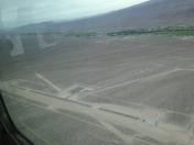
By: riggerparish


