Login
Register


LGC
Lagrange/Callaway Airport
Official FAA Data Effective 2026-02-19 0901Z
Chart Supplement

VFR Chart of KLGC
Sectional Charts at SkyVector.com
IFR Chart of KLGC
Enroute Charts at SkyVector.com
Location Information for KLGC
Coordinates: N33°0.55' / W85°4.39'Located 03 miles SW of Lagrange, Georgia on 751 acres of land. View all Airports in Georgia.
Surveyed Elevation is 693 feet MSL.
Operations Data
|
|
Airport Communications
| AWOS-3: | 126.325 Tel. 706-845-0677 |
|---|---|
| ATLANTA APPROACH: | 125.5 323.1 ;BLW 7000 FT |
| ATLANTA DEPARTURE: | 125.5 323.1 ;BLW 7000 FT |
| CLEARANCE DELIVERY: | 119.25 |
| CTAF: | 122.975 |
| UNICOM: | 122.975 |
| AWOS-3PT at PIM (14.1 SE): | 120.275 706-663-2081 |
| AWOS-3PT at 5A9 (19.4 E): | 118.35 706-655-2005 |
| AWOS-3PT at CCO (23.7 NE): | 118.975 770-254-1617 |
- ATLANTA LARGE TRACON PROVIDES APCH/DEP SVC 0615-2300; ATLANTA ARTCC PROVIDES APCH/DEP SVC 2300-0615 ON FREQS 120.45/298.850 & CLNC DEL ON FREQ 120.45 (COLUMBUS RCAG).
Nearby Navigation Aids
|
| ||||||||||||||||||||||||||||||||||||||||||||||||||||||||||||


Runway 13/31
| Dimensions: | 6499 x 100 feet / 1981 x 30 meters | |
|---|---|---|
| Surface: | Asphalt / Grooved in Good Condition | |
| Weight Limits: | S-75, D-100, ST-100 | |
| Edge Lighting: | High Intensity | |
| Runway 13 | Runway 31 | |
| Coordinates: | N33°0.80' / W85°4.89' | N33°0.16' / W85°3.87' |
| Elevation: | 687.7 | 675.3 |
| Traffic Pattern: | Left | Left |
| Runway Heading: | 127° True | 306° True |
| Markings: | Precision Instrument in good condition. | Precision Instrument in good condition. |
| Glide Slope Indicator | P4L (3.00° Glide Path Angle) | P4R (3.00° Glide Path Angle) |
| Approach Lights: | MALSR 1,400 Foot Medium-intensity Approach Lighting System with runway alignment indicator lights. | |
| REIL: | Yes | |
| Obstacles: | 123 ft Trees 2414 ft from runway, 675 ft right of center | 143 ft Trees 5634 ft from runway, 592 ft right of center |
Runway 03/21
| Dimensions: | 5000 x 100 feet / 1524 x 30 meters | |
|---|---|---|
| Surface: | Asphalt in Fair Condition | |
| Weight Limits: | S-45, D-50 | |
| Runway 03 | Runway 21 | |
| Coordinates: | N33°0.26' / W85°4.61' | N33°1.01' / W85°4.20' |
| Elevation: | 677.9 | 693.6 |
| Traffic Pattern: | Left | Left |
| Runway Heading: | 24° True | 204° True |
| Markings: | Non-Precision Instrument in good condition. | Non-Precision Instrument in good condition. |
| Obstacles: | 81 ft Trees 1334 ft from runway, 246 ft left of center | 72 ft Trees 992 ft from runway, 230 ft right of center |
Services Available
| Fuel: | 100LL (blue), Jet A+ |
|---|---|
| Transient Storage: | Tiedowns |
| Airframe Repair: | MAJOR |
| Engine Repair: | MAJOR |
| Bottled Oxygen: | LOW |
| Bulk Oxygen: | NONE |
| Other Services: | AIR AMBULANCE SERVICES,PILOT INSTRUCTION,AIRCRAFT RENTAL |
Ownership Information
| Ownership: | Publicly owned | |
|---|---|---|
| Owner: | CITY OF LA GRANGE & TROUP CO | |
| TROUP COUNTY, 100 RIDLEY AVE, 100 RIDLEY AVE | ||
| LAGRANGE, GA 30241 | ||
| 706-883-1610 | ||
| Manager: | TROY ANDERSON | |
| 200 AIRPORT PARKWAY | ||
| LAGRANGE, GA 30240 | ||
| 706-616-1553 | ||
Other Remarks
- DEER ON & INVOF ARPT.
- 0LL FUEL 24 HR CREDIT CARD SVC AVBL.
- ACTVT MALSR RWY 31; HIRL RWY 13/31; TWY LGTS - CTAF.
Weather Minimums


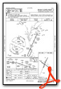
Instrument Approach Procedure (IAP) Charts


Nearby Airports with Instrument Procedures
| ID | Name | Heading / Distance | ||
|---|---|---|---|---|
 |
KPIM | Harris County Airport | 136° | 13.9 |
|
7A3 | Lanett Regional Airport | 213° | 14.2 |
|
KCCO | Newnan Coweta County Airport | 040° | 23.7 |
|
KAUO | Auburn University Regional Airport | 217° | 29.8 |
|
KCSG | Columbus Airport | 166° | 30.3 |
|
KFFC | Atlanta Regional Falcon Field Airport | 050° | 32.7 |
|
KCTJ | West Georgia Regional/O V Gray Field Airport | 353° | 37.5 |
|
KOPN | Thomaston-Upson County Airport | 094° | 41.0 |
|
KLSF | Lawson AAF (Fort Benning) Airport | 173° | 40.8 |
|
6A2 | Griffin-Spalding County Airport | 071° | 42.3 |
|
KHMP | Atlanta Speedway Airport | 058° | 43.8 |
|
06A | Moton Field Municipal Airport | 223° | 45.0 |
Airport Images
Do you have a recent image of this airport? Upload it here!


Comments
Airport Phone Number
Tried the listed phone numbers and didnt reach the airport. I think its somewhere downtown Lagrange. Anyways, they gave me the airport number. Its actually 706 884 2121. Super nice folks.