Login
Register


M72
New Albany/Union County Airport
Official FAA Data Effective 2026-02-19 0901Z
Chart Supplement

VFR Chart of M72
Sectional Charts at SkyVector.com
IFR Chart of M72
Enroute Charts at SkyVector.com
Location Information for M72
Coordinates: N34°32.94' / W89°1.47'Located 03 miles N of New Albany, Mississippi on 100 acres of land. View all Airports in Mississippi.
Surveyed Elevation is 412 feet MSL.
Operations Data
|
|
Airport Communications
| CTAF: | 122.800 |
|---|---|
| UNICOM: | 122.800 |
| ASOS at TUP (21.1 SE): | 133.525 662-200-1505 |
| AWOS-3PT at UOX (27.2 W): | 132.725 662-234-9751 |
| AWOS-3PT at CRX (30.4 NE): | 118.675 662-287-5103 |
- APCH/DEP SVC PRVDD BY MEMPHIS ARTCC ON FREQS 135.9/273.55 (TUPELO RCAG).
Nearby Navigation Aids
|
| ||||||||||||||||||||||||||||||||||||||||||||||||||||||


Runway 18/36
| Dimensions: | 3903 x 75 feet / 1190 x 23 meters | |
|---|---|---|
| Surface: | Asphalt in Good Condition | |
| Weight Limits: | S-20 | |
| Edge Lighting: | Medium Intensity | |
| Runway 18 | Runway 36 | |
| Coordinates: | N34°33.26' / W89°1.49' | N34°32.62' / W89°1.44' |
| Elevation: | 409.0 | 405.9 |
| Traffic Pattern: | Left | Left |
| Runway Heading: | 176° True | 356° True |
| Markings: | Non-Precision Instrument in good condition. | Non-Precision Instrument in good condition. |
| Glide Slope Indicator | P2L (3.00° Glide Path Angle) | P2L (3.00° Glide Path Angle) |
| Obstacles: | 64 ft Trees 1952 ft from runway, 28 ft right of center | 78 ft Trees 2436 ft from runway |
Services Available
| Fuel: | 100LL (blue) |
|---|---|
| Transient Storage: | Hangars,Tiedowns PILOTS MUST PRVD THEIR OWN TIEDOWN ROPES. |
| Airframe Repair: | NOT AVAILABLE ON REQ. |
| Engine Repair: | NOT AVAILABLE ON REQ. |
| Bottled Oxygen: | NONE |
| Bulk Oxygen: | NONE |
Ownership Information
| Ownership: | Publicly owned | |
|---|---|---|
| Owner: | NEW ALBANY CITY & UNION COUNTY | |
| PO BOX 56 | ||
| NEW ALBANY, MS 38652 | ||
| 662-534-1010 | ||
| Manager: | RUDY DIXON | |
| 1034 COUNTY ROAD 80 | ||
| NEW ALBANY, MS 38652 | ||
| 662-534-1050 | ||
Other Remarks
- FOR CD CTC MEMPHIS ARTCC AT 901-368-8453/8449.
- 0LL FUEL AVBL 24 HRS WITH CREDIT CARD.
- MIRL RWY 18/36 OPR DUSK-2200.
Weather Minimums

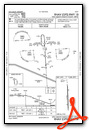
Instrument Approach Procedure (IAP) Charts

Nearby Airports with Instrument Procedures
| ID | Name | Heading / Distance | ||
|---|---|---|---|---|
 |
25M | Ripley Airport | 002° | 10.4 |
|
8M1 | Booneville/Baldwyn Airport | 082° | 18.8 |
|
KTUP | Tupelo Regional Airport | 142° | 21.0 |
|
KUOX | University-Oxford Airport | 248° | 27.3 |
|
M41 | Holly Springs-Marshall County Airport | 302° | 28.9 |
|
KCRX | Roscoe Turner Airport | 043° | 30.2 |
|
5A4 | Okolona Municipal/Richard Stovall Field Airport | 155° | 35.2 |
|
M08 | William L Whitehurst Field Airport | 358° | 39.9 |
|
KFYE | Fayette County Airport | 335° | 43.5 |
|
KPMU | Panola County Airport | 255° | 44.5 |
|
15M | Segars Field Airport | 072° | 44.6 |
|
KOLV | Olive Branch/Taylor Field Airport | 304° | 45.6 |
Airport Images
Do you have a recent image of this airport? Upload it here!


