Login
Register


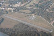
M93
Houston County Airport
Official FAA Data Effective 2026-01-22 0901Z
Chart Supplement

VFR Chart of M93
Sectional Charts at SkyVector.com
IFR Chart of M93
Enroute Charts at SkyVector.com
Location Information for M93
Coordinates: N36°19.00' / W87°55.00'Located 00 miles W of Mc Kinnon, Tennessee on 84 acres of land. View all Airports in Tennessee.
Estimated Elevation is 370 feet MSL.
Operations Data
|
|
Airport Communications
| CTAF: | 122.900 |
|---|---|
| AWOS-3 at PHT (22.7 W): | 118.825 731-644-0451 |
| ATIS at EOD (25.9 NE): | 306.5 |
| AWOS-3 at EOD (25.9 NE): | 270-956-3100 |
Nearby Navigation Aids
|
| ||||||||||||||||||||||||||||||||||||||||||||||||||||||||||||


Runway 08/26
| Dimensions: | 3000 x 75 feet / 914 x 23 meters | |
|---|---|---|
| Surface: | Asphalt in Good Condition | |
| Weight Limits: | S-11, D-24 | |
| Runway 08 | Runway 26 | |
| Traffic Pattern: | Left | Left |
| Markings: | Basic in fair condition. | Basic in fair condition. |
| Obstacles: | 59 ft Trees 675 ft from runway, 119 ft right of center RY 08 TREES ALONG ROAD NEAR ROW OF HOUSES VIOLATE 7:1 TRANSITIONAL SFC. |
79 ft Trees 809 ft from runway, 129 ft left of center RY 26 TREES ON SOUTH SIDE OF THLD VIOLATE 7:1 TRANSITIONAL SFC. |
Services Available
| Fuel: | 100LL (blue) |
|---|---|
| Transient Storage: | Tiedowns NO TIE DOWN ROPES |
| Airframe Repair: | NONE |
| Engine Repair: | NONE |
| Bottled Oxygen: | NONE |
| Bulk Oxygen: | NONE |
Ownership Information
| Ownership: | Publicly owned | |
|---|---|---|
| Owner: | HOUSTON COUNTY | |
| COUNTY COURTHOUSE | ||
| ERIN, TN 37061 | ||
| 931-289-3633 | ||
| Manager: | JOEY BRAKE HOUSTON CNTY MAYOR | |
| COUNTY COURTHOUSE, P.O. BOX 366 | ||
| ERIN, TN 37061 | ||
| 931-289-3633 | ||
Other Remarks
- FOR CD CTC MEMPHIS ARTCC AT 901-368-8453/8449.
Nearby Airports with Instrument Procedures
| ID | Name | Heading / Distance | ||
|---|---|---|---|---|
 |
0M5 | Humphreys County Airport | 144° | 14.8 |
|
0M4 | Benton County Airport | 208° | 21.0 |
|
KPHT | Henry County Airport | 273° | 22.7 |
|
M02 | Dickson Municipal Airport | 115° | 26.2 |
|
KHOP | Campbell AAF (Fort Campbell) Airport | 043° | 29.6 |
|
KHZD | Sgt Lee Russell Carroll County Airport | 242° | 29.8 |
|
KCEY | Kyle-Oakley Field Airport | 313° | 30.4 |
|
KCKV | Outlaw Field Airport | 052° | 30.4 |
|
KGHM | Centerville Municipal Airport | 141° | 36.7 |
|
KHVC | Hopkinsville-Christian County Airport | 034° | 39.3 |
|
KPVE | Beech River Regional Airport | 199° | 41.8 |
|
M25 | Mayfield Graves County Airport | 310° | 42.2 |