Login
Register


MHP
John Edwin Jones Sr Field/Metter Municipal Airport
Official FAA Data Effective 2026-01-22 0901Z
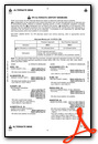
Chart Supplement

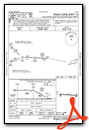
VFR Chart of KMHP
Sectional Charts at SkyVector.com
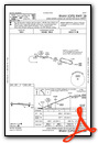
IFR Chart of KMHP
Enroute Charts at SkyVector.com
Location Information for KMHP
Coordinates: N32°22.44' / W82°4.89'Located 02 miles S of Metter, Georgia on 82 acres of land. View all Airports in Georgia.
Surveyed Elevation is 197 feet MSL.
Operations Data
|
|
Airport Communications
| AWOS-3PT: | 120.3 Tel. 912-685-2729 |
|---|---|
| UNICOM: | 123.000 |
| CTAF: | 123.000 |
| AWOS-3 at CWV (15.1 SE): | 120.075 912-739-3768 |
| AWOS-3 at VDI (18.3 SW): | 119.925 912-538-0219 |
| AWOS-3 at TBR (18.6 E): | 119.025 912-764-9321 |
- APCH/DEP SVC PRVDD BY JACKSONVILLE ARTCC ON FREQS 132.925/363.2 (MILLEN RCAG).
Nearby Navigation Aids
|
| ||||||||||||||||||||||||||||||||||||||||||||||||||||||||||||


Runway 10/28
| Dimensions: | 5001 x 75 feet / 1524 x 23 meters | |
|---|---|---|
| Surface: | Asphalt in Good Condition | |
| Weight Limits: | S-19 | |
| Edge Lighting: | Medium Intensity | |
| Runway 10 | Runway 28 | |
| Coordinates: | N32°22.46' / W82°5.37' | N32°22.42' / W82°4.40' |
| Elevation: | 188.0 | 195.9 |
| Traffic Pattern: | Left | Left |
| Runway Heading: | 93° True | 273° True |
| Markings: | Non-Precision Instrument in fair condition. | Non-Precision Instrument in fair condition. |
| Glide Slope Indicator | P2R (3.00° Glide Path Angle) | P2L (3.00° Glide Path Angle) |
| REIL: | Yes | |
| Obstacles: | 81 ft Trees 2565 ft from runway, 575 ft left of center | 14 ft Road 442 ft from runway, 286 ft right of center 6 FT FENCE AND SHRUBS 0 FT-200 FT FM THR, 180 FT RIGHT. |
Services Available
| Fuel: | 100LL (blue), Jet A+ |
|---|---|
| Transient Storage: | Tiedowns |
| Airframe Repair: | MAJOR |
| Engine Repair: | MAJOR |
| Bottled Oxygen: | NONE |
| Bulk Oxygen: | NONE |
| Other Services: | PILOT INSTRUCTION |
Ownership Information
| Ownership: | Publicly owned | |
|---|---|---|
| Owner: | METTER-CANDLER AIRPORT AUTHORITY | |
| PO BOX 61 | ||
| METTER, GA 30439 | ||
| 912-685-7845 | ||
| Manager: | CLIFF HENDRIX | SECRETARY/ TREASURER. |
| METTER-CANDLER AIRPORT AUTHORITY, 25 S. TERRELL STREET | ||
| METTER, GA 30439 | ||
| 912-536-5909 | ARPT PHONE 912-685-4162. | |
Other Remarks
- FOR CD CTC JACKSONVILLE ARTCC AT 904-845-1592.
- ACTVT PAPI RWY 10 & 28; REIL RWY 10; MIRL RWY 10/28 - CTAF.
Weather Minimums

Instrument Approach Procedure (IAP) Charts
Nearby Airports with Instrument Procedures
| ID | Name | Heading / Distance | ||
|---|---|---|---|---|
 |
KCWV | Claxton-Evans County Airport | 134° | 15.2 |
|
KVDI | Vidalia Regional Airport | 233° | 18.3 |
|
KTBR | Statesboro-Bulloch County Airport | 069° | 18.7 |
|
KRVJ | Swinton Smith Field At Reidsville Municipal Airport | 191° | 19.2 |
|
KSBO | East Georgia Regional Airport | 313° | 20.3 |
|
KJYL | Plantation Airpark Airport | 056° | 29.5 |
|
2J5 | Millen Airport | 010° | 31.6 |
|
KLHW | Wright AAF (Fort Stewart)/Midcoast Regional Airport | 137° | 39.3 |
|
2J3 | Louisville Municipal Airport | 337° | 39.7 |
|
KBXG | Burke County Airport | 005° | 40.1 |
|
KAZE | Hazlehurst Airport | 224° | 41.1 |
|
KBHC | Baxley Municipal Airport | 202° | 42.6 |
Airport Images
Do you have a recent image of this airport? Upload it here!


