Login
Register


JYL
Plantation Airpark Airport
Official FAA Data Effective 2026-02-19 0901Z
Chart Supplement

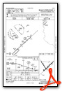
VFR Chart of KJYL
Sectional Charts at SkyVector.com
IFR Chart of KJYL
Enroute Charts at SkyVector.com
Location Information for KJYL
Coordinates: N32°38.73' / W81°35.80'Located 07 miles S of Sylvania, Georgia on 1846 acres of land. View all Airports in Georgia.
Surveyed Elevation is 190 feet MSL.
Operations Data
|
|
Airport Communications
| AWOS-3: | 118.875 Tel. 912-857-9000 |
|---|---|
| CTAF: | 122.800 |
| UNICOM: | 122.800 |
| AWOS-3 at TBR (12.1 SW): | 119.025 912-764-9321 |
| AWOS-3PT at 2J5 (23.8 NW): | 120.2 478-982-4562 |
| AWOS-3PT at AQX (26.6 NE): | 118.950 803-584-3696 |
- APCH/DEP SVC PRVDD BY JACKSONVILLE ARTCC ON FREQS 132.925/363.2 (MILLEN RCAG).
Nearby Navigation Aids
|
| ||||||||||||||||||||||||||||||||||||||||||||||||||||||||||||


Runway 05/23
| Dimensions: | 5501 x 100 feet / 1677 x 30 meters | |
|---|---|---|
| Surface: | Asphalt in Fair Condition | |
| Weight Limits: | S-20 | |
| Edge Lighting: | Medium Intensity | |
| Runway 05 | Runway 23 | |
| Coordinates: | N32°38.40' / W81°36.04' | N32°39.01' / W81°35.25' |
| Elevation: | 169.5 | 190.3 |
| Traffic Pattern: | Right | Left |
| Runway Heading: | 47° True | 227° True |
| Markings: | Non-Precision Instrument in good condition. | Non-Precision Instrument in good condition. |
| Glide Slope Indicator | P2L (3.00° Glide Path Angle) | P2L (3.00° Glide Path Angle) |
| Obstacles: | 30 ft Trees 971 ft from runway, 336 ft left of center | 32 ft Trees 908 ft from runway, 467 ft left of center |
Runway 15/33
| Dimensions: | 3787 x 75 feet / 1154 x 23 meters | |
|---|---|---|
| Surface: | Asphalt in Good Condition | |
| Runway 15 | Runway 33 | |
| Coordinates: | N32°39.03' / W81°36.23' | N32°38.51' / W81°35.81' |
| Elevation: | 175.3 | 174.9 |
| Traffic Pattern: | Right | Left |
| Runway Heading: | 145° True | 325° True |
| Markings: | Basic in good condition. | Basic in good condition. |
| Obstacles: | 65 ft Trees 1596 ft from runway, 259 ft left of center | |
Services Available
| Fuel: | 100LL (blue), Jet A+ |
|---|---|
| Transient Storage: | Tiedowns |
| Airframe Repair: | MAJOR |
| Engine Repair: | MAJOR |
| Bottled Oxygen: | NONE |
| Bulk Oxygen: | NONE |
| Other Services: | CROP DUSTING SERVICES,PARACHUTE JUMP ACTIVITY |
Ownership Information
| Ownership: | Publicly owned | |
|---|---|---|
| Owner: | SYLVANIA SCREVEN ARPT AUTH | |
| 104 EAST TELEPHONE STREET | ||
| SYLVANIA, GA 30467 | ||
| 912-8573328 | ||
| Manager: | HANK MAIERHOFFER | |
| 538 BEACON ROAD | ||
| SYLVANIA, GA 30467 | ||
| 912-857-3220 | ALT PHONE 912-682-9313. | |
Other Remarks
- DEER ON & INVOF ARPT.
- FOR CD CTC JACKSONVILLE ARTCC AT 904-845-1592.
- MIL OPN RQR 24 HR PPR AT 912-687-0653.
- 0LL FUEL 24 HR CREDIT CARD SVC AVBL.
- MIRL RWY 05/23 PRESET LOW INTST DUSK-0100, TO INCR INTST AND ACTVT AFTER 0100 - CTAF. PAPI RWY 05 & 23 - CTAF.
Weather Minimums


Instrument Approach Procedure (IAP) Charts

Nearby Airports with Instrument Procedures
| ID | Name | Heading / Distance | ||
|---|---|---|---|---|
 |
KTBR | Statesboro-Bulloch County Airport | 216° | 12.1 |
|
2J5 | Millen Airport | 308° | 23.8 |
|
KAQX | Allendale County Airport | 038° | 26.7 |
|
KMHP | John Edwin Jones Sr Field/Metter Municipal Airport | 236° | 29.5 |
|
KCWV | Claxton-Evans County Airport | 207° | 30.3 |
|
KBXG | Burke County Airport | 319° | 31.4 |
|
KSAV | Savannah/Hilton Head International Airport | 147° | 36.9 |
|
KBNL | Barnwell Regional Airport | 015° | 38.1 |
|
KSBO | East Georgia Regional Airport | 267° | 39.2 |
|
KSVN | Hunter AAF Airport | 148° | 44.4 |
|
2J3 | Louisville Municipal Airport | 297° | 44.8 |
|
KRVJ | Swinton Smith Field At Reidsville Municipal Airport | 219° | 45.1 |
Airport Images

By: wbarthur

By: wbarthur


Comments
KJYL Camping Area
Fly in and camp under your wing at KJYL. We have a campsite complete with restroom, showers and picnic table available for pilots and passengers. There is no cost but we'd appreciate it if you would buy some gas. Bring your own tie down equipment. All campers should have an airplane, no car campers. One night only unless you make arrangements with the airport management. Walk down the dirt road to the east and there is a dumpster for trash. Enjoy the quiet of our 1800 acre airport!