Login
Register


CWV
Claxton-Evans County Airport
Official FAA Data Effective 2026-02-19 0901Z
Chart Supplement

VFR Chart of KCWV
Sectional Charts at SkyVector.com
IFR Chart of KCWV
Enroute Charts at SkyVector.com
Location Information for KCWV
Coordinates: N32°11.70' / W81°52.16'Located 03 miles NE of Claxton, Georgia on 105 acres of land. View all Airports in Georgia.
Surveyed Elevation is 111 feet MSL.
Operations Data
|
|
Airport Communications
| AWOS-3: | 120.075 Tel. 912-739-3768 |
|---|---|
| CTAF: | 122.800 |
| UNICOM: | 122.800 |
| AWOS-3PT at MHP (15.1 NW): | 120.3 912-685-2729 |
| AWOS-3PT at RVJ (16.4 SW): | 128.325 912-557-0011 |
| AWOS-3 at TBR (18.5 N): | 119.025 912-764-9321 |
- APCH/DEP SVC PRVDD BY JACKSONVILLE ARTCC ON FREQS 132.925/363.2 (SAVANNAH RCAG).
Nearby Navigation Aids
|
| ||||||||||||||||||||||||||||||||||||||||||||||||||||||||||||


Runway 10/28
| Dimensions: | 5151 x 75 feet / 1570 x 23 meters | |
|---|---|---|
| Surface: | Asphalt in Good Condition | |
| Weight Limits: | S-30 | |
| Edge Lighting: | Medium Intensity | |
| Runway 10 | Runway 28 | |
| Coordinates: | N32°11.69' / W81°52.66' | N32°11.71' / W81°51.66' |
| Elevation: | 111.5 | 98.2 |
| Traffic Pattern: | Left | Left |
| Runway Heading: | 89° True | 269° True |
| Displaced Threshold: | 500 Feet | |
| Declared Distances: | TORA:5151 TODA:5151 ASDA:5151 LDA:4651 | TORA:5151 TODA:5151 ASDA:5151 LDA:5151 |
| Markings: | Non-Precision Instrument in good condition. | Non-Precision Instrument in good condition. |
| Glide Slope Indicator | P2L (3.00° Glide Path Angle) | P2L (3.00° Glide Path Angle) |
| REIL: | Yes | Yes |
| Obstacles: | 18 ft Road 414 ft from runway, 282 ft left of center RWY 10 - 20:1 SLP TO DSPLCD THLD. |
89 ft Trees 2514 ft from runway, 121 ft left of center |
Services Available
| Fuel: | 100LL (blue) |
|---|---|
| Transient Storage: | Tiedowns |
| Airframe Repair: | NONE |
| Engine Repair: | NONE |
| Bottled Oxygen: | NONE |
| Bulk Oxygen: | NONE |
| Other Services: | CROP DUSTING SERVICES |
Ownership Information
| Ownership: | Publicly owned | |
|---|---|---|
| Owner: | CITY OF CLAXTON | |
| BOX 33 | ||
| CLAXTON, GA 30417 | ||
| 912-739-1712 | ||
| Manager: | VERNON OWENS, AIRPORT MANAGER | |
| 389 AIRPORT ROAD | ||
| CLAXTON, GA 30417 | ||
| 912-739-0124 | ||
Other Remarks
- FOR CD CTC JACKSONVILLE ARTCC AT 904-845-1592.
- ACTVT REIL RWY 10 & 28; PAPI RWYS 10 & 28 - CTAF. MIRL RWY 10/28 PRESET LOW INTST; TO INCR INTST & ACTVT AFTER 2200 - CTAF.
Weather Minimums


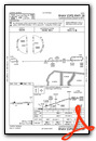
Instrument Approach Procedure (IAP) Charts

Nearby Airports with Instrument Procedures
| ID | Name | Heading / Distance | ||
|---|---|---|---|---|
 |
KMHP | John Edwin Jones Sr Field/Metter Municipal Airport | 314° | 15.2 |
|
KRVJ | Swinton Smith Field At Reidsville Municipal Airport | 240° | 16.6 |
|
KTBR | Statesboro-Bulloch County Airport | 021° | 18.5 |
|
KLHW | Wright AAF (Fort Stewart)/Midcoast Regional Airport | 139° | 24.1 |
|
KVDI | Vidalia Regional Airport | 269° | 25.6 |
|
KJYL | Plantation Airpark Airport | 027° | 30.3 |
|
KSAV | Savannah/Hilton Head International Airport | 096° | 34.2 |
|
KSBO | East Georgia Regional Airport | 314° | 35.5 |
|
KSVN | Hunter AAF Airport | 106° | 38.5 |
|
KJES | Jesup-Wayne County Airport | 181° | 38.4 |
|
KBHC | Baxley Municipal Airport | 223° | 39.3 |
|
2J5 | Millen Airport | 353° | 42.1 |
Airport Images
Do you have a recent image of this airport? Upload it here!


Comments
Жизнь на юге