Login
Register


MPE
Philadelphia Municipal Airport
Official FAA Data Effective 2026-02-19 0901Z
Chart Supplement

VFR Chart of KMPE
Sectional Charts at SkyVector.com
IFR Chart of KMPE
Enroute Charts at SkyVector.com
Location Information for KMPE
Coordinates: N32°47.95' / W89°7.56'Located 02 miles NW of Philadelphia, Mississippi on 60 acres of land. View all Airports in Mississippi.
Surveyed Elevation is 458 feet MSL.
Operations Data
|
|
Airport Communications
| AWOS-3P: | 118.725 Tel. 601-663-0040 |
|---|---|
| UNICOM: | 123.000 |
| CTAF: | 123.000 |
| AWOS-3PT at LMS (21.0 N): | 118.325 |
| ATIS at NMM (32.4 SE): | 290.525 |
| ASOS at MEI (33.7 SE): | 601-207-0082 |
- APCH/DEP SVC PRVDD BY MEMPHIS ARTCC ON FREQS 132.75/263.0 (LOUISVILLE RCAG).
Nearby Navigation Aids
|
| ||||||||||||||||||||||||||||||||||||||||||||||||||||||


Runway 18/36
| Dimensions: | 5001 x 75 feet / 1524 x 23 meters | |
|---|---|---|
| Surface: | Asphalt in Good Condition | |
| Weight Limits: | S-30 | |
| Edge Lighting: | Medium Intensity | |
| Runway 18 | Runway 36 | |
| Coordinates: | N32°48.36' / W89°7.51' | N32°47.54' / W89°7.61' |
| Elevation: | 440.4 | 458.1 |
| Traffic Pattern: | Left | Left |
| Runway Heading: | 185° True | 5° True |
| Markings: | Non-Precision Instrument in good condition. | Non-Precision Instrument in good condition. |
| Glide Slope Indicator | P2L (3.00° Glide Path Angle) | P2L (3.00° Glide Path Angle) PAPI UNUSBL BYD 7 DEGS LEFT OF CNTRLN. |
| REIL: | Yes | Yes |
| Obstacles: | 75 ft Trees 1550 ft from runway | 68 ft Trees 1575 ft from runway, 250 ft right of center |
Services Available
| Fuel: | 100LL (blue), Jet-A |
|---|---|
| Transient Storage: | Tiedowns |
| Airframe Repair: | NOT AVAILABLE |
| Engine Repair: | NOT AVAILABLE |
| Bottled Oxygen: | NOT AVAILABLE |
| Bulk Oxygen: | NOT AVAILABLE |
Ownership Information
| Ownership: | Publicly owned | |
|---|---|---|
| Owner: | CITY OF PHILADELPHIA | |
| 525 MAIN ST | ||
| PHILADELPHIA, MS 39350 | ||
| 601-656-3612 | ||
| Manager: | DAN CUMBERLAND | |
| 1036 AIRPORT RD | ||
| PHILADELPHIA, MS 39350 | ||
| 601-656-0203 | ||
Other Remarks
- FOR CD CTC MEMPHIS ARTCC AT 901-368-8453/8449.
- NO CREDIT CARD SELF SVC AVBL.
- ACTVT REIL RWY 18 & 36; PAPI RWY 18 & 36; MIRL 18/36 - CTAF.
Weather Minimums


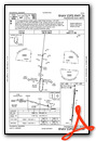
Instrument Approach Procedure (IAP) Charts

Nearby Airports with Instrument Procedures
| ID | Name | Heading / Distance | ||
|---|---|---|---|---|
 |
KLMS | Louisville/Winston County Airport | 008° | 21.0 |
|
KOSX | Kosciusko-Attala County Airport | 309° | 27.3 |
|
KNMM | Meridian NAS (Mc Cain Field) Airport | 116° | 32.4 |
|
KMEI | Key Field Airport | 145° | 33.8 |
|
KSTF | George M Bryan Airport | 020° | 40.5 |
|
KGTR | Golden Triangle Regional Airport | 034° | 47.3 |
|
M51 | Oktibbeha Airport | 028° | 47.4 |
|
19M | C A Moore Airport | 293° | 49.4 |
|
5A6 | Winona-Montgomery County Airport | 322° | 50.2 |
|
KAIV | George Downer Airport | 068° | 50.4 |
|
M83 | Mccharen Field Airport | 026° | 52.4 |
|
KMBO | Bruce Campbell Field Airport | 246° | 54.0 |
Airport Images
Do you have a recent image of this airport? Upload it here!


Comments
Fuel Truck Down
Effective 2/27/2024 the FBO said the fuel truch is not operable and is awairting parts. Fuel is available at the tank farm.
Don Biscoe