Login
Register


MYR
Myrtle Beach International Airport
Official FAA Data Effective 2026-02-19 0901Z
Chart Supplement

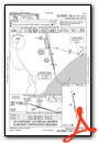
KMYR Airport Diagram

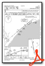
VFR Chart of KMYR
Sectional Charts at SkyVector.com
IFR Chart of KMYR
Enroute Charts at SkyVector.com
Location Information for KMYR
Coordinates: N33°40.78' / W78°55.70'Located 03 miles SW of Myrtle Beach, South Carolina on 3795 acres of land. View all Airports in South Carolina.
Surveyed Elevation is 25 feet MSL.
Operations Data
|
|
Airport Communications
| ATIS: | 123.925 |
|---|---|
| AWOS-3PT: | 123.925 Tel. 843-238-0335 |
| MYRTLE BEACH TOWER: | 128.45 259.3 |
| MYRTLE BEACH GROUND: | 120.3 275.8 |
| MYRTLE BEACH APPROACH: | 119.2 ;322-170 127.4 ;171-321 257.95 ;171-321 350.3 ;322-170 |
| MYRTLE BEACH DEPARTURE: | 119.2 ;322-170 127.4 ;171-321 257.95 ;171-321 350.3 ;322-170 |
| CLEARANCE DELIVERY: | 120.3 |
| UNICOM: | 122.950 |
| CTAF: | 128.450 |
| EMERG: | 121.5 243.0 |
| CLASS C: | 119.2 ;322-170 127.4 ;171-321 257.95 ;171-321 350.3 ;322-170 |
| PMSV METRO: | 239.8 |
| ATIS at CRE (12.9 NE): | 119.625 |
| AWOS-3 at HYW (13.2 NW): | 119.525 843-397-8046 |
| ASOS at CRE (13.2 NE): | 119.625 843-361-2802 |
- APCH/DEP SVC PRVDD BY JACKSONVILLE ARTCC ON FREQS 134.375/317.550 (MYRTLE BEACH RCAG) WHEN APCH CTLCLSD.
Nearby Navigation Aids
|
| ||||||||||||||||||||||||||||||||||||||||||||||||||||||||||||


Runway 18/36
| Dimensions: | 9503 x 150 feet / 2897 x 46 meters | |
|---|---|---|
| Surface: | Asphalt / Grooved in Good Condition | |
| Weight Limits: | S-120, D-233, ST-424, DT-943
PCR VALUE: 302/F/A/X/T
| |
| Edge Lighting: | High Intensity | |
| Runway 18 | Runway 36 | |
| Coordinates: | N33°41.55' / W78°55.89' | N33°40.02' / W78°55.51' |
| Elevation: | 22.5 | 21.8 |
| Traffic Pattern: | Right | Left |
| Runway Heading: | 168° True | 348° True |
| Markings: | Precision Instrument in good condition. | Precision Instrument in good condition. |
| Glide Slope Indicator | P4L (3.00° Glide Path Angle) | P4L (3.00° Glide Path Angle) |
| RVR Equipment | Touchdown Rollout | Touchdown Rollout |
| Approach Lights: | MALSR 1,400 Foot Medium-intensity Approach Lighting System with runway alignment indicator lights. | MALSF 1,400 Foot Medium-intensity Approach Lighting System with sequenced flashers. |
| Obstacles: | ft Power Line 3000 ft from runway | ft Trees 2100 ft from runway |
Services Available
| Fuel: | 100LL (blue), Jet-A |
|---|---|
| Transient Storage: | Tiedowns |
| Airframe Repair: | MAJOR |
| Engine Repair: | MAJOR |
| Bottled Oxygen: | NONE |
| Bulk Oxygen: | NONE |
| Other Services: | CHARTER SERVICE,PILOT INSTRUCTION,AIRCRAFT RENTAL |
Ownership Information
| Ownership: | Publicly owned | |
|---|---|---|
| Owner: | HORRY COUNTY | |
| P O BOX 1236 | ||
| CONWAY, SC 29526 | ||
| 843-448-1580 | ||
| Manager: | JUDI OLMSTEAD | |
| 1100 JETPORT RD | ||
| MYRTLE BEACH, SC 29577 | ||
| 843-448-1580 | ATCT MANAGER 843-238-3008, EXT 1. VANMOPPES@HORRYCOUNTY.ORG | |
Other Remarks
- GULLS ON & INVOF ARPT.
- NO APVL RQRD FOR PUSHBACK AT TRML GATES; PUSH IS AT PILOT DISCRETION; RMN CLR OF TWYS.
- CONTACT MYR OPS ON CTAF 128.45 PRIOR TO LANDING 2300-0600.
- SIGHTSEEING HELS OPRG IN CLOSE PROXIMITY OF ARPT AND RWY AT OR BLW 1200 FT. HEL RTES AND HLDG POINTS RMN CLR OF RWY CNTRLNS. HELS DEPG/ARRG PAD LCTD 700 FT SSE APCH END RWY 36.
- MEDEVAC HEL DEPARTING GRAND STRAND MED CTR, SW BOUND, CTC MYR TWR ON 134.05 PRIOR TO DEP OR AS SOON AS AB.
- WHEN ATCT CLSD ACTVT MALSR RWY 18, MALSF RWY 36; HIRL RWY 18/36 - CTAF.
- U.S. CUSTOMS SVC AVBL MON-FRI 0800-1700, OTR TIMES PPR & FEE CHARGED.
Weather Minimums

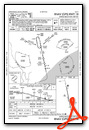
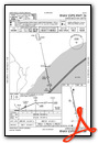
Instrument Approach Procedure (IAP) Charts


Nearby Airports with Instrument Procedures
| ID | Name | Heading / Distance | ||
|---|---|---|---|---|
 |
KCRE | Grand Strand Airport | 052° | 12.9 |
|
KHYW | Conway-Horry County Airport | 312° | 13.2 |
|
5J9 | Twin City Airport | 007° | 24.7 |
|
KGGE | Georgetown County Airport | 221° | 29.6 |
|
KPHH | Robert F Swinnie Airport | 245° | 32.9 |
|
KMAO | Marion County Airport | 326° | 36.2 |
|
KCPC | Columbus County Regional Airport | 016° | 37.1 |
|
51J | Lake City Municipal Cj Evans Field Airport | 284° | 43.3 |
|
KSUT | Cape Fear Regional Jetport/Howie Franklin Field Airport | 070° | 45.3 |
|
KCKI | Williamsburg Regional Airport | 273° | 46.5 |
|
KFLO | Florence Regional Airport | 307° | 49.9 |
|
KDLC | Dillon County Airport | 334° | 51.0 |
Airport Images
Do you have a recent image of this airport? Upload it here!


