Login
Register


N19
Aztec Municipal Airport
Official FAA Data Effective 2026-02-19 0901Z
Chart Supplement

VFR Chart of N19
Sectional Charts at SkyVector.com
IFR Chart of N19
Enroute Charts at SkyVector.com
Location Information for N19
Coordinates: N36°50.22' / W108°1.72'Located 02 miles NW of Aztec, New Mexico on 160 acres of land. View all Airports in New Mexico.
Estimated Elevation is 5882 feet MSL.
Operations Data
|
|
Airport Communications
| CTAF: | 122.900 |
|---|---|
| ASOS at FMN (11.2 SW): | 127.15 505-421-0068 |
| ATIS at FMN (11.3 SW): | 127.15 |
| ASOS at DRO (23.0 NE): | 120.625 970-259-3579 |
Nearby Navigation Aids
|
| ||||||||||||||||||||||||||||||||||||


Runway 08/26
4 FT FENCE 105 FT FM CNTRLN INTMT ALG RWY BOTH SIDES. 60-180 FT TRRN DROP OFF BYD RWY ENDS. | ||
| Dimensions: | 4314 x 60 feet / 1315 x 18 meters | |
|---|---|---|
| Surface: | Asphalt in Good Condition | |
| Weight Limits: | 4 /F/C/Y/T, S-10 | |
| Edge Lighting: | Medium Intensity | |
| Runway 08 | Runway 26 | |
| Coordinates: | N36°50.24' / W108°2.16' | N36°50.19' / W108°1.28' |
| Elevation: | 5866.2 | 5881.4 |
| Traffic Pattern: | Left | Left |
| Runway Heading: | 94° True | 274° True |
| Displaced Threshold: | 226 Feet | 277 Feet |
| Declared Distances: | TORA:4314 TODA:4314 ASDA:4037 LDA:3811 | TORA:4314 TODA:4314 ASDA:4088 LDA:3811 |
| Markings: | Basic in good condition. | Basic in good condition. |
| Glide Slope Indicator | PNIL (3.50° Glide Path Angle) | PSIL (3.00° Glide Path Angle) |
Services Available
| Fuel: | 100LL (blue) |
|---|---|
| Transient Storage: | Hangars,Tiedowns CALL AHEAD FOR AVBLTY. |
| Airframe Repair: | NOT AVAILABLE |
| Engine Repair: | NOT AVAILABLE |
| Bottled Oxygen: | NOT AVAILABLE |
| Bulk Oxygen: | NOT AVAILABLE |
Ownership Information
| Ownership: | Publicly owned | |
|---|---|---|
| Owner: | CITY OF AZTEC | |
| 201 WEST CHACO | ||
| AZTEC, NM 87410 | ||
| 505-334-7602 | ||
| Manager: | DIANNE LOPEZ | |
| 201 W. CHACO | ||
| AZTEC, NM 87410 | ||
| 505-334-7606 | ||
Other Remarks
- LCTD ATOP MESA.
- RUNUPS ON TURN AROUNDS NA.
- GATE ACES 1987#.
- FOR CD CTC DENVER ARTCC AT 303-651-4257.
- PREFERRED NGT OPS.
- 0LL 24 HR 100 LL AVBL WITH MAJOR CREDIT CARD.
- ACTVT PLASI RWY 26; MIRL RWY 08/26 - CTAF. MIRL ON FM SS TO 2230 HRS AND FM 0400 TO SR.
Nearby Airports with Instrument Procedures
| ID | Name | Heading / Distance | ||
|---|---|---|---|---|
 |
KFMN | Four Corners Regional Airport | 239° | 11.3 |
|
KDRO | Durango-La Plata County Airport | 034° | 23.0 |
|
KCEZ | Cortez Municipal Airport | 314° | 40.1 |
|
KPSO | Stevens Field Airport | 059° | 53.9 |
|
KTEX | Telluride Regional Airport | 004° | 67.2 |
|
KBDG | Blanding Municipal Airport | 303° | 82.8 |
|
KRQE | Window Rock Airport | 215° | 87.1 |
|
KGUP | Gallup Municipal Airport | 205° | 87.6 |
|
KAIB | Hopkins Field Airport | 343° | 87.8 |
|
U64 | Monticello Airport | 316° | 90.8 |
|
KRCV | Astronaut Kent Rominger Airport | 056° | 96.0 |
|
KGNT | Grants-Milan Municipal Airport | 176° | 100.2 |
Airport Images
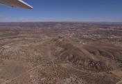
By: animas


