Login
Register
NC08
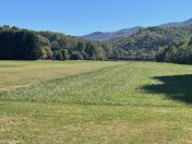
Tusquittee Landing Airport
Official FAA Data Effective 2025-12-25 0901Z
VFR Chart of NC08
Sectional Charts at SkyVector.com
IFR Chart of NC08
Enroute Charts at SkyVector.com
Location Information for NC08
Coordinates: N35°5.12' / W83°44.18'Located 05 miles NE of Hayesville, North Carolina on 17 acres of land. View all Airports in North Carolina.
Estimated Elevation is 2000 feet MSL.
Operations Data
|
|
Airport Communications
| CTAF: | 122.750 |
|---|---|
| AWOS-3P at RHP (9.1 NW): | 119.675 828-321-1049 |
| AWOS-3P at 1A5 (17.8 NE): | 118.225 828-349-3156 |
| AWOS-3PT at DZJ (19.0 SW): | 119.325 706-745-9271 |
Nearby Navigation Aids
|
| ||||||||||||||||||||||||||||||||||||||||||||||||||||||||||||
Runway 10/28
| Dimensions: | 2700 x 50 feet / 823 x 15 meters | |
|---|---|---|
| Surface: | Turf | |
| Runway 10 | Runway 28 | |
| Traffic Pattern: | Right | |
| Obstacles: | 60 ft Trees 600 ft from runway | |
Ownership Information
| Ownership: | Privately Owned | |
|---|---|---|
| Owner: | TUSQITTEE LANDING FLYERS ASSOC INC | |
| P.O. BOX 293 | ||
| HAYESVILLE, NC 28904 | ||
| 678-787-8993 | ||
| Manager: | TOMMY SHOAF | |
| P.O. BOX 293 | ||
| HAYESVILLE, NC 28904 | ||
| 678-787-8993 | ||
Other Remarks
- FOR CD CTC ATLANTA ARTCC AT 770-210-7692.
Nearby Airports with Instrument Procedures
| ID | Name | Heading / Distance | ||
|---|---|---|---|---|
 |
KRHP | Western Carolina Regional Airport | 316° | 9.1 |
 |
1A5 | Macon County Airport | 062° | 17.6 |
 |
KDZJ | Blairsville Airport | 223° | 18.9 |
 |
24A | Jackson County Airport | 061° | 29.4 |
 |
1A3 | Martin Campbell Field Airport | 262° | 30.4 |
 |
KAJR | Habersham County Airport | 165° | 36.2 |
 |
KTOC | Toccoa Rg Letourneau Field Airport | 143° | 36.6 |
 |
KMNV | Monroe County Airport | 311° | 41.9 |
 |
KMMI | Mcminn County Airport | 295° | 44.7 |
 |
KTYS | Mc Ghee Tyson Airport | 343° | 45.3 |
 |
KGKT | Gatlinburg-Pigeon Forge Airport | 012° | 47.4 |
 |
49A | Gilmer County Airport | 235° | 47.7 |


