Login
Register


O53
Medford Municipal Airport
Official FAA Data Effective 2026-02-19 0901Z
Chart Supplement

VFR Chart of O53
Sectional Charts at SkyVector.com
IFR Chart of O53
Enroute Charts at SkyVector.com
Location Information for O53
Coordinates: N36°47.44' / W97°44.94'Located 01 miles SW of Medford, Oklahoma on 127 acres of land. View all Airports in Oklahoma.
Surveyed Elevation is 1092 feet MSL.
Operations Data
|
|
Airport Communications
| VANCE APPROACH: | 118.075 273.475 |
|---|---|
| VANCE DEPARTURE: | 118.075 273.475 |
| UNICOM: | 122.800 |
| CTAF: | 122.800 |
| AWOS-3PT at BKN (19.5 E): | 120.575 580-363-0688 |
| AWOS-3PT at WDG (24.8 S): | 123.725 580-237-1475 |
| AWOS-3PT at ANY (27.2 NW): | 119.575 620-842-4345 |
- APCH/DEP CTL SVC PRVDD BY KANSAS CITY ARTCC (ZKC) ON FREQS 127.8/319.1 (PONCA CITY RCAG) WHEN VANCE APCH CTL (END) CLSD.
Nearby Navigation Aids
|
| ||||||||||||||||||||||||||||||||||||||||||||||||||||||||||||


Runway 17/35
| Dimensions: | 3007 x 60 feet / 917 x 18 meters | |
|---|---|---|
| Surface: | Asphalt in Good Condition | |
| Weight Limits: | S-13 | |
| Edge Lighting: | Medium Intensity | |
| Runway 17 | Runway 35 | |
| Coordinates: | N36°47.68' / W97°44.94' | N36°47.19' / W97°44.94' |
| Elevation: | 1092.0 | 1085.0 |
| Traffic Pattern: | Left | Left |
| Runway Heading: | 180° True | 360° True |
| Markings: | Non-Precision Instrument in good condition. | Non-Precision Instrument in good condition. |
| Glide Slope Indicator | P2L (3.51° Glide Path Angle) | P2L (3.51° Glide Path Angle) |
Services Available
| Fuel: | NONE |
|---|---|
| Transient Storage: | Hangars,Tiedowns |
| Airframe Repair: | NONE |
| Engine Repair: | NONE |
| Bottled Oxygen: | NONE |
| Bulk Oxygen: | NONE |
Ownership Information
| Ownership: | Publicly owned | |
|---|---|---|
| Owner: | CITY OF MEDFORD | |
| 615 N. FRONT ST. | ||
| MEDFORD, OK 73759 | ||
| 580-395-2875 | ||
| Manager: | STEVEN BIRKELBACH | |
| 615 N. FRONT ST., PO BOX 123 | ||
| MEDFORD, OK 73759 | ||
| 580-395-2875 | ||
Other Remarks
- THIS AIRPORT HAS BEEN SURVEYED BY THE NATIONAL GEODETIC SURVEY.
- 100 FT REFINERY 1 NM SW OF ARPT.
- FOR CD CTC VANCE APCH AT 580-213-6765. WHEN VANCE APCH IS CLSD, CTC KANSAS CITY ARTCC AT 913-254-8508.
- DUSK-DAWN ACTVT MIRL RY 17/35 - CTAF.
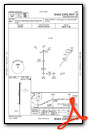
Instrument Approach Procedure (IAP) Charts

Nearby Airports with Instrument Procedures
| ID | Name | Heading / Distance | ||
|---|---|---|---|---|
 |
KBKN | Blackwell-Tonkawa Municipal Airport | 097° | 19.4 |
|
KWDG | Enid Woodring Regional Airport | 184° | 24.9 |
|
KANY | Anthony Municipal Airport | 324° | 27.2 |
|
KEND | Vance AFB Airport | 196° | 28.2 |
|
KPNC | Ponca City Regional Airport | 096° | 31.5 |
|
8K2 | Harper Municipal Airport | 334° | 32.5 |
|
F22 | Perry Municipal Airport | 136° | 33.3 |
|
KEGT | Wellington Municipal Airport | 028° | 36.4 |
|
KWLD | Strother Field Airport | 056° | 41.0 |
|
KAVK | Alva Regional Airport | 268° | 44.5 |
|
6K4 | Fairview Municipal Airport | 229° | 46.2 |
|
KSWO | Stillwater Regional Airport | 139° | 49.5 |
Airport Images
Do you have a recent image of this airport? Upload it here!


