Login
Register


OGS
Ogdensburg International Airport
Official FAA Data Effective 2026-02-19 0901Z
Chart Supplement

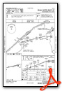
KOGS Airport Diagram

VFR Chart of KOGS
Sectional Charts at SkyVector.com
IFR Chart of KOGS
Enroute Charts at SkyVector.com
Location Information for KOGS
Coordinates: N44°40.94' / W75°27.80'Located 02 miles SE of Ogdensburg, New York on 500 acres of land. View all Airports in New York.
Surveyed Elevation is 301 feet MSL.
Operations Data
|
|
Airport Communications
| AWOS-3: | 118.525 Tel. 315-393-8982 |
|---|---|
| UNICOM: | 122.800 |
| CTAF: | 122.800 |
| AWOS-3P at PTD (22.0 E): | 118.325 315-265-6106 |
| ASOS at MSS (30.2 NE): | 128.075 315-764-0481 |
| ATIS at GTB (39.2 S): | 119.525 |
- APCH/DEP SVC PRVDD BY BOSTON ARTCC ON FREQS 135.25/377.1 (TURIN RCAG).
Nearby Navigation Aids
|
| ||||||||||||||||||||||||||||||||||||||||||||||||||||||||||||


Runway 09/27
| Dimensions: | 6400 x 150 feet / 1951 x 46 meters | |
|---|---|---|
| Surface: | Asphalt / Grooved in Excellent Condition | |
| Weight Limits: | S-114, D-151, ST-225
PCR VALUE: 523/F/D/X/T
| |
| Edge Lighting: | High Intensity | |
| Runway 09 | Runway 27 | |
| Coordinates: | N44°40.81' / W75°28.51' | N44°41.06' / W75°27.08' |
| Elevation: | 286.0 | 301.5 |
| Traffic Pattern: | Left | Left |
| Runway Heading: | 76° True | 256° True |
| Declared Distances: | TORA:6400 TODA:6400 ASDA:6006 LDA:6006 | TORA:6400 TODA:6400 ASDA:6035 LDA:6035 |
| Markings: | Non-Precision Instrument in good condition. | Non-Precision Instrument in good condition. |
| Glide Slope Indicator | P4L (3.00° Glide Path Angle) | P4L (3.00° Glide Path Angle) |
| Approach Lights: | MALSF 1,400 Foot Medium-intensity Approach Lighting System with sequenced flashers. | |
Services Available
| Fuel: | 100LL (blue), Jet-A |
|---|---|
| Transient Storage: | Tiedowns |
| Airframe Repair: | NOT AVAILABLE |
| Engine Repair: | NOT AVAILABLE |
| Bottled Oxygen: | NONE |
| Bulk Oxygen: | NONE |
| Other Services: | PILOT INSTRUCTION,AIRCRAFT RENTAL |
Ownership Information
| Ownership: | Publicly owned | |
|---|---|---|
| Owner: | OGDENSBURG BRIDGE & PORT | |
| BRIDGE PLAZA | ||
| OGDENSBURG, NY 13669 | ||
| 315-393-4080 | ||
| Manager: | CHARLIE GARRELTS | |
| 5840 STATE HWY 812 | ||
| OGDENSBURG, NY 13669 | ||
| (315) 869-2676 | ||
Other Remarks
- BIRDS & DEER ON & INVOF ARPT.
- FOR CD IF UNA TO CTC ON FSS FREQ, CTC BOSTON ARTCC AT 603-879-6859 .
- RWY/TWY/APN COND NOT MONITORED OUTSIDE NML ATTENDANCE HRS.
- 0LL FUEL AVBL AFT 1600 CALL 315-869-2676.
- ACTVT MALSF RWY 27; HIRL RWY 09/27; TWY LGTS - CTAF. PAPI RWY 09 & 27 OPR CONSLY.
- ACFT APCHING FROM THE WEST AND LDG ON RWY 09 SHOULD MNT BROCKVILLE ARPT (CNL3) UNICOM ON 123.0.
Weather Minimums


Instrument Approach Procedure (IAP) Charts


Nearby Airports with Instrument Procedures
| ID | Name | Heading / Distance | ||
|---|---|---|---|---|
 |
KPTD | Potsdam Municipal/Damon Field Airport | 090° | 22.0 |
|
CYSH | Montague/Russ Beach Airport | 307° | 25.8 |
|
KMSS | Massena International-Richards Field Airport | 059° | 30.5 |
|
KGTB | Wheeler-Sack AAF Airport | 196° | 39.2 |
|
CYOW | Ottawa/Macdonald-Cartier International Airport | 347° | 39.4 |
|
KART | Watertown International Airport | 210° | 47.8 |
|
KMAL | Malone-Dufort Airport | 077° | 49.6 |
|
CYND | Ottawa/Gatineau Airport | 355° | 50.6 |
|
KSLK | Adirondack Regional Airport | 107° | 56.8 |
|
KLKP | Lake Placid Airport | 110° | 69.2 |
|
K09 | Piseco Airport | 150° | 84.4 |
|
KPBG | Plattsburgh International Airport | 090° | 85.4 |
Airport Images
Do you have a recent image of this airport? Upload it here!


Comments
Airport Aircraft Information
The aircraft basing info for all the airports has been removed for approximately 6 months for all airports from this site. Can you direct me to where this information is maintained either on your site or another civil or FAA site. Thx in advance.