Login
Register


OK06
Snake Creek Wilderness Airport
Official FAA Data Effective 2026-02-19 0901Z
VFR Chart of OK06
Sectional Charts at SkyVector.com
IFR Chart of OK06
Enroute Charts at SkyVector.com
Location Information for OK06
Coordinates: N35°38.87' / W94°57.00'Located 03 miles S of Cookson, Oklahoma on 1500 acres of land. View all Airports in Oklahoma.
Estimated Elevation is 1130 feet MSL.
Operations Data
|
|
Airport Communications
| UNICOM: | 122.800 |
|---|---|
| AWOS-3 at JSV (14.5 SE): | 118.475 918-775-4136 |
| AWOS-3P at TQH (17.2 N): | 118.425 918-453-2729 |
| ASOS at MKO (20.3 W): | 135.025 918-683-6987 |
Nearby Navigation Aids
|
| ||||||||||||||||||||||||||||||||||||||||||||||||||||||||||||


Runway 03/21
| Dimensions: | 2840 x 50 feet / 866 x 15 meters | |
|---|---|---|
| Surface: | Asphalt | |
| Runway 03 | Runway 21 | |
| Obstacles: | 50 ft Trees 500 ft from runway | 50 ft Trees 500 ft from runway |
Ownership Information
| Ownership: | Privately Owned | |
|---|---|---|
| Owner: | VERAMAN DAVIS | |
| 310 NORTH ST. | ||
| TALEQUAH, OK 74464 | ||
| 918-931-7886 | ||
| Manager: | LARUE LOGUE | |
| 36650 S. DOGWOOD LANE | ||
| COOKSON, OK 74427 | ||
| 918-316-3846 | ||
Other Remarks
- TREES ALONG SIDES OF RY.
- RY 21 SLOPES DOWNHILL.
- CELL TWR, 350 FT (AGL) 950 FT MSL APPROXIMATELY 1 MI SW OF ARPT.
- FOR CD CTC RAZORBACK APCH AT 479-649-2416, WHEN APCH CLSD CTC MEMPHIS ARTCC AT 901-368-8453/8449.
Nearby Airports with Instrument Procedures
| ID | Name | Heading / Distance | ||
|---|---|---|---|---|
 |
KJSV | Sallisaw Municipal Airport | 150° | 14.5 |
|
KTQH | Tahlequah Municipal Airport | 351° | 17.1 |
|
KMKO | Muskogee-Davis Regional Airport | 271° | 20.1 |
|
KGZL | Stigler Regional Airport | 198° | 22.7 |
|
H68 | Hefner-Easley Airport | 315° | 27.0 |
|
KFSM | Fort Smith Regional Airport | 122° | 34.1 |
|
H71 | Mid-America Industrial Airport | 331° | 39.2 |
|
KSLG | Smith Field Airport | 034° | 39.6 |
|
KRKR | Robert S Kerr Airport | 156° | 40.8 |
|
KFYV | Drake Field Airport | 060° | 43.7 |
|
KGCM | Claremore Regional Airport | 326° | 46.5 |
|
5M5 | Crystal Lake Airport | 030° | 48.4 |
Airport Images
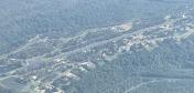
By: Big Orange Bird


