Login
Register


RKR
Robert S Kerr Airport
Official FAA Data Effective 2026-02-19 0901Z
Chart Supplement

VFR Chart of KRKR
Sectional Charts at SkyVector.com
IFR Chart of KRKR
Enroute Charts at SkyVector.com
Location Information for KRKR
Coordinates: N35°1.30' / W94°37.28'Located 02 miles S of Poteau, Oklahoma on 175 acres of land. View all Airports in Oklahoma.
Surveyed Elevation is 450 feet MSL.
Operations Data
|
|
Airport Communications
| AWOS-3: | 120.625 Tel. 918-647-4063 |
|---|---|
| RAZORBACK APPROACH: | 120.9 343.75 |
| RAZORBACK DEPARTURE: | 120.9 343.75 |
| CTAF: | 122.800 |
| UNICOM: | 122.800 |
| ASOS at FSM (22.5 NE): | 479-649-2425 |
| ATIS at FSM (22.7 NE): | 124.775 |
| AWOS-3 at JSV (26.5 N): | 118.475 918-775-4136 |
- APCH/DEP SVC PRVDD BY MEMPHIS ARTCC ON FREQS 126.1/269.0 (FAYETTEVILLE RCAG) WHEN RAZORBACK APCH CTL CLSD.
Nearby Navigation Aids
|
| ||||||||||||||||||||||||||||||||||||||||||||||||||||||||||||


Runway 18/36
| Dimensions: | 4007 x 75 feet / 1221 x 23 meters | |
|---|---|---|
| Surface: | Asphalt in Fair Condition | |
| Weight Limits: | S-27 | |
| Edge Lighting: | Medium Intensity | |
| Runway 18 | Runway 36 | |
| Coordinates: | N35°1.62' / W94°37.21' | N35°0.97' / W94°37.34' |
| Elevation: | 447.9 | 450.4 |
| Traffic Pattern: | Left | Left |
| Runway Heading: | 190° True | 10° True |
| Markings: | Non-Precision Instrument in poor condition. | Non-Precision Instrument in poor condition. |
| Glide Slope Indicator | P4L (3.00° Glide Path Angle) | P4L (3.00° Glide Path Angle) |
| Approach Lights: | ODALS Omnidirectional Approach Lighting System | |
| REIL: | Yes | |
| Obstacles: | 54 ft Trees 1831 ft from runway, 99 ft left of center | |
Services Available
| Fuel: | 100LL (blue), Jet A+ |
|---|---|
| Transient Storage: | Hangars,Tiedowns |
| Airframe Repair: | MAJOR |
| Engine Repair: | MAJOR |
| Bottled Oxygen: | NOT AVAILABLE |
| Bulk Oxygen: | NOT AVAILABLE |
| Other Services: | PILOT INSTRUCTION,AIRCRAFT SALES |
Ownership Information
| Ownership: | Publicly owned | |
|---|---|---|
| Owner: | CITY OF POTEAU | |
| CITY HALL, 111 PETERS ST. | ||
| POTEAU, OK 74953 | ||
| 918-647-4191 | ||
| Manager: | ROSSI CHRISTENBERRY | |
| 1900 AIRPORT ROAD | ||
| POTEAU, OK 74953 | ||
| 918-647-4226 | 918-647-7576. | |
Other Remarks
- FOR CD CTC RAZORBACK APCH 479-649-2416, WHEN APCH CLSD CTC MEMPHIS ARTCC AT 901-368-8453/8449.
- ULTRALIGHT ACT ON & INVOF ARPT.
- FADED.
- FADED.
- 0LL AVBL H24 WITH CREDIT CARD.
- ACTVT ODALS RWY 18; REIL RWY 36 - CTAF. MIRL RWY 18/36 - SS-SR; INCR INTST - CTAF.
Weather Minimums

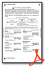
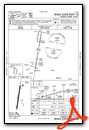
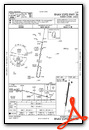
Instrument Approach Procedure (IAP) Charts
Nearby Airports with Instrument Procedures
| ID | Name | Heading / Distance | ||
|---|---|---|---|---|
 |
KFSM | Fort Smith Regional Airport | 033° | 22.7 |
|
KJSV | Sallisaw Municipal Airport | 340° | 26.5 |
|
KGZL | Stigler Regional Airport | 304° | 28.2 |
|
KMEZ | Mena Intermountain Municipal Airport | 143° | 35.2 |
|
7M5 | Ozark/Franklin County Airport | 052° | 48.3 |
|
KMKO | Muskogee-Davis Regional Airport | 316° | 52.7 |
|
KTQH | Tahlequah Municipal Airport | 341° | 57.6 |
|
KMLC | Mc Alester Regional Airport | 262° | 57.9 |
|
32A | Danville Municipal Airport | 085° | 58.9 |
|
KDEQ | J Lynn Helms Sevier County Airport | 169° | 59.4 |
|
KFYV | Drake Field Airport | 020° | 62.9 |
|
H35 | Clarksville Municipal Airport | 065° | 64.6 |


