Login
Register


TQH
Tahlequah Municipal Airport
Official FAA Data Effective 2026-02-19 0901Z
Chart Supplement

VFR Chart of KTQH
Sectional Charts at SkyVector.com
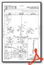
IFR Chart of KTQH
Enroute Charts at SkyVector.com
Location Information for KTQH
Coordinates: N35°55.82' / W95°0.27'Located 02 miles NW of Tahlequah, Oklahoma on 125 acres of land. View all Airports in Oklahoma.
Surveyed Elevation is 874 feet MSL.
Operations Data
|
|
Airport Communications
| AWOS-3P: | 118.425 Tel. 918-453-2729 |
|---|---|
| CTAF: | 122.800 |
| UNICOM: | 122.800 |
| AWOS-3PT at H71 (23.7 NW): | 120.1 918-476-0517 |
| ASOS at MKO (24.0 SW): | 135.025 918-683-6987 |
| AWOS-3PT at SLG (29.5 NE): | 118.375 479-524-9893 |
- APCH/DEP SVC PRVDD BY MEMPHIS ARTCC ON FREQS 126.1/269.0 (FAYETTEVILLE RCAG).
Nearby Navigation Aids
|
| ||||||||||||||||||||||||||||||||||||||||||||||||||||||||||||


Runway 17/35
| Dimensions: | 5001 x 75 feet / 1524 x 23 meters | |
|---|---|---|
| Surface: | Asphalt in Fair Condition | |
| Weight Limits: | S-26 | |
| Edge Lighting: | Medium Intensity | |
| Runway 17 | Runway 35 | |
| Coordinates: | N35°56.23' / W95°0.25' | N35°55.41' / W95°0.29' |
| Elevation: | 869.4 | 851.2 |
| Traffic Pattern: | Left | Left |
| Runway Heading: | 182° True | 2° True |
| Markings: | Non-Precision Instrument in fair condition. | Non-Precision Instrument in fair condition. |
| Glide Slope Indicator | P4L (3.50° Glide Path Angle) | P4L (3.00° Glide Path Angle) PAPI UNUSBL BYD 8 DEGS RIGHT OF CNTRLN. |
| REIL: | Yes | Yes |
| Obstacles: | 68 ft Trees 1280 ft from runway, 343 ft right of center | 31 ft Trees 239 ft from runway, 112 ft left of center 28 FT TREE 156 FT FM RWY END 131 FT L OF CNTRLN. |
Services Available
| Fuel: | 100LL (blue), Jet A+ |
|---|---|
| Transient Storage: | Hangars,Tiedowns |
| Airframe Repair: | MAJOR |
| Engine Repair: | MAJOR |
| Bottled Oxygen: | NOT AVAILABLE |
| Bulk Oxygen: | NOT AVAILABLE |
| Other Services: | PILOT INSTRUCTION |
Ownership Information
| Ownership: | Publicly owned | |
|---|---|---|
| Owner: | CITY OF TAHLEQUAH | |
| CITY HALL, 111 S. CHEROKEE | ||
| TAHLEQUAH, OK 74464 | ||
| 918-456-0561 | ||
| Manager: | BRIAN LAMBERT | |
| 2100 AIRPORT PARKWAY | ||
| TAHLEQUAH, OK 74464 | ||
| (918) 708-5600 | ||
Other Remarks
- FOR CD CTC MEMPHIS ARTCC AT 901-368-8453/8449.
- SELF SVC CREDIT CARD FUEL H24.
- ACTVT REIL RWY 17 & 35; MIRL RWY 17/35 - CTAF. PAPI RWY 17 & 35 ON CONSLY.
Weather Minimums

Instrument Approach Procedure (IAP) Charts

Nearby Airports with Instrument Procedures
| ID | Name | Heading / Distance | ||
|---|---|---|---|---|
 |
H68 | Hefner-Easley Airport | 277° | 16.6 |
|
H71 | Mid-America Industrial Airport | 318° | 23.7 |
|
KMKO | Muskogee-Davis Regional Airport | 226° | 23.9 |
|
KSLG | Smith Field Airport | 057° | 29.5 |
|
KJSV | Sallisaw Municipal Airport | 161° | 31.1 |
|
KGCM | Claremore Regional Airport | 313° | 31.7 |
|
5M5 | Crystal Lake Airport | 047° | 36.8 |
|
1K8 | South Grand Lake Regional Airport | 359° | 36.9 |
|
KGZL | Stigler Regional Airport | 186° | 38.7 |
|
KXNA | Northwest Arkansas Ntl Airport | 057° | 39.9 |
|
KFYV | Drake Field Airport | 083° | 40.9 |
|
H04 | Vinita Municipal Airport | 350° | 41.6 |
Airport Images

By: imrenee1


