Login
Register
RDK
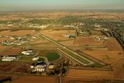
Red Oak Municipal Airport
Official FAA Data Effective 2025-11-27 0901Z
VFR Chart of KRDK
Sectional Charts at SkyVector.com
IFR Chart of KRDK
Enroute Charts at SkyVector.com
Location Information for KRDK
Coordinates: N41°0.65' / W95°15.53'Located 02 miles W of Red Oak, Iowa on 202 acres of land. View all Airports in Iowa.
Surveyed Elevation is 1045 feet MSL.
Operations Data
|
|
Airport Communications
| AWOS-3P: | 123.925 Tel. 712-623-3220 |
|---|---|
| OMAHA APPROACH: | 124.5 263.0 |
| OMAHA DEPARTURE: | 124.5 263.0 |
| CTAF: | 122.800 |
| UNICOM: | 122.800 |
| AWOS-3 at SDA (17.1 SW): | 125.525 712-246-4021 |
| AWOS-3 at ICL (20.3 SE): | 132.025 712-542-3345 |
| AWOS-3 at AIO (25.7 N): | 127.825 712-243-2748 |
- APCH/DEP SVC PRVDD BY OMAHA APCH CTL (R90) 0N 124.5/263.0.
Nearby Navigation Aids
|
| ||||||||||||||||||||||||||||||||||||||||||||||||||||||
Runway 05/23
RWY 23 CALM WIND RWY. | ||
| Dimensions: | 5100 x 75 feet / 1554 x 23 meters | |
|---|---|---|
| Surface: | Concrete in Good Condition | |
| Weight Limits: | 9 /R/C/W/T, S-30, D-42 | |
| Edge Lighting: | Medium Intensity | |
| Runway 05 | Runway 23 | |
| Coordinates: | N41°0.42' / W95°16.00' | N41°0.87' / W95°15.06' |
| Elevation: | 1042.1 | 1045.0 |
| Runway Heading: | 58° True | 238° True |
| Displaced Threshold: | 1000 Feet | |
| Markings: | Non-Precision Instrument in good condition. | Non-Precision Instrument in good condition. |
| Glide Slope Indicator | P2L (3.00° Glide Path Angle) | P2L (3.00° Glide Path Angle) |
| REIL: | Yes | Yes |
| Obstacles: | 60 ft Railroad 1752 ft from runway | 76 ft Trees 1796 ft from runway, 111 ft left of center |
Runway 17/35
| Dimensions: | 2901 x 60 feet / 884 x 18 meters | |
|---|---|---|
| Surface: | Concrete in Fair Condition | |
| Weight Limits: | 8 /R/C/W/T, S-12 | |
| Edge Lighting: | Medium Intensity | |
| Runway 17 | Runway 35 | |
| Coordinates: | N41°0.86' / W95°15.63' | N41°0.38' / W95°15.57' |
| Elevation: | 1044.8 | 1038.7 |
| Traffic Pattern: | Left | Left |
| Runway Heading: | 174° True | 354° True |
| Markings: | Non-Precision Instrument in good condition. | Non-Precision Instrument in good condition. |
| Glide Slope Indicator | P2L (3.00° Glide Path Angle) | P2L (3.00° Glide Path Angle) |
| REIL: | Yes | Yes |
| Obstacles: | 23 ft Road 680 ft from runway | 44 ft Power Line 1124 ft from runway, 83 ft right of center |
Runway 13/31
NOT MNTND NOV-APR. | ||
| Dimensions: | 2050 x 210 feet / 625 x 64 meters | |
|---|---|---|
| Surface: | Turf in Fair Condition | |
| Runway 13 | Runway 31 | |
| Coordinates: | N41°0.83' / W95°15.56' | N41°0.57' / W95°15.28' |
| Elevation: | 1042.4 | 1038.7 |
| Traffic Pattern: | Left | Left |
| Runway Heading: | 142° True | 322° True |
| Obstacles: | 27 ft Road 900 ft from runway | 51 ft Pole 1210 ft from runway |
Services Available
| Fuel: | 100LL (blue), Jet A-1+ |
|---|---|
| Transient Storage: | Hangars,Tiedowns |
| Airframe Repair: | NOT AVAILABLE |
| Engine Repair: | NOT AVAILABLE |
| Bottled Oxygen: | NOT AVAILABLE |
| Bulk Oxygen: | NOT AVAILABLE |
| Other Services: | CROP DUSTING SERVICES,PILOT INSTRUCTION |
Ownership Information
| Ownership: | Publicly owned | |
|---|---|---|
| Owner: | CITY OF RED OAK | NICK HILDRETH |
| 601 6TH ST | ||
| RED OAK, IA 51566 | ||
| 402-658-1782 | ||
| Manager: | KEVIN MCGREW | |
| 1674 200TH ST | ||
| RED OAK, IA 51566 | ||
| 712-274-3614 | ||
Other Remarks
- ULTRALIGHTS ON & INVOF ARPT.
- FOR CD CTC OMAHA APCH AT 402-682-4395.
- +44 FT PWR POLES 1650 FT FM THR.
- YELLOW CONES.
- YELLOW CONES.
- ACTVT REIL RWY 05, 17, 23 & 35; PAPI RWY 05, 17, 23 & 35; MIRL RWY 17/35 & 05/23 - CTAF.
Weather Minimums
Instrument Approach Procedure (IAP) Charts
Nearby Airports with Instrument Procedures
| ID | Name | Heading / Distance | ||
|---|---|---|---|---|
 |
KSDA | Shenandoah Municipal Airport | 204° | 17.1 |
 |
KICL | Schenck Field Airport | 148° | 20.3 |
 |
KCRZ | Corning Municipal Airport | 092° | 22.9 |
 |
KAIO | Atlantic Municipal Airport | 021° | 25.4 |
 |
KCBF | Council Bluffs Municipal Airport | 303° | 27.1 |
 |
KPMV | Plattsmouth Municipal/Douglas V Duey Field Airport | 263° | 30.2 |
 |
KOFF | Offutt AFB Airport | 282° | 30.2 |
 |
KOMA | Eppley Airfield Airport | 301° | 33.7 |
 |
K57 | Gould Peterson Municipal Airport | 188° | 34.3 |
 |
KHNR | Harlan Municipal Airport | 353° | 34.6 |
 |
KAFK | Nebraska City Municipal Airport | 228° | 36.8 |
 |
KMLE | Millard Airport | 286° | 40.3 |


