Login
Register


SBX
Shelby Airport
Official FAA Data Effective 2026-02-19 0901Z
Chart Supplement

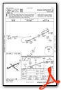
VFR Chart of KSBX
Sectional Charts at SkyVector.com
IFR Chart of KSBX
Enroute Charts at SkyVector.com
Location Information for KSBX
Coordinates: N48°32.44' / W111°52.28'Located 02 miles N of Shelby, Montana on 634 acres of land. View all Airports in Montana.
Surveyed Elevation is 3442 feet MSL.
Operations Data
|
|
Airport Communications
| AWOS-3PT: | 128.325 Tel. 406-434-2542 |
|---|---|
| CTAF: | 122.800 |
| UNICOM: | 122.800 |
| ASOS at CTB (20.4 W): | 119.025 406-873-2939 |
| AWOS-2 at CII (44.5 S): | 119.275 406-466-2259 |
| AWOS-3PT at 79S (64.8 SE): | 121.125 406-622-5976 |
- APCH/DEP CTL SVC PRVDD BY SALT LAKE CITY ARTCC ( ZLC) ON FREQS 133.4/285.4 (GREAT FALLS RCAG).
- COMMUNICATIONS PRVDD BY GREAT FALLS RADIO ON FREQ 122.2 (CUT BANK RCO).
Nearby Navigation Aids
|
| ||||||||||||||||||||||||


Runway 05/23
| Dimensions: | 5005 x 75 feet / 1526 x 23 meters | |
|---|---|---|
| Surface: | Asphalt in Excellent Condition | |
| Weight Limits: | 6 /F/D/Y/T, S-15 | |
| Edge Lighting: | Medium Intensity | |
| Runway 05 | Runway 23 | |
| Coordinates: | N48°32.30' / W111°52.89' | N48°32.65' / W111°51.76' |
| Elevation: | 3418.1 | 3442.8 |
| Traffic Pattern: | Left | Left |
| Runway Heading: | 65° True | 245° True |
| Markings: | Non-Precision Instrument in good condition. | Non-Precision Instrument in good condition. |
| Glide Slope Indicator | P2L (3.00° Glide Path Angle) | P2L (3.00° Glide Path Angle) |
Runway 11/29
| Dimensions: | 3701 x 60 feet / 1128 x 18 meters | |
|---|---|---|
| Surface: | Asphalt in Excellent Condition | |
| Weight Limits: | S-15 | |
| Edge Lighting: | Medium Intensity | |
| Runway 11 | Runway 29 | |
| Coordinates: | N48°32.59' / W111°52.57' | N48°32.20' / W111°51.85' |
| Elevation: | 3419.6 | 3428.7 |
| Traffic Pattern: | Left | Left |
| Runway Heading: | 129° True | 309° True |
| Markings: | Basic in good condition. | Basic in good condition. |
| Glide Slope Indicator | P2L (3.00° Glide Path Angle) | P2L (3.00° Glide Path Angle) |
Services Available
| Fuel: | 100LL (blue), Jet A+ |
|---|---|
| Transient Storage: | Tiedowns |
| Airframe Repair: | NONE |
| Engine Repair: | NONE |
| Bottled Oxygen: | NONE |
| Bulk Oxygen: | NONE |
| Other Services: | CROP DUSTING SERVICES,PILOT INSTRUCTION,AIRCRAFT RENTAL |
Ownership Information
| Ownership: | Publicly owned | |
|---|---|---|
| Owner: | TOOLE COUNTY | |
| 226 1ST ST. SOUTH | ||
| SHELBY, MT 59474-1920 | ||
| 406-424-8310 | ||
| Manager: | JERRY LARSON JR | |
| PO BOX 210 | ||
| SHELBY, MT 59474 | ||
| (406) 450-2463 | ||
Other Remarks
- DEER ON & INVOF ARPT.
- TWY EDGES MKD WITH REFLECTORS.
- FOR CD CTC SALT LAKE ARTCC AT 801-320-2568.
- 0LL FOR FUEL AFTER HRS CALL 406-450-2461 OR 406-450-2463. SELF SVC CREDIT CARD FOR 100LL & JET A+. FUEL TRUCK AVBL FOR JET A+.
- ACTVT PAPI RWY 05 & 23; MIRL RWY 05/23 & 11/29-CTAF.
Weather Minimums


Instrument Approach Procedure (IAP) Charts

Nearby Airports with Instrument Procedures
| ID | Name | Heading / Distance | ||
|---|---|---|---|---|
 |
KCTB | Cut Bank International Airport | 281° | 20.5 |
|
S01 | Conrad Airport | 190° | 22.8 |
|
KCII | Choteau Airport | 195° | 44.4 |
|
79S | Fort Benton Airport | 129° | 64.8 |
|
KGTF | Great Falls International Airport | 162° | 66.7 |
|
KHVR | Havre City-County Airport | 089° | 84.1 |
|
KGPI | Glacier Park International Airport | 262° | 96.3 |
|
CZPC | Pincher Creek Airport | 305° | 102.5 |
|
8S1 | Polson Airport | 242° | 106.0 |
|
7S0 | Ronan Airport | 237° | 107.1 |
|
KHLN | Helena Regional Airport | 182° | 116.2 |
|
KLWT | Lewistown Municipal Airport | 131° | 132.2 |
Airport Images
Do you have a recent image of this airport? Upload it here!


