Login
Register


WA70
Quinault Indian Nation Heliport
Official FAA Data Effective 2025-11-27 0901Z
VFR Chart of WA70
Sectional Charts at SkyVector.com
IFR Chart of WA70
Enroute Charts at SkyVector.com
Location Information for WA70
Coordinates: N47°20.37' / W124°16.93'Located 01 miles SE of Taholah, Washington. View all Airports in Washington.
Estimated Elevation is 130 feet MSL.
Operations Data
|
|
Airport Communications
| ASOS at HQM (26.2 SE): | 135.775 360-538-7021 |
|---|---|
| ASOS at UIL (37.6 N): | 135.225 360-374-9731 |
| ASOS at SHN (46.6 E): | 119.275 360-358-3006 |
Nearby Navigation Aids
|
| ||||||||||||||||||||||||||||||||||||

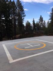
Helipad H1
| Dimensions: | 50 x 50 feet / 15 x 15 meters | |
|---|---|---|
| Surface: | Concrete | |
| Coordinates: | N47°20.37' / W124°16.93' | N0°0.00' / E0°0.00' |
| Elevation: | 130.0 | |
Ownership Information
| Ownership: | Privately Owned | |
|---|---|---|
| Owner: | QUINAULT INDIAN NATION | |
| 1214 AALIS DR | ||
| TAHOLAH, WA 98587 | ||
| 360 276 8215 | ||
| Manager: | ALIZA BROWN | ABROWN@QUINAULT.ORG |
| QUINAULT INDIAN NATION ROGER SAUX | ||
| TAHOLAH, WA 98587 | ||
| 360 276 4405 | ||
Nearby Airports with Instrument Procedures
| ID | Name | Heading / Distance | ||
|---|---|---|---|---|
 |
KHQM | Bowerman Field Airport | 147° | 26.3 |
|
KSHN | Sanderson Field Airport | 097° | 46.8 |
|
KCLM | William R Fairchild International Airport | 033° | 56.6 |
|
KNOW | Port Angeles CGAS Airport | 035° | 59.6 |
|
KOLM | Olympia Regional Airport | 110° | 60.7 |
|
KPWT | Bremerton Ntl Airport | 081° | 62.5 |
|
KCLS | Chehalis-Centralia Airport | 126° | 66.5 |
|
KTIW | Tacoma Narrows Airport | 092° | 69.7 |
|
KGRF | Gray AAF (Joint Base Lewis-Mcchord) Airport | 102° | 71.3 |
|
KAST | Astoria Regional Airport | 166° | 72.8 |
|
0S9 | Jefferson County International Airport | 053° | 73.5 |
|
KTCM | Mcchord Field (Joint Base Lewis-Mcchord) Airport | 098° | 74.8 |
Airport Images
By: skyvector70


