Login
Register


Y47
Oakland Southwest Airport
Official FAA Data Effective 2026-02-19 0901Z
Chart Supplement

VFR Chart of Y47
Sectional Charts at SkyVector.com
IFR Chart of Y47
Enroute Charts at SkyVector.com
Location Information for Y47
Coordinates: N42°30.19' / W83°37.42'Located 01 miles SW of New Hudson, Michigan on 67 acres of land. View all Airports in Michigan.
Estimated Elevation is 926 feet MSL.
Operations Data
|
|
Airport Communications
| DETROIT APPROACH: | 132.35 284.0 |
|---|---|
| DETROIT DEPARTURE: | 132.35 284.0 |
| UNICOM: | 122.700 |
| CTAF: | 122.700 |
| ATIS at PTK (13.3 NE): | 125.025 |
| ASOS at PTK (13.3 NE): | 125.025 248-886-8551 |
| ATIS at YIP (16.3 S): | 127.425 |
Nearby Navigation Aids
|
| ||||||||||||||||||||||||||||||||||||||||||||||||||||||||||||


Runway 08/26
| Dimensions: | 3128 x 40 feet / 953 x 12 meters | |
|---|---|---|
| Surface: | Asphalt in Excellent Condition | |
| Edge Lighting: | Low Intensity | |
| Runway 08 | Runway 26 | |
| Coordinates: | N42°30.10' / W83°37.75' | N42°30.27' / W83°37.09' |
| Elevation: | 920.9 | 926.1 |
| Traffic Pattern: | Left | Left |
| Runway Heading: | 71° True | 251° True |
| Displaced Threshold: | 867 Feet | 864 Feet |
| Markings: | Basic in good condition. | Basic in good condition. |
| Glide Slope Indicator | V2R (4.00° Glide Path Angle) | V2L (4.00° Glide Path Angle) |
| Obstacles: | 20 ft Brush 200 ft from runway, 98 ft left of center CTLG OBSTN EXCEEDS A 45 DEG SLP. APCH RATIO 2:1 TO DTHR OVR +22 FT TREE, 62 FT DIST, 125 FT R. -4 FT DITCH, 40 FT DIST; SCATTERED 5-30 FT TREES & BRUSH, 0-199 FT DIST, 125 FT L & R. |
79 ft Trees 200 ft from runway, 125 ft right of center CTLG OBSTN EXCEEDS A 45 DEG SLP. APCH RATIO 0:1 TO DTHR OVR +12 FT TREE, 0 FT DIST, 115 FT L. +30 FT PLINE, 697 FT DIST; +20 FT TREES, 110 FT L; +15-50 FT TREES, MOST QUADS. 15-40 FT TREES & BRUSH, 0-90 FT DIST, 110 FT L. |
Services Available
| Fuel: | 100LL (blue) |
|---|---|
| Transient Storage: | Hangars,Tiedowns HNGR AVBL BY PRIOR ARNGMT CTC AMGR. |
| Airframe Repair: | NOT AVAILABLE |
| Engine Repair: | NOT AVAILABLE |
| Bottled Oxygen: | NONE |
| Bulk Oxygen: | NONE |
Ownership Information
| Ownership: | Publicly owned | |
|---|---|---|
| Owner: | OAKLAND COUNTY | |
| 6500 PATTERSON PKWY | ||
| WATERFORD, MI 48327-1683 | ||
| 248-437-2333 | ||
| Manager: | CHERYL BUSH | |
| 6500 PATTERSON PKWY | ||
| WATERFORD, MI 48327-1683 | ||
| 248-666-3900 | ||
Other Remarks
- TREES & BRUSH IN PRIMARY SFC 70-120 FT L & R.
- FOR CD CTC DETROIT APCH AT 734-955-1404.
- DEER & LRG BIRDS ON & INVOF ARPT.
- ACTVT LIRL RWY 08/26 - CTAF. VASI RWY 08 & 26 OTS INDEFLY.
Weather Minimums

Instrument Approach Procedure (IAP) Charts

Nearby Airports with Instrument Procedures
| ID | Name | Heading / Distance | ||
|---|---|---|---|---|
 |
1D2 | Canton-Plymouth-Mettetal Airport | 141° | 11.9 |
|
KPTK | Oakland County International Airport | 042° | 13.3 |
|
KYIP | Willow Run Airport | 165° | 16.3 |
|
KOZW | Livingston County/Spencer J Hardy Airport | 295° | 17.6 |
|
KARB | Ann Arbor Municipal Airport | 197° | 17.7 |
|
9G2 | Prices Airport | 340° | 19.4 |
|
KVLL | Oakland/Troy Airport | 082° | 19.9 |
|
KDTW | Detroit Metro Wayne County Airport | 145° | 21.2 |
|
KDET | Coleman A Young Municipal Airport | 101° | 27.8 |
|
KFNT | Bishop International Airport | 349° | 28.2 |
|
KONZ | Grosse Ile Municipal Airport | 139° | 31.8 |
|
CYQG | Windsor Airport | 114° | 32.6 |
Airport Images
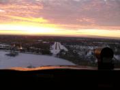
By: JMills


