Login
Register


Y49
Walker Municipal Airport
Official FAA Data Effective 2026-02-19 0901Z
Chart Supplement

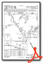
VFR Chart of Y49
Sectional Charts at SkyVector.com
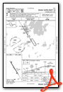
IFR Chart of Y49
Enroute Charts at SkyVector.com
Location Information for Y49
Coordinates: N47°9.57' / W94°38.72'Located 04 miles NW of Walker, Minnesota on 257 acres of land. View all Airports in Minnesota.
Surveyed Elevation is 1348 feet MSL.
Operations Data
|
|
Airport Communications
| AWOS-3PT: | 119.0 Tel. 218-547-2451 |
|---|---|
| CTAF: | 122.900 |
| AWOS-3 at XVG (20.7 SE): | 118.275 218-363-3347 |
| ASOS at PKD (23.4 SW): | 119.25 218-732-0920 |
| AWOS-3 at BJI (24.2 NW): | 119.275 218-755-2575 |
- APCH/DEP SVC PRVDD BY MINNEAPOLIS ARTCC ON FREQS 134.75/251.1 (BEMIDJI RCAG).
Nearby Navigation Aids
|
| ||||||||||||||||||||||||||||||||||||||||||||||||


Runway 15/33
| Dimensions: | 3220 x 75 feet / 981 x 23 meters | |
|---|---|---|
| Surface: | Asphalt in Fair Condition | |
| Edge Lighting: | Medium Intensity | |
| Runway 15 | Runway 33 | |
| Coordinates: | N47°9.79' / W94°38.93' | N47°9.34' / W94°38.52' |
| Elevation: | 1345.1 | 1346.0 |
| Traffic Pattern: | Left | Left |
| Runway Heading: | 148° True | 328° True |
| Markings: | Non-Precision Instrument in good condition. | Non-Precision Instrument in good condition. |
| Glide Slope Indicator | P4L (3.00° Glide Path Angle) | P4L (3.00° Glide Path Angle) |
| REIL: | Yes | Yes |
| Obstacles: | ft Trees ft from runway | 101 ft Trees 1894 ft from runway, 336 ft right of center |
Services Available
| Fuel: | 100LL (blue) |
|---|---|
| Transient Storage: | Hangars,Tiedowns |
| Airframe Repair: | NONE |
| Engine Repair: | NONE |
| Bottled Oxygen: | NONE |
| Bulk Oxygen: | NONE |
| Other Services: | PILOT INSTRUCTION,AIRCRAFT RENTAL,ANNUAL SURVEYING |
Ownership Information
| Ownership: | Publicly owned | |
|---|---|---|
| Owner: | CITY OF WALKER | |
| 205 MINNESOTA AVE WEST | ||
| WALKER, MN 56484 | ||
| 218-547-5501 | ||
| Manager: | HOPE FAIRCHILD | |
| 205 MINNESOTA AVE WEST | ||
| WALKER, MN 56484 | ||
| (218) 547-5501 | ||
Other Remarks
- FOR CD CTC MINNEAPOLIS ARTCC AT 651-463-5588.
- 0LL FUEL AVBL 24 HOURS BY CREDIT CARD.
- MIRL RY 15/33 PRESET TO LOW SS-SR; INCR INTST & ACTVT REIL RY 15 & 33; PAPI RY 15 & 33 - CTAF.
Weather Minimums


Instrument Approach Procedure (IAP) Charts
Nearby Airports with Instrument Procedures
| ID | Name | Heading / Distance | ||
|---|---|---|---|---|
 |
KXVG | Longville Municipal Airport | 119° | 20.8 |
|
KPKD | Park Rapids Municipal/Konshok Field Airport | 228° | 23.4 |
|
KBJI | Bemidji Regional Airport | 330° | 24.2 |
|
KPWC | Pine River Regional Airport | 157° | 28.3 |
|
KGPZ | Grand Rapids/Itasca County-Gordon Newstrom Field Airport | 085° | 46.6 |
|
KSAZ | Staples Municipal Airport | 188° | 47.2 |
|
KADC | Wadena Municipal Airport | 208° | 48.6 |
|
KBRD | Brainerd Lakes Regional Airport | 154° | 50.0 |
|
16D | Perham Municipal Airport | 230° | 51.5 |
|
3N8 | Mahnomen County Airport | 277° | 52.8 |
|
KFSE | Fosston Municipal/Anderson Field Airport | 299° | 52.8 |
|
KAIT | Aitkin Municipal/Steve Kurtz Field Airport | 132° | 54.2 |
Airport Images
Do you have a recent image of this airport? Upload it here!


