Login
Register
MBL
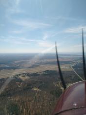
Manistee County/Blacker Airport
Official FAA Data Effective 2025-11-27 0901Z
VFR Chart of KMBL
Sectional Charts at SkyVector.com
IFR Chart of KMBL
Enroute Charts at SkyVector.com
Location Information for KMBL
Coordinates: N44°16.35' / W86°14.81'Located 03 miles NE of Manistee, Michigan on 290 acres of land. View all Airports in Michigan.
Surveyed Elevation is 621 feet MSL.
Operations Data
|
|
Airport Communications
| AWOS-3PT: | 118.825 Tel. 231-723-6073 |
|---|---|
| UNICOM: | 122.800 |
| CTAF: | 122.800 |
| AWOS-3 at LDM (20.0 S): | 119.925 231-843-0459 |
| AWOS-3P at FKS (21.3 N): | 118.325 231-352-7573 |
| AWOS-3P at CAD (35.5 E): | 128.325 231-779-9536 |
- APCH/DEP SVC PRVDD BY MINNEAPOLIS ARTCC (ZMP) ON FREQS 120.85/322.35 (WHITE CLOUD RCAG).
Nearby Navigation Aids
|
| ||||||||||||||||||||||||||||||||||||||||||||||||||||||||||||
Runway 10/28
| Dimensions: | 5501 x 100 feet / 1677 x 30 meters | |
|---|---|---|
| Surface: | Asphalt / Porous Friction Course in Excellent Condition | |
| Weight Limits: | 30 /F/A/X/T, S-83, D-126 | |
| Edge Lighting: | High Intensity | |
| Runway 10 | Runway 28 | |
| Coordinates: | N44°16.37' / W86°15.29' | N44°16.35' / W86°14.03' |
| Elevation: | 617.6 | 621.3 |
| Traffic Pattern: | Left | Left |
| Runway Heading: | 91° True | 271° True |
| Declared Distances: | TORA:5501 TODA:5501 ASDA:5501 LDA:5501 | TORA:5501 TODA:5501 ASDA:5501 LDA:5501 |
| Markings: | Precision Instrument in good condition. | Precision Instrument in good condition. |
| Glide Slope Indicator | P4L (3.00° Glide Path Angle) | P4L (3.00° Glide Path Angle) |
| Approach Lights: | MALSR 1,400 Foot Medium-intensity Approach Lighting System with runway alignment indicator lights. | |
| REIL: | Yes | |
| Obstacles: | 55 ft Tree 2050 ft from runway, 100 ft left of center | 102 ft Trees 4350 ft from runway, 950 ft left of center |
Runway 01/19
RWY 01/19 NOT AVBL FOR PART 121/PART 380 OPS WITH SKED PAX CARRYING OPS MORE THAN 9 PAX SEATS AND NON-SKED PAX CARRYING OPS MORE THAN 30 PAX SEATS. NO PART 121/PART 380 OPS EXC FOR TAX. | ||
| Dimensions: | 2721 x 75 feet / 829 x 23 meters | |
|---|---|---|
| Surface: | Asphalt in Good Condition | |
| Weight Limits: | 6 /F/A/X/T, S-25 | |
| Edge Lighting: | Medium Intensity | |
| Runway 01 | Runway 19 | |
| Coordinates: | N44°16.10' / W86°15.13' | N44°16.55' / W86°15.12' |
| Elevation: | 618.5 | 617.7 |
| Traffic Pattern: | Left | Left |
| Runway Heading: | 1° True | 181° True |
| Declared Distances: | TORA:2721 TODA:2721 ASDA:2721 LDA:2721 | TORA:2721 TODA:2721 ASDA:2721 LDA:2721 |
| Markings: | Basic in good condition. | Basic in good condition. |
| Glide Slope Indicator | P2L (4.00° Glide Path Angle) | P2L (4.00° Glide Path Angle) |
| Obstacles: | 8 ft Tree 312 ft from runway, 75 ft left of center | 49 ft Trees 1080 ft from runway, 172 ft left of center ALSO +15 FT ROAD, 498 FT DIST, APCH RATIO 33:1. |
Services Available
| Fuel: | 100LL (blue), Jet-A |
|---|---|
| Transient Storage: | Hangars,Tiedowns |
| Airframe Repair: | MINOR |
| Engine Repair: | MINOR |
| Bottled Oxygen: | NOT AVAILABLE |
| Bulk Oxygen: | NOT AVAILABLE |
Ownership Information
| Ownership: | Publicly owned | |
|---|---|---|
| Owner: | MANISTEE BLACKER ARPT AUTHORITY | |
| 2323 AIRPORT RD | ||
| MANISTEE, MI 49660-9710 | ||
| 231-723-4351 | ||
| Manager: | MILES WEAVER | |
| 2323 AIRPORT RD | ||
| MANISTEE, MI 49660-9710 | ||
| 231-723-4351 | ||
Other Remarks
- BIRDS ON & INVOF ARPT.
- FLD CONDS UNMON AFT ATNDD HRS EXC FOR ACR OPS.
- TWY E MKD WITH REFLECTORS.
- ARFF MNT CTAF DRG ACR OPS.
- MAINT PSNL MNT CTAF DRG WORK ON TWYS & RWYS.
- ACTVT MALSR RWY 28; REIL RWY 10; PAPI RWY 01, 19, 10, & 28; HIRL RWY 10/28; MIRL RWY 01/19 - CTAF.
Weather Minimums
Instrument Approach Procedure (IAP) Charts
Nearby Airports with Instrument Procedures
| ID | Name | Heading / Distance | ||
|---|---|---|---|---|
 |
KLDM | Mason County Airport | 200° | 19.9 |
 |
KFKS | Frankfort Dow Memorial Field Airport | 005° | 21.3 |
 |
7D3 | Baldwin Municipal Airport | 143° | 29.6 |
 |
KCAD | Wexford County Airport | 089° | 35.7 |
 |
C04 | Oceana County Airport | 185° | 38.0 |
 |
KTVC | Cherry Capital Airport | 045° | 40.1 |
 |
KRQB | Roben-Hood Airport | 135° | 46.1 |
 |
KFFX | Fremont Municipal Airport | 167° | 51.2 |
 |
KSUE | Door County Cherryland Airport | 304° | 60.9 |
 |
KACB | Antrim County Airport | 045° | 62.2 |
 |
KMTW | Manitowoc County Airport | 262° | 62.5 |
 |
13C | Lakeview/Griffith Field Airport | 138° | 65.1 |


Comments
Great airport with friendly service
Great airport with friendly folks. Beautiful terminal. Limited tie downs, approximately 8. No fees to tie down or leave an airport car.
David Haak