Login
Register


L52
Oceano County Airport
Official FAA Data Effective 2025-02-20 0901Z
Chart Supplement

VFR Chart of L52
Sectional Charts at SkyVector.com
IFR Chart of L52
Enroute Charts at SkyVector.com
Location Information for L52
Coordinates: N35°6.09' / W120°37.34'Located 01 miles W of Oceano, California on 58 acres of land. View all Airports in California.
Surveyed Elevation is 14 feet MSL.
Operations Data
|
|
Airport Communications
| AWOS-3: | 118.375 Tel. 805-489-1305 |
|---|---|
| CTAF: | 122.700 |
| UNICOM: | 122.700 |
| ATIS at SBP (8.2 N): | 120.6 |
| ASOS at SBP (8.3 N): | 120.6 805-547-1260 |
| ATIS at SMX (14.6 SE): | 121.15 |
Nearby Navigation Aids
|
| ||||||||||||||||||||||||||||||||||||||||||||||||


Runway 11/29
| Dimensions: | 2325 x 50 feet / 709 x 15 meters | |
|---|---|---|
| Surface: | Asphalt in Fair Condition | |
| Weight Limits: | S-12 | |
| Edge Lighting: | Medium Intensity | |
| Runway 11 | Runway 29 | |
| Coordinates: | N35°6.20' / W120°37.53' | N35°5.99' / W120°37.14' |
| Elevation: | 12.0 | 16.5 |
| Traffic Pattern: | Right | Left |
| Runway Heading: | 124° True | 304° True |
| Markings: | Basic in fair condition. | Basic in fair condition. |
| Obstacles: | 8 ft Brush 380 ft from runway, 80 ft right of center | 15 ft Trees 506 ft from runway, 53 ft left of center |
Services Available
| Fuel: | 100LL (blue) |
|---|---|
| Transient Storage: | Tiedowns |
| Airframe Repair: | NOT AVAILABLE |
| Engine Repair: | NOT AVAILABLE |
| Bottled Oxygen: | NONE |
| Bulk Oxygen: | NONE |
| Other Services: | CHARTER SERVICE,PILOT INSTRUCTION,AIRCRAFT RENTAL |
Ownership Information
| Ownership: | Publicly owned | |
|---|---|---|
| Owner: | SAN LUIS OBISPO COUNTY | C.A.E. |
| COUNTY GOVT CNTR 460 | ||
| SAN LUIS OBISPO, CA 93408 | ||
| 805-781-5200 | ||
| Manager: | COURTNEY JOHNSON | COUNTY AIRPORT MANAGER LOCATED IN SAN LUIS OBISPO. |
| 975 AIRPORT DRIVE, SUITE 1 | ||
| SAN LUIS OBISPO, CA 93401-8417 | ||
| 805-781-5218 | PHONE AT ARPT 805-788-2000 | |
Other Remarks
- UNSFCD AREAS SOFT AND UNUSBL.
- RECURRING FLOCKS OF WATERFOWL ON AND INVOF ARPT.
- ULTRALIGHT ACT ON AND INVOF ARPT.
- BE ALERT FOR KITES FLOWN ALONG BEACH 1/2 MILE W OF RWY.
- TAXILANES VERY NRW NR BLDGS & PARKED ACFT.
- EXTREMELY NOISE SENSITIVE ARPT & COMMUNITY; FOR TKOF RWY 29 PILOTS ARE REQD TO MNTN RWY HDG TIL XNG THE SHORELINE.
- TWY LGTS AT EXIT ONLY.
- FOR CD CTC LOS ANGELES ARTCC AT 661-575-2079.
- ARPT LCTD 2 SM S OF PISMO BEACH.
- 0LL SELF SVC FUEL AVBL 24 HRS.
- ACTVT MIRL RWY 11/29 - CTAF.
- DUSK-DAWN.
Nearby Airports with Instrument Procedures
| ID | Name | Heading / Distance | ||
|---|---|---|---|---|
 |
KSBP | San Luis Obispo County Regional Airport | 353° | 8.2 |
|
KSMX | Santa Maria Pub/Capt G Allan Hancock Field Airport | 146° | 14.5 |
|
KVBG | Vandenberg Space Force Base Airport | 175° | 21.9 |
|
KLPC | Lompoc Airport | 163° | 27.2 |
|
KPRB | Paso Robles Municipal Airport | 359° | 34.2 |
|
KIZA | Santa Ynez/Kunkle Field Airport | 137° | 40.1 |
|
KSBA | Santa Barbara Municipal Airport | 136° | 55.9 |
|
C80 | New Coalinga Municipal Airport | 014° | 65.5 |
|
KKIC | Mesa Del Rey Airport | 340° | 71.8 |
|
KMIT | Shafter-Minter Field Airport | 070° | 74.3 |
|
KDLO | Delano Municipal Airport | 060° | 78.1 |
|
KBFL | Meadows Field Airport | 075° | 79.4 |
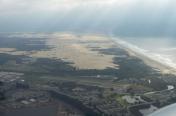
Airport Images

By: jgills240
By: Rene


Comments
Flew in on a Saturday morning
Flew in on a Saturday morning. Walked to the beach and then got lunch. Nice airport community. Very friendly people.
Nice location
Great little airport community. Bikes available for use, even had a handpump for teh bikes I had to use toput air in one of my aircraft tires. Definitely a "come back to".