Login
Register


ERY
Luce County Airport
Official FAA Data Effective 2024-12-26 0901Z
Chart Supplement

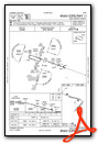
VFR Chart of KERY
Sectional Charts at SkyVector.com
IFR Chart of KERY
Enroute Charts at SkyVector.com
Location Information for KERY
Coordinates: N46°18.66' / W85°27.43'Located 03 miles SE of Newberry, Michigan on 160 acres of land. View all Airports in Michigan.
Estimated Elevation is 869 feet MSL.
Operations Data
|
|
Airport Communications
| AWOS-3P: | 119.525 Tel. 906-293-2979 |
|---|---|
| UNICOM: | 122.800 |
| CTAF: | 122.800 |
| AWOS-3 at ISQ (35.9 SW): | 118.775 906-341-8585 |
| AWOS-3 at SJX (37.4 S): | 118.075 231-448-3081 |
| AWOS-3PT at CIU (41.0 E): | 127.575 906-495-1156 |
- COMMUNICATIONS PRVDD BY GREEN BAY RADIO ON FREQ 122.4 (NEWBERRY RCO).
- APCH/DEP SVC PRVDD BY MINNEAPOLIS ARTCC (ZMP) ON FREQ 134.6/354.05 (PELLSTON RCAG).
Nearby Navigation Aids
|
| ||||||||||||||||||||||||||||||||||||||||||||||||


Runway 11/29
| Dimensions: | 4304 x 75 feet / 1312 x 23 meters | |
|---|---|---|
| Surface: | Asphalt in Good Condition | |
| Weight Limits: | S-8 | |
| Edge Lighting: | Medium Intensity | |
| Runway 11 | Runway 29 | |
| Coordinates: | N46°18.94' / W85°28.07' | N46°18.70' / W85°27.11' |
| Elevation: | 869.1 | 851.2 |
| Traffic Pattern: | Left | Left |
| Runway Heading: | 110° True | 290° True |
| Markings: | Non-Precision Instrument in good condition. | Non-Precision Instrument in good condition. |
| Glide Slope Indicator | P4L (3.20° Glide Path Angle) | P4L (3.20° Glide Path Angle) |
| REIL: | Yes | Yes |
Runway 04/22
CLSD WHEN SNOW COVD EXC FOR SKI EQUIPPED ACFT. | ||
| Dimensions: | 2856 x 150 feet / 871 x 46 meters | |
|---|---|---|
| Surface: | Turf in Good Condition | |
| Runway 04 | Runway 22 | |
| Coordinates: | N46°18.24' / W85°27.41' | N46°18.60' / W85°26.97' |
| Elevation: | 853.3 | 850.4 |
| Traffic Pattern: | Left | Left |
| Runway Heading: | 41° True | 221° True |
| Displaced Threshold: | 936 Feet | |
| Obstacles: | 10 ft Fence 0 ft from runway, 114 ft left of center ALSO +16 FT ROAD, 0 FT DIST, 125 FT R, APCH RATIO 0:1. APCH RATIO 19:1 TO DTHR OVR +82 FT TREES, 1600 FT DIST, 120 FT L. |
21 ft Trees 263 ft from runway, 116 ft left of center |
Services Available
| Fuel: | 100LL (blue), Jet A+ |
|---|---|
| Transient Storage: | Hangars,Tiedowns |
| Airframe Repair: | NONE |
| Engine Repair: | NONE |
| Bottled Oxygen: | NONE |
| Bulk Oxygen: | NONE |
Ownership Information
| Ownership: | Publicly owned | |
|---|---|---|
| Owner: | LUCE COUNTY | |
| LUCE CO GOVT BLDG, 407 W HARRIE ST | ||
| NEWBERRY, MI 49868-1208 | ||
| 906-293-5521 | ||
| Manager: | GLEN PITTMAN | |
| 5523 COUNTY ROAD 399 | ||
| NEWBERRY, MI 49868-7882 | ||
| 906-291-0214 | CELL. | |
Other Remarks
- DEER, BIRDS, & WILDLIFE ON & INVOF ARPT.
- FOR CD IF UNA TO CTC ON FSS FREQ, CTC MINNEAPOLIS ARTCC AT 651-463-5588.
- 3 FT YELLOW CONES.
- 3 FT YELLOW CONES.
- ACTVT WIND CONE; REIL RWY 11 & 29; PAPI RWY 11 & 29; MIRL RWY 11/29 - CTAF.
Weather Minimums
Instrument Approach Procedure (IAP) Charts
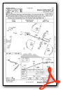
Nearby Airports with Instrument Procedures
| ID | Name | Heading / Distance | ||
|---|---|---|---|---|
 |
KISQ | Schoolcraft County Airport | 236° | 36.0 |
|
KSJX | Beaver Island Airport | 187° | 37.4 |
|
83D | Mackinac County Airport | 129° | 39.2 |
|
CYAM | Sault Ste Marie Airport | 074° | 40.7 |
|
KCIU | Chippewa County International Airport | 094° | 41.1 |
|
KMCD | Mackinac Island Airport | 127° | 43.5 |
|
KANJ | Sault Ste Marie Municipal/Sanderson Field Airport | 077° | 46.3 |
|
6Y1 | Bois Blanc Island Airport | 129° | 51.5 |
|
KPLN | Pellston Regional/Emmet County Airport | 147° | 52.3 |
|
KSLH | Cheboygan County Airport | 134° | 55.6 |
|
CPF2 | Bar River Airport | 082° | 56.8 |
|
KMGN | Harbor Springs Airport | 156° | 57.8 |
Airport Images
Do you have a recent image of this airport? Upload it here!


Comments
Liked it when you had a link to google maps
What happened to the link to Google maps on the side of the airport site info? That was a great feature when looking at an airport and it's surroundings.
Hope you bring it back.
Google decided to change its
Google decided to change its terms. We are trying to get an alternative view. We loved it as well, just know that we are working on it. Thanks for the feedback!
JM
Admin