Login
Register
5V5
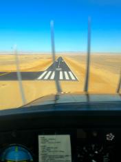
Shiprock Airstrip Airport
Official FAA Data Effective 2024-12-26 0901Z
VFR Chart of 5V5
Sectional Charts at SkyVector.com
IFR Chart of 5V5
Enroute Charts at SkyVector.com
Location Information for 5V5
Coordinates: N36°41.86' / W108°42.06'Located 05 miles S of Shiprock, New Mexico on 104 acres of land. View all Airports in New Mexico.
Surveyed Elevation is 5272 feet MSL.
Operations Data
|
|
Airport Communications
| CTAF: | 122.900 |
|---|---|
| ATIS at FMN (22.8 E): | 127.15 |
| ASOS at FMN (22.9 E): | 127.15 505-325-9268 |
| ASOS at CEZ (36.8 N): | 135.625 970-564-0193 |
Nearby Navigation Aids
|
| ||||||||||||||||||||||||||||||
Runway 02/20
DITCH NW OF RWY ENTIRE LEN. | ||
| Dimensions: | 5214 x 75 feet / 1589 x 23 meters | |
|---|---|---|
| Surface: | Asphalt in Excellent Condition | |
| Weight Limits: | 3 /F/D/Y/T, S-11 | |
| Edge Lighting: | Medium Intensity | |
| Runway 02 | Runway 20 | |
| Coordinates: | N36°41.49' / W108°42.33' | N36°42.23' / W108°41.78' |
| Elevation: | 5272.4 | 5224.8 |
| Traffic Pattern: | Left | Left |
| Runway Heading: | 31° True | 211° True |
| Markings: | Non-Precision Instrument in good condition. | Non-Precision Instrument in good condition. |
| Glide Slope Indicator | P2L (3.00° Glide Path Angle) | P2L (3.00° Glide Path Angle) |
| Obstacles: | 50 ft Pole 1400 ft from runway, 125 ft right of center 50 FT LGT POLES IN APCH AREA. |
|
Services Available
| Fuel: | NONE |
|---|---|
| Transient Storage: | Tiedowns |
| Airframe Repair: | NOT AVAILABLE |
| Engine Repair: | NOT AVAILABLE |
| Bottled Oxygen: | NOT AVAILABLE |
| Bulk Oxygen: | NOT AVAILABLE |
Ownership Information
| Ownership: | Publicly owned | |
|---|---|---|
| Owner: | NAVAJO TRIBE | |
| NAVAJO TRANSPORTATION, PO BOX 4620 | ||
| WINDOW ROCK, AZ 86515 | ||
| 505-371-8300 | ||
| Manager: | RAINEY CRAWFORD | EMERG & MAINT COORD - GARRETT SILVERSMITH 505-606-6357/505-371-8354/505-908-7961. |
| NAVAJO DIV. OF TRANSPORTATION, PO BOX 4620 | ||
| WINDOW ROCK, AZ 86515 | ||
| (505) 728-2804 | ||
Other Remarks
- FOR CD CTC DENVER ARTCC AT 303-651-4257.
- PARL TWY A: COND POOR; UNMKD; SFC CRACKS WITH GRASS & LOOSE AGGREGATE.
- ACTVT MIRL RWY 02/20 - CTAF.
Nearby Airports with Instrument Procedures
| ID | Name | Heading / Distance | ||
|---|---|---|---|---|
 |
KFMN | Four Corners Regional Airport | 083° | 22.9 |
 |
KCEZ | Cortez Municipal Airport | 005° | 36.4 |
 |
KDRO | Durango-La Plata County Airport | 058° | 53.1 |
 |
KBDG | Blanding Municipal Airport | 324° | 65.0 |
 |
KRQE | Window Rock Airport | 195° | 65.1 |
 |
KGUP | Gallup Municipal Airport | 183° | 71.2 |
 |
U64 | Monticello Airport | 337° | 80.1 |
 |
KTEX | Telluride Regional Airport | 026° | 84.3 |
 |
KPSO | Stevens Field Airport | 065° | 86.6 |
 |
KAIB | Hopkins Field Airport | 004° | 92.6 |
 |
KGNT | Grants-Milan Municipal Airport | 156° | 99.6 |
 |
KMTJ | Montrose Regional Airport | 019° | 115.2 |


