Login
Register


ALM
Alamogordo-White Sands Regional Airport
Official FAA Data Effective 2024-12-26 0901Z
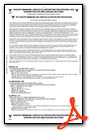
Chart Supplement

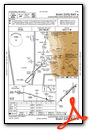
VFR Chart of KALM
Sectional Charts at SkyVector.com
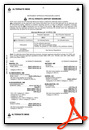
IFR Chart of KALM
Enroute Charts at SkyVector.com
Location Information for KALM
Coordinates: N32°50.37' / W105°59.47'Located 04 miles SW of Alamogordo, New Mexico on 1465 acres of land. View all Airports in New Mexico.
Surveyed Elevation is 4199 feet MSL.
Operations Data
|
|
Airport Communications
| AWOS-3: | 127.825 Tel. 575-439-4112 |
|---|---|
| HOLLOMAN APPROACH: | 120.6 269.225 |
| HOLLOMAN DEPARTURE: | 128.1 284.0 |
| UNICOM: | 122.800 |
| CTAF: | 122.800 |
| ATIS at HMN (6.0 W): | 273.5 ;LTD BYD 15 NM 020-140 |
| AWOS-3 at SRR (44.3 NE): | 126.475 575-336-8455 |
| AWOS-3PT at 0A0 (50.0 W): | 118.675 575-267-8806 |
- APCH/DEP SVC PRVDD BY ALBUQUERQUE ARTCC (ZAB) ON FREQS 132.65/257.6 (ALAMOGORDO RCAG) WHEN HOLLOMAN APCH CTL (HMN) CLSD.
Nearby Navigation Aids
|
| ||||||||||||||||||||||||||||||||||||||||||||||||||||||


Runway 04/22
RWY 22 CALM WIND RWY WHEN LESS THAN 5 KTS. 200 FT BLAST PADS MKD BY CHEVRONS. | ||
| Dimensions: | 9207 x 150 feet / 2806 x 46 meters | |
|---|---|---|
| Surface: | Asphalt / Porous Friction Course in Good Condition | |
| Weight Limits: | 48 /F/B/X/T, S-54, D-74, ST-120 | |
| Edge Lighting: | Medium Intensity | |
| Runway 04 | Runway 22 | |
| Coordinates: | N32°49.74' / W106°0.23' | N32°50.80' / W105°58.95' |
| Elevation: | 4127.0 | 4199.9 |
| Traffic Pattern: | Right | Left |
| Runway Heading: | 46° True | 226° True |
| Declared Distances: | TORA:9207 TODA:9207 ASDA:9207 LDA:9207 | TORA:9207 TODA:9207 ASDA:9207 LDA:9207 |
| Markings: | Non-Precision Instrument in good condition. | Non-Precision Instrument in good condition. |
| Glide Slope Indicator | P4R (3.00° Glide Path Angle) | V2L (3.00° Glide Path Angle) |
| REIL: | Yes | Yes |
Runway 17/35
OPS DURG WET COND NA; FOR COND - 575-551-6245. | ||
| Dimensions: | 3257 x 190 feet / 993 x 58 meters | |
|---|---|---|
| Surface: | Dirt in Fair Condition | |
| Runway 17 | Runway 35 | |
| Coordinates: | N32°50.90' / W105°59.16' | N32°50.37' / W105°59.09' |
| Elevation: | 4195.0 | 4174.2 |
| Traffic Pattern: | Left | Right |
| Runway Heading: | 174° True | 354° True |
| Obstacles: | 4 ft Brush 28 ft from runway, 120 ft right of center | 4 ft Brush 0 ft from runway, 105 ft right of center |
Helipad H1
| Dimensions: | 105 x 135 feet / 32 x 41 meters | |
|---|---|---|
| Surface: | Asphalt | |
| Coordinates: | N32°50.29' / W105°59.68' | N0°0.00' / E0°0.00' |
| Elevation: | 4163.0 | |
Services Available
| Fuel: | 100LL (blue), Jet A-1+ |
|---|---|
| Transient Storage: | Hangars,Tiedowns |
| Airframe Repair: | MAJOR |
| Engine Repair: | MAJOR |
| Bottled Oxygen: | NOT AVAILABLE |
| Bulk Oxygen: | HIGH |
| Other Services: | AIR AMBULANCE SERVICES,AVIONICS,CHARTER SERVICE,GLIDER SERVICE,PILOT INSTRUCTION,GLIDER TOWING SERVICES |
Ownership Information
| Ownership: | Publicly owned | |
|---|---|---|
| Owner: | CITY OF ALAMOGORDO | |
| 1376 E 9TH STREET | ||
| ALAMOGORDO, NM 88310 | ||
| 505-439-4100 | ||
| Manager: | TROY ORR | |
| 3500 AIRPORT ROAD | ||
| ALAMOGORDO, NM 88310 | ||
| 575-439-4110 | ||
Other Remarks
- 8000 FT MTS 4 NM E.
- VFR OPS BTN EL PASO & ALAMOGORDO-WHITE SANDS FLW & RMN W OF HWY 54 & TRAIN TRACKS; RMN CLEAR OF RSTRD ASP.
- MIL, GLIDER, ULTRALIGHT & UNMANNED AERIAL VEHICLE ACT ON & INVOF ARPT.
- HOLLOMAN RAPCON IFR SDBY SVC 60 MIN RECALL - 575-572-7575.
- FOR CD IF UNA TO CTC ON FSS FREQ, CTC ALBUQUERQUE ARTCC AT 505-856-4561.
- ACTVT PAPI RWY 04; VASI RWY 22; MIRL RWY 04/22 - CTAF. MIRL RWY 04/22 PRESET MED INTST; INCR INTST - CTAF.
Weather Minimums
Instrument Approach Procedure (IAP) Charts
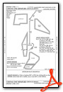
Departure Procedure Obstacles (DPO) Charts
Nearby Airports with Instrument Procedures
| ID | Name | Heading / Distance | ||
|---|---|---|---|---|
 |
KHMN | Holloman AFB Airport | 277° | 6.0 |
|
KSRR | Sierra Blanca Regional Airport | 031° | 43.9 |
|
KLRU | Las Cruces International Airport | 235° | 57.6 |
|
KELP | El Paso International Airport | 197° | 64.8 |
|
KDNA | Dona Ana County International Jetport Airport | 212° | 67.9 |
|
KTCS | Truth Or Consequences Municipal Airport | 290° | 68.7 |
|
KATS | Artesia Municipal Airport | 089° | 77.0 |
|
KROW | Roswell Air Center Airport | 069° | 78.7 |
|
KONM | Socorro Municipal Airport | 327° | 84.4 |
|
KCNM | Cavern City Air Trml Airport | 108° | 92.6 |
|
KDMN | Deming Municipal Airport | 248° | 94.2 |
|
KSVC | Grant County Airport | 264° | 110.3 |
Airport Images
Do you have a recent image of this airport? Upload it here!


