Login
Register
5FD7
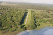
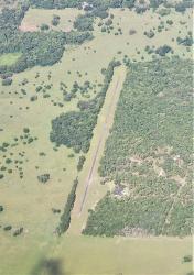
Chinsegut Airport
Official FAA Data Effective 2024-11-28 0901Z
VFR Chart of 5FD7
Sectional Charts at SkyVector.com
IFR Chart of 5FD7
Enroute Charts at SkyVector.com
Location Information for 5FD7
Coordinates: N28°36.70' / W82°22.07'Located 07 miles N of Brooksville, Florida. View all Airports in Florida.
Estimated Elevation is 80 feet MSL.
Operations Data
|
|
Airport Communications
| ASOS at BKV (9.5 SW): | 134.725 352-799-5881 |
|---|---|
| AWOS-3 at INF (12.0 N): | 119.975 352-560-6012 |
| AWOS-3 at CGC (18.8 NW): | 118.325 352-563-6600 |
Nearby Navigation Aids
|
| ||||||||||||||||||||||||||||||||||||||||||
Runway 09/27
| Dimensions: | 2500 x 15 feet / 762 x 5 meters | |
|---|---|---|
| Surface: | Asphalt | |
| Runway 09 | Runway 27 | |
Ownership Information
| Ownership: | Privately Owned | |
|---|---|---|
| Owner: | DEBRA D. SELPH ET AL | MULTIPLE OWNERS - ROBIN & ERIC KESSEL; RANDY MAZOUREK AND PAMELA BATES |
| 22270 PILOTS PATH | ||
| BROOKSVILLE, FL 34601 | ||
| 352-796-4948 | ||
| Manager: | DEBRA SELPH | |
| 22270 PILOTS PATH | ||
| BROOKSVILLE, FL 34601 | ||
| 352-650-9457 | ||
Other Remarks
- FOR CD CTC TAMPA APCH AT 813-878-2528.
Nearby Airports with Instrument Procedures
| ID | Name | Heading / Distance | ||
|---|---|---|---|---|
 |
KBKV | Brooksville-Tampa Bay Regional Airport | 209° | 9.5 |
 |
KINF | Inverness Airport | 012° | 11.8 |
 |
KCGC | Crystal River-Capt Tom Davis Field Airport | 324° | 18.8 |
 |
KZPH | Zephyrhills Municipal Airport | 153° | 25.6 |
 |
X35 | Marion County Airport | 359° | 26.9 |
 |
KLEE | Leesburg International Airport | 066° | 32.1 |
 |
KOCF | Ocala International-Jim Taylor Field Airport | 012° | 34.4 |
 |
KVDF | Tampa Exec Airport | 178° | 35.8 |
 |
KPCM | Plant City Airport | 163° | 38.2 |
 |
KTPA | Tampa International Airport | 192° | 39.1 |
 |
KLAL | Lakeland Linder International Airport | 153° | 41.7 |
 |
X04 | Orlando Apopka Airport | 081° | 41.9 |


