Login
Register
4S9
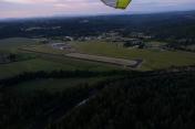
Mulino State Airport
Official FAA Data Effective 2024-12-26 0901Z
VFR Chart of 4S9
Sectional Charts at SkyVector.com
IFR Chart of 4S9
Enroute Charts at SkyVector.com
Location Information for 4S9
Coordinates: N45°12.99' / W122°35.41'Located 20 miles S of Portland-Mulino, Oregon on 275 acres of land. View all Airports in Oregon.
Surveyed Elevation is 259 feet MSL.
Operations Data
|
|
Airport Communications
| CLEARANCE DELIVERY: | 119.95 |
|---|---|
| UNICOM: | 123.050 |
| CTAF: | 123.050 |
| ATIS at UAO (7.8 W): | 118.525 |
| ASOS at UAO (7.9 W): | 118.525 503-678-3011 |
| ATIS at TTD (21.5 N): | 135.625 |
Nearby Navigation Aids
|
| ||||||||||||||||||||||||||||||||||||||||||||||||
Runway 14/32
| Dimensions: | 3425 x 100 feet / 1044 x 30 meters | |
|---|---|---|
| Surface: | Asphalt in Good Condition | |
| Edge Lighting: | Medium Intensity | |
| Runway 14 | Runway 32 | |
| Coordinates: | N45°13.26' / W122°35.55' | N45°12.73' / W122°35.27' |
| Elevation: | 247.8 | 259.9 |
| Traffic Pattern: | Right | |
| Runway Heading: | 159° True | 340° True |
| Markings: | Basic in good condition. | Basic in good condition. |
| Glide Slope Indicator | P2L (3.00° Glide Path Angle) | P2L (3.00° Glide Path Angle) PAPI OTS INDEF. |
| Obstacles: | 77 ft Tree 1002 ft from runway, 194 ft right of center | 212 ft Trees 3059 ft from runway, 138 ft right of center |
Services Available
| Fuel: | 100LL (blue) |
|---|---|
| Transient Storage: | Tiedowns |
| Airframe Repair: | MAJOR |
| Engine Repair: | MAJOR |
| Bottled Oxygen: | NONE |
| Bulk Oxygen: | NONE |
| Other Services: | PILOT INSTRUCTION,PARACHUTE JUMP ACTIVITY,AIRCRAFT RENTAL |
Ownership Information
| Ownership: | Publicly owned | |
|---|---|---|
| Owner: | OREGON DEPARTMENT OF AVIATION | |
| 3040 25TH STREET SE | ||
| SALEM, OR 97302 | ||
| 503-378-4880 | ||
| Manager: | OREGON DEPARTMENT OF AVIATION | |
| 3040 25TH STREET SE | ||
| SALEM, OR 97302 | ||
| 503-378-4880 | ||
Other Remarks
- RY 32 DESIGNATED CALM WIND RY.
- WILDLIFE ON & INVOF OF ARPT.
- BE ALERT FOR WEEKEND GLIDER ACTIVITY.
- SKYDIVING ACTIVITY ON AND IN VICINITY OF AIRPORT. LANDING ZONE 1400' EAST OF RUNWAY.
- FOR CD CTC PORTLAND APCH AT 503-493-7545.
- ACTIVATE MIRL RY 14/32, TWY LGTS, & WINDCONE - CTAF. PAPI RYS 14 & 32 OPR 24 HRS.
Nearby Airports with Instrument Procedures
| ID | Name | Heading / Distance | ||
|---|---|---|---|---|
 |
KUAO | Aurora State Airport | 283° | 7.8 |
 |
KTTD | Portland-Troutdale Airport | 021° | 21.5 |
 |
KPDX | Portland International Airport | 359° | 22.3 |
 |
KMMV | Mc Minnville Municipal Airport | 266° | 23.2 |
 |
KVUO | Pearson Field Airport | 353° | 24.4 |
 |
KHIO | Portland-Hillsboro Airport | 322° | 24.8 |
 |
KSLE | Mcnary Field Airport | 223° | 25.4 |
 |
KSPB | Scappoose Airport | 341° | 35.2 |
 |
S12 | Albany Municipal Airport | 210° | 40.1 |
 |
KCVO | Corvallis Municipal Airport | 214° | 52.5 |
 |
KTMK | Tillamook Airport | 283° | 53.2 |
 |
KKLS | Southwest Washington Regional Airport | 346° | 55.6 |


