Login
Register
9X1
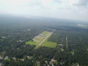
North Houston Airport
Official FAA Data Effective 2021-09-09 0901Z
VFR Chart of 9X1
Sectional Charts at SkyVector.com
IFR Chart of 9X1
Enroute Charts at SkyVector.com
Location Information for 9X1
Coordinates: N30°9.20' / W95°19.32'Located 23 miles N of Houston, Texas on 135 acres of land. View all Airports in Texas.
Estimated Elevation is 125 feet MSL.
Operations Data
|
|
Airport Communications
| CTAF: | 122.800 |
|---|---|
| UNICOM: | 122.800 |
| D-ATIS at IAH (10.2 S): | 124.05 |
| ASOS at IAH (10.4 S): | 281-443-6397 |
| ASOS at CXO (12.9 N): | 118.325 936-760-4237 |
Nearby Navigation Aids
|
| ||||||||||||||||||||||||||||||||||||||||||||||||||||||||||||
Runway 17/35
| Dimensions: | 3594 x 46 feet / 1095 x 14 meters | |
|---|---|---|
| Surface: | Asphalt in Poor Condition PAVEMENT CRACKING & SURFACE IRREGULARITIES. | |
| Edge Lighting: | Low Intensity NSTD LIRL - NSTD COLOR & LAYOUT. | |
| Runway 17 | Runway 35 | |
| Traffic Pattern: | Left | Left |
| Markings: | Non-Standard in poor condition. | Non-Standard in poor condition. |
| Obstacles: | 70 ft Trees 220 ft from runway, 75 ft right of center +33 FT PLINE 175 FT FM THR 150 FT R & L OF CNTRLN; ROAD 190 FT FM THR ACRS APCH; 8 FT FENCE 160 FT FM THR ACRS APCH. |
30 ft Trees 201 ft from runway, 50 ft right of center NUMEROUS SM TREES 50-199 FT DSTC, 50 FT LEFT & RIGHT. |
Services Available
| Fuel: | 100LL (blue) |
|---|---|
| Transient Storage: | Hangars SHADE HNGR AVBL OVNGT PRKG FOR FEE. |
| Airframe Repair: | NOT AVAILABLE |
| Engine Repair: | NOT AVAILABLE |
| Bottled Oxygen: | NOT AVAILABLE |
| Bulk Oxygen: | NOT AVAILABLE |
| Other Services: | AIRCRAFT RENTAL |
Ownership Information
| Ownership: | Privately Owned | |
|---|---|---|
| Owner: | NORTH HOUSTON AIRPORT AVIATION LLC | |
| 20266 AIRFIELD LN | ||
| PORTER, TX 77365 | ||
| 281-572-1111 | NORTHHOUSTONAIRPORT@GMAIL.COM | |
| Manager: | WILLIAM HARKNESS | |
| 20266 AIRFIELD LANE | ||
| PORTER, TX 77365 | ||
| 281-572-1111 | 713-502-2480 (MGR CELL). | |
Operational Statistics
| Single Engine Aircraft Based on Field: | 60 | Statistics collected for 12 month period ending 2020-04-26 | |
|---|---|---|---|
| Multi-Engine Aircraft Based on Field: | none | Annual Commercial Operations: | none |
| Jet Aircraft Based on Field: | none | Annual Commuter Operations: | none |
| Helicopters Based on Field: | none | Annual Air Taxi Operations: | none |
| Military Aircraft Based on Field: | none | Annual Military Operations: | none |
| Gliders Based on Field: | none | Annual GA Local Operations: | 6000 |
| Ultralights Based on Field: | none | Annual GA Itinerant Operations: | 4000 |
Other Remarks
- DEER & ANIMALS ON & INVOF ARPT.
- OBSTN 8 FT FENCE LCTD 160 FT NORTH APCH END RWY 17.
- FOR CD CTC HOUSTON APCH AT 281-443-5844 TO CNL IFR CALL 281-443-5888.
- PARL TWY ADJ RWY 17/35 CLSD TO ACFT WINGSPAN MORE THAN 40 FT.
- ARPT CLSD TO HEL EXCP 1 HR PPR, CTC AMGR 713-502-2480.
- RWY 17/35 MKGS FADED.
- NUMBERS 30 FT TALL.
- NUMBERS 30 FT TALL.
- 0LL 24 HR SELF SVC FUEL AVBL.
- ACTVT LIRL RWY 17/35 - CTAF.
Nearby Airports with Instrument Procedures
| ID | Name | Heading / Distance | ||
|---|---|---|---|---|
 |
KIAH | George Bush Intcntl/Houston Airport | 185° | 10.2 |
 |
KCXO | Conroe-North Houston Regional Airport | 338° | 12.9 |
 |
KDWH | David Wayne Hooks Memorial Airport | 245° | 13.2 |
 |
6R3 | Cleveland Municipal Airport | 053° | 20.3 |
 |
KIWS | West Houston Airport | 222° | 27.1 |
 |
KHPY | Baytown Airport | 138° | 29.2 |
 |
KHOU | William P Hobby Airport | 175° | 30.5 |
 |
T41 | La Porte Municipal Airport | 155° | 31.9 |
 |
T78 | Liberty Municipal Airport | 097° | 32.8 |
 |
KEFD | Ellington Airport | 165° | 33.8 |
 |
54T | Rwj Airpark Airport | 133° | 34.1 |
 |
00R | Livingston Municipal Airport | 026° | 35.6 |


Comments
Airport is CLOSED.
Airport is CLOSED.
William Harkness