Login
Register
3J1
Ridgeland-Claude Dean Airport
Official FAA Data Effective 2026-01-22 0901Z
VFR Chart of 3J1
Sectional Charts at SkyVector.com
IFR Chart of 3J1
Enroute Charts at SkyVector.com
Location Information for 3J1
Coordinates: N32°29.81' / W80°59.59'Located 01 miles NW of Ridgeland, South Carolina on 326 acres of land. View all Airports in South Carolina.
Surveyed Elevation is 84 feet MSL.
Operations Data
|
|
Airport Communications
| AWOS-3PT: | 118.450 Tel. 843-547-8419 |
|---|---|
| CTAF: | 123.075 |
| UNICOM: | 123.075 |
| ATIS at NBC (13.9 E): | 279.525 |
| AWOS-3 at ARW (18.9 E): | 119.675 843-524-1000 |
| ATIS at HXD (22.2 SE): | 121.4 |
Nearby Navigation Aids
|
| ||||||||||||||||||||||||||||||||||||||||||||||||||||||||||||
Runway 18/36
| Dimensions: | 4200 x 75 feet / 1280 x 23 meters | |
|---|---|---|
| Surface: | Asphalt in Excellent Condition | |
| Weight Limits: | S-30, D-45 | |
| Edge Lighting: | Medium Intensity | |
| Runway 18 | Runway 36 | |
| Coordinates: | N32°30.16' / W80°59.56' | N32°29.47' / W80°59.62' |
| Elevation: | 84.8 | 74.9 |
| Traffic Pattern: | Left | Left |
| Runway Heading: | 184° True | 4° True |
| Markings: | Basic in good condition. | Basic in good condition. |
| Glide Slope Indicator | P2L (3.00° Glide Path Angle) RWY 18 PAPI UNUSBL BYD 8 DEGS LEFT OF RCL. | P2L (3.00° Glide Path Angle) |
| REIL: | Yes | Yes |
Services Available
| Fuel: | 100LL (blue), Jet-A, Jet A+ |
|---|---|
| Transient Storage: | Tiedowns |
| Airframe Repair: | MINOR |
| Engine Repair: | MINOR |
| Bottled Oxygen: | NONE |
| Bulk Oxygen: | NONE |
| Other Services: | GLIDER SERVICE,GLIDER TOWING SERVICES |
Ownership Information
| Ownership: | Publicly owned | |
|---|---|---|
| Owner: | COUNTY OF JASPER | |
| P.O. BOX 1149, 358 3RD AVENUE | ||
| RIDGELAND, SC 29936-8785 | ||
| (843) 717-3690 | ||
| Manager: | LEONARD SANSONE | |
| 1765 GRAYS HIGHWAY, PO BOX 653 | ||
| RIDGELAND, SC 29936 | ||
| 843-226-0399 | ||
Other Remarks
- GLIDER OPNS INVOF ARPT.
- FOR CD CTC BEAUFORT APCH AT 843-228-6298, WHEN APCH CLSD CTC JACKSONVILLE ARTCC AT 904-845-1592.
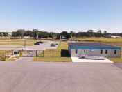
- FBO LCTD MID-FLD.
- RWY 36 CALM WIND RWY.
- SKYBLUE AVIATION FBO.
- JET A WITH PRIST.
- MIRL RWY 18/36 PRESET LOW INTST; TO INCR INTST CTAF. REIL RWY 18 & 36; PAPI RWY 18 & 36 OPR CONSLY DUSK-DAWN.
Nearby Airports with Instrument Procedures
| ID | Name | Heading / Distance | ||
|---|---|---|---|---|
 |
KARW | Beaufort Exec Airport | 105° | 18.9 |
 |
KHXD | Hilton Head Airport | 137° | 22.2 |
 |
KSAV | Savannah/Hilton Head International Airport | 205° | 24.5 |
 |
KSVN | Hunter AAF Airport | 194° | 30.2 |
 |
KRBW | Lowcountry Regional Airport | 034° | 31.0 |
 |
KJYL | Plantation Airpark Airport | 286° | 31.9 |
 |
KAQX | Allendale County Airport | 334° | 33.0 |
 |
KTBR | Statesboro-Bulloch County Airport | 268° | 37.8 |
 |
KLHW | Wright AAF (Fort Stewart)/Midcoast Regional Airport | 218° | 46.6 |
 |
KCWV | Claxton-Evans County Airport | 248° | 48.1 |
 |
6J2 | St George Airport | 030° | 48.5 |
 |
99N | Bamberg County Airport | 353° | 48.7 |


Comments
AWOS
AWOS 118.450 (843) 547 - 8419
FBO Operating Hours
8am - 6pm 7 days per week