Login
Register
76N
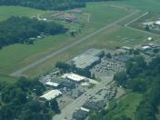
Skyhaven Airport
Official FAA Data Effective 2026-02-19 0901Z
VFR Chart of 76N
Sectional Charts at SkyVector.com
IFR Chart of 76N
Enroute Charts at SkyVector.com
Location Information for 76N
Coordinates: N41°31.69' / W75°56.75'Located 01 miles S of Tunkhannock, Pennsylvania on 100 acres of land. View all Airports in Pennsylvania.
Estimated Elevation is 639 feet MSL.
Operations Data
|
|
Airport Communications
| WILKES-BARRE APPROACH: | 120.95 256.7 |
|---|---|
| WILKES-BARRE DEPARTURE: | 120.95 256.7 |
| UNICOM: | 122.800 |
| CTAF: | 122.800 |
| ATIS at AVP (15.2 SE): | 135.75 |
| ASOS at AVP (15.4 SE): | 570-456-5433 |
| AWOS-3 at N27 (25.7 NW): | 119.925 570-265-1024 |
Nearby Navigation Aids
|
| ||||||||||||||||||||||||||||||||||||||||||||||||||||||
Runway 01/19
| Dimensions: | 2007 x 50 feet / 612 x 15 meters | |
|---|---|---|
| Surface: | Asphalt in Good Condition | |
| Weight Limits: | S-12 | |
| Runway 01 | Runway 19 | |
| Coordinates: | N41°31.53' / W75°56.73' | N41°31.85' / W75°56.78' |
| Elevation: | 639.0 | 619.0 |
| Runway Heading: | 354° True | 174° True |
| Displaced Threshold: | 438 Feet | |
| Markings: | Basic in good condition. | Basic in good condition. |
| Obstacles: | 41 ft Trees 217 ft from runway, 101 ft right of center APCH SLP 15:1 TO DTHR. CTLG OBSTN EXCEEDS A 45 DEG SLP. |
|
Services Available
| Fuel: | 100LL (blue) |
|---|---|
| Transient Storage: | Hangars,Tiedowns |
| Airframe Repair: | MAJOR |
| Engine Repair: | MAJOR |
| Bottled Oxygen: | NONE |
| Bulk Oxygen: | NONE |
| Other Services: | CROP DUSTING SERVICES,ANNUAL SURVEYING |
Ownership Information
| Ownership: | Privately Owned | |
|---|---|---|
| Owner: | SKYHAVEN AIRPORT INC | |
| 17 RUNWAY RD | ||
| TUNKHANNOCK, PA 18657 | ||
| 570-836-4800 | ||
| Manager: | CHARLIE GAY | |
| 626 HUNTER HWY | ||
| TUNKHANNOCK, PA 18657 | ||
| 570-466-0697 | ||
Other Remarks
- FOR CD CTC WILKES-BARRE APCH AT 570-655-2084.
Nearby Airports with Instrument Procedures
| ID | Name | Heading / Distance | ||
|---|---|---|---|---|
 |
9N3 | Seamans Field Airport | 066° | 9.3 |
 |
KWBW | Wilkes-Barre Wyoming Valley Airport | 162° | 14.5 |
 |
KAVP | Wilkes-Barre/Scranton International Airport | 138° | 15.2 |
 |
N27 | Bradford County Airport | 299° | 25.9 |
 |
N30 | Cherry Ridge Airport | 091° | 31.3 |
 |
KHZL | Hazleton Regional Airport | 183° | 32.5 |
 |
KCZG | Tri-Cities Airport | 348° | 33.7 |
 |
KMPO | Pocono Mountains Regional Airport | 132° | 34.7 |
 |
N13 | Bloomsburg Municipal Airport | 215° | 38.8 |
 |
KBGM | Greater Binghamton/Edwin A Link Field Airport | 357° | 40.8 |
 |
22N | Jake Arner Memorial Airport | 168° | 43.9 |
 |
8N8 | Danville Airport | 222° | 47.0 |


