Login
Register


CZK
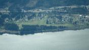
Cascade Locks State Airport
Official FAA Data Effective 2026-02-19 0901Z
Chart Supplement

VFR Chart of KCZK
Sectional Charts at SkyVector.com
IFR Chart of KCZK
Enroute Charts at SkyVector.com
Location Information for KCZK
Coordinates: N45°40.62' / W121°52.73'Located 01 miles NE of Cascade Locks, Oregon on 37 acres of land. View all Airports in Oregon.
Surveyed Elevation is 151 feet MSL.
Operations Data
|
|
Airport Communications
| CTAF: | 122.900 |
|---|---|
| AWOS-3 at 4S2 (14.4 E): | 134.375 541-386-2386 |
| ASOS at TTD (23.2 W): | 135.625 503-492-2887 |
| ATIS at TTD (23.2 W): | 135.625 |
Nearby Navigation Aids
|
| ||||||||||||||||||||||||||||||||||||||||||||||||


Runway 06/24
| Dimensions: | 1800 x 30 feet / 549 x 9 meters | |
|---|---|---|
| Surface: | Asphalt in Good Condition | |
| Weight Limits: | S-4 | |
| Runway 06 | Runway 24 | |
| Traffic Pattern: | Left | Right |
| Markings: | Basic in good condition. | Basic in good condition. |
| Obstacles: | 28 ft Tree 374 ft from runway, 35 ft right of center 25' TREES AT 0-90 FROM RUNWAY END AND 95' LEFT OF CENTERLINE |
10 ft Road 200 ft from runway +5 FT BRUSH & FENCE 40 FT L AT 180 FT. |
Services Available
| Fuel: | NONE |
|---|---|
| Transient Storage: | Tiedowns |
| Airframe Repair: | NONE |
| Engine Repair: | NONE |
| Bottled Oxygen: | NONE |
| Bulk Oxygen: | NONE |
Ownership Information
| Ownership: | Publicly owned | |
|---|---|---|
| Owner: | OREGON DEPARTMENT OF AVIATION | |
| 3040 25TH ST, SE | ||
| SALEM, OR 97310 | ||
| 503-378-4880 | ||
| Manager: | STATE AIRPORT MANAGER | |
| 3040 25TH ST, SE | ||
| SALEM, OR 97310 | ||
| 503-378-4880 | ||
Other Remarks
- OWNER ADVISES CTC OREGON DEPT OF AVIATION 503-378-4880 PRIOR TO USE.
- (E94) OBSVR REPORTS READING TO USWB BY TELEPHONE.
- UNLGTD POWER LINES 3 NM SW OF ARPT.
- TERRAIN DROPS OFF RAPIDLY TO THE WEST.
- RY SURROUNDED BY TREES. CROSSWINDS CAN PRODUCE EXTREME LOW LEVEL TURBULENCE AND UNEXPECTED WIND CURRENTS.
- SURFACE CONDITIONS NOT REPORTED.
- FOR CD CTC PORTLAND APCH AT 503-493-7545.
Nearby Airports with Instrument Procedures
| ID | Name | Heading / Distance | ||
|---|---|---|---|---|
 |
KTTD | Portland-Troutdale Airport | 250° | 23.3 |
|
KDLS | Columbia Gorge Regional/The Dalles Municipal Airport | 096° | 30.1 |
|
KPDX | Portland International Airport | 260° | 30.7 |
|
KVUO | Pearson Field Airport | 264° | 32.9 |
|
KSPB | Scappoose Airport | 278° | 41.7 |
|
KUAO | Aurora State Airport | 235° | 45.6 |
|
KHIO | Portland-Hillsboro Airport | 260° | 45.9 |
|
KKLS | Southwest Washington Regional Airport | 302° | 50.3 |
|
KMMV | Mc Minnville Municipal Airport | 241° | 60.5 |
|
KTDO | Ed Carlson Memorial Field/South Lewis County Airport | 321° | 61.7 |
|
KSLE | Mcnary Field Airport | 226° | 66.2 |
|
S33 | Madras Municipal Airport | 152° | 67.8 |
Airport Images

By: henderson503
By: blendy


