Login
Register
WV21
Needwood Farm Airport
Official FAA Data Effective 2025-12-25 0901Z
VFR Chart of WV21
Sectional Charts at SkyVector.com
IFR Chart of WV21
Enroute Charts at SkyVector.com
Location Information for WV21
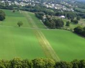
Coordinates: N39°19.83' / W77°47.68'Located 03 miles W of Harpers Ferry, West Virginia on 15 acres of land. View all Airports in West Virginia.
Estimated Elevation is 440 feet MSL.
Operations Data
|
|
Airport Communications
| ASOS at MRB (9.5 NW): | 119.925 304-264-0988 |
|---|---|
| AWOS-3 at JYO (18.8 SE): | 125.225 703-777-3781 |
| AWOS-3 at OKV (19.8 SW): | 124.85 540-662-6970 |
Nearby Navigation Aids
|
| ||||||||||||||||||||||||||||||||||||||||||||||||||||||||||||
Runway 02/20
| Dimensions: | 2000 x 75 feet / 610 x 23 meters | |
|---|---|---|
| Surface: | Turf in Fair Condition | |
| Runway 02 | Runway 20 | |
| Obstacles: | 40 ft Trees 600 ft from runway 40 FT TREES 300 FT FM S END OF RWY. |
40 ft Trees 100 ft from runway |
Ownership Information
| Ownership: | Privately Owned | |
|---|---|---|
| Owner: | JAMES GIBSON | |
| 201 NEEDWOOD FARM LN | ||
| HARPERS FERRY, WV 25425 | ||
| 304-725-2688 | ||
| Manager: | JAMES GIBSON | |
| 201 NEEDWOOD FARM LN | ||
| HARPERS FERRY, WV 25425 | ||
| 304-725-2688 | ||
Other Remarks
- 199 FT CELL TWR 1 MILE NW.
- FOR CD CTC POTOMAC APCH AT 866-709-4993.
Nearby Airports with Instrument Procedures
| ID | Name | Heading / Distance | ||
|---|---|---|---|---|
 |
KMRB | Eastern Wv Regional/Shepherd Field Airport | 296° | 9.8 |
 |
KJYO | Leesburg Exec Airport | 143° | 18.8 |
 |
KOKV | Winchester Regional Airport | 235° | 19.8 |
 |
KFDK | Frederick Municipal Airport | 075° | 20.2 |
 |
KHGR | Hagerstown Regional/Richard A Henson Field Airport | 007° | 22.9 |
 |
W35 | Potomac Airpark Airport | 321° | 27.7 |
 |
KIAD | Washington Dulles International Airport | 145° | 27.8 |
 |
W50 | Davis Airport | 099° | 30.4 |
 |
KGAI | Montgomery County Airpark Airport | 108° | 30.9 |
 |
KFRR | Front Royal-Warren County Airport | 221° | 32.7 |
 |
2W2 | Clearview Airpark Airport | 077° | 37.1 |
 |
KHEF | Manassas Regional/Harry P Davis Field Airport | 160° | 38.8 |


