Login
Register
15PA
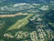
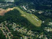
Pittsburgh-Monroeville Airport
Official FAA Data Effective 2023-02-23 0901Z
VFR Chart of 15PA
Sectional Charts at SkyVector.com
IFR Chart of 15PA
Enroute Charts at SkyVector.com
Location Information for 15PA
Coordinates: N40°27.16' / W79°46.50'Located 01 miles N of Monroeville, Pennsylvania on 58 acres of land. View all Airports in Pennsylvania.
Estimated Elevation is 1187 feet MSL.
Operations Data
|
|
Airport Communications
| CTAF: | 122.900 |
|---|---|
| ATIS at AGC (9.2 SW): | 120.55 |
| ASOS at AGC (9.2 SW): | 120.55 412-466-8968 |
| AWOS-A at 42PN (10.5 W): | 412-442-2213 |
Nearby Navigation Aids
|
| ||||||||||||||||||||||||||||||||||||||||||||||||||||||||||||
Runway 05/23
| Dimensions: | 2280 x 28 feet / 695 x 9 meters | |
|---|---|---|
| Surface: | Asphalt in Failed Condition RWY 05/23 UNSAFE. PAVEMENT IN DISREPAIR. | |
| Runway 05 | Runway 23 | |
| Coordinates: | N40°27.01' / W79°46.65' | N40°27.30' / W79°46.34' |
| Elevation: | 1158.0 | 1179.0 |
| Traffic Pattern: | Left | Right |
| Runway Heading: | 40° True | 220° True |
| Markings: | Non-Standard in fair condition. | Non-Standard in fair condition. |
| Obstacles: | 40 ft Trees 216 ft from runway, 64 ft right of center | 12 ft Trees 320 ft from runway, 65 ft right of center |
Services Available
| Fuel: | NONE |
|---|---|
| Transient Storage: | Hangars,Tiedowns |
| Airframe Repair: | NONE |
| Engine Repair: | NONE |
| Bottled Oxygen: | NONE |
| Bulk Oxygen: | NONE |
Ownership Information
| Ownership: | Privately Owned | |
|---|---|---|
| Owner: | ESTATE OF HELEN M. BROWN | |
| 2401 TILBROOK ROAD | ||
| MONROEVILLE, PA 15146 | ||
| (412) 372-5031 | ||
| Manager: | ||
Operational Statistics
| Single Engine Aircraft Based on Field: | 8 | Statistics collected for 12 month period ending 2017-01-27 | |
|---|---|---|---|
| Multi-Engine Aircraft Based on Field: | none | Annual Commercial Operations: | none |
| Jet Aircraft Based on Field: | none | Annual Commuter Operations: | none |
| Helicopters Based on Field: | none | Annual Air Taxi Operations: | none |
| Military Aircraft Based on Field: | none | Annual Military Operations: | 8 |
| Gliders Based on Field: | none | Annual GA Local Operations: | 1000 |
| Ultralights Based on Field: | none | Annual GA Itinerant Operations: | 974 |
Other Remarks
- DEER ON AND IN VICINITY OF AIRPORT
- RY NOT MAINTAINED DURING WINTER MONTHS.
- FOR CD CTC PITTSBURGH APCH AT 412-472-5591
- RWY 05/23 EXTSV CRACKS, UNEVEN PATCHES AND CRUMBLING PAVEMENT.
- RY CNTRLN IS A SOLID WHITE LINE.
- RY CNTRLN IS A SOLID WHITE LINE.
Nearby Airports with Instrument Procedures
| ID | Name | Heading / Distance | ||
|---|---|---|---|---|
 |
KAGC | Allegheny County Airport | 230° | 9.2 |
 |
KFWQ | Rostraver Airport | 190° | 14.8 |
 |
G05 | Finleyville Airpark Airport | 221° | 16.4 |
 |
6P7 | Mcville Airport | 025° | 18.8 |
 |
KLBE | Arnold Palmer Regional Airport | 122° | 19.9 |
 |
KPIT | Pittsburgh International Airport | 276° | 21.1 |
 |
KBTP | Pittsburgh/Butler Regional Airport | 337° | 21.0 |
 |
KPJC | Zelienople Municipal Airport | 320° | 27.4 |
 |
KVVS | Joseph A Hardy Connellsville Airport | 169° | 30.1 |
 |
KAFJ | Washington County Airport | 231° | 30.3 |
 |
KIDI | Indiana County/Jimmy Stewart Field Airport | 070° | 32.6 |
 |
KBVI | Beaver County Airport | 304° | 34.1 |


