Login
Register
18GE
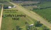
Lefty's Landing Airport
Official FAA Data Effective 2025-11-27 0901Z
VFR Chart of 18GE
Sectional Charts at SkyVector.com
IFR Chart of 18GE
Enroute Charts at SkyVector.com
Location Information for 18GE
Coordinates: N32°2.73' / W82°28.06'Located 03 miles E of Uvalda, Georgia. View all Airports in Georgia.
Estimated Elevation is 230 feet MSL.
Operations Data
|
|
Airport Communications
| CTAF: | 122.900 |
|---|---|
| AWOS-3 at VDI (10.1 NE): | 119.925 912-538-0219 |
| AWOS-3 at AZE (13.5 SW): | 119.125 (912) 375-0650 |
| AWOS-3PT at RVJ (16.2 E): | 128.325 912-557-0011 |
Nearby Navigation Aids
|
| ||||||||||||||||||||||||||||||||||||||||||||||||||||||||||||
Runway 16/34
| Dimensions: | 2242 x 100 feet / 683 x 30 meters | |
|---|---|---|
| Surface: | Turf in Good Condition | |
| Edge Lighting: | Non-Standard | |
| Runway 16 | Runway 34 | |
| Coordinates: | N32°2.90' / W82°28.14' | N32°2.56' / W82°27.98' |
| Elevation: | 221.2 | 227.5 |
| Runway Heading: | 157° True | 337° True |
| Displaced Threshold: | 121 Feet | 119 Feet |
| Markings: | None | None |
Ownership Information
| Ownership: | Privately Owned | |
|---|---|---|
| Owner: | HOLLERA T NIELSEN | |
| 1844 GEORGE DAVIS RD | ||
| UVALDA, GA 30473 | ||
| 407-353-4141 | ||
| Manager: | HOLLERA T NIELSEN | |
| 1844 GEORGE DAVIS RD | ||
| UVALDA, GA 30473 | ||
| 407-353-4141 | ||
Other Remarks
- PRVDD VFR OPS.
Nearby Airports with Instrument Procedures
| ID | Name | Heading / Distance | ||
|---|---|---|---|---|
 |
KVDI | Vidalia Regional Airport | 029° | 10.1 |
 |
KAZE | Hazlehurst Airport | 223° | 13.3 |
 |
KRVJ | Swinton Smith Field At Reidsville Municipal Airport | 086° | 16.0 |
 |
KBHC | Baxley Municipal Airport | 169° | 20.2 |
 |
KMQW | Telfair-Wheeler Airport | 278° | 21.2 |
 |
KMHP | John Edwin Jones Sr Field/Metter Municipal Airport | 044° | 27.8 |
 |
KAMG | Bacon County Airport | 183° | 30.6 |
 |
KCWV | Claxton-Evans County Airport | 073° | 31.8 |
 |
KSBO | East Georgia Regional Airport | 008° | 34.1 |
 |
KEZM | Heart of Georgia Regional Airport | 287° | 35.2 |
 |
KDQH | Douglas Municipal Airport | 210° | 39.5 |
 |
KDBN | W H 'Bud' Barron Airport | 319° | 40.7 |


