Login
Register


1K1
Lloyd Stearman Field Airport
Official FAA Data Effective 2026-01-22 0901Z
Chart Supplement

VFR Chart of 1K1
Sectional Charts at SkyVector.com
IFR Chart of 1K1
Enroute Charts at SkyVector.com
Location Information for 1K1
Coordinates: N37°46.47' / W97°6.79'Located 01 miles SW of Benton, Kansas on 44 acres of land. View all Airports in Kansas.
Surveyed Elevation is 1364 feet MSL.
Operations Data
|
|
Airport Communications
| AWOS-2: | 118.3 Tel. 316-530-6004 |
|---|---|
| WICHITA APPROACH: | 134.8 269.1 |
| WICHITA DEPARTURE: | 134.8 269.1 |
| CLEARANCE DELIVERY: | 125.0 |
| UNICOM: | 123.075 |
| CTAF: | 123.075 |
| ASOS at AAO (5.4 W): | 134.025 316-636-2541 |
| AWOS-3P at 3AU (6.4 S): | 124.175 316-733-6696 |
| AWOS-3PT at BEC (6.8 SW): | 119.45 316-515-7116 |
Nearby Navigation Aids
|
| ||||||||||||||||||||||||||||||||||||||||||||||||||||||||||||


Runway 17/35
| Dimensions: | 5106 x 75 feet / 1556 x 23 meters | |
|---|---|---|
| Surface: | Asphalt in Good Condition | |
| Edge Lighting: | High Intensity | |
| Runway 17 | Runway 35 | |
| Coordinates: | N37°46.89' / W97°6.83' | N37°46.05' / W97°6.76' |
| Elevation: | 1364.1 | 1349.1 |
| Traffic Pattern: | Right | Left |
| Runway Heading: | 176° True | 356° True |
| Displaced Threshold: | 242 Feet | |
| Markings: | Non-Precision Instrument in good condition. | Non-Precision Instrument in good condition. |
| Glide Slope Indicator | P2L (3.00° Glide Path Angle) | |
| Obstacles: | 47 ft Trees 530 ft from runway, 240 ft right of center OBSTN CLNC SLOPE 0:1 TO DTHR OVR 25 FT BLDG, 0 FT DSTC, 200 FT L. 17 FT RD 38 FT DSTC, 125 FT L/R; 31 FT TREE, 1 FT DSTC, 190 FT R. |
24 ft Hangar 0 ft from runway, 218 ft right of center OBSTN CLNC SLOPE 0:1 TO DTHR OVR 25 FT BLDG, 0 FT DSTC, 200 FT L. 24 FT HGR, 0-199 FT DSTC, 218 FT R; 23 FT WINDSOCK, 132 FT DSTC, 118 FT R. |
Services Available
| Fuel: | 100LL (blue), Jet A+ |
|---|---|
| Transient Storage: | Hangars,Tiedowns |
| Airframe Repair: | NOT AVAILABLE |
| Engine Repair: | NOT AVAILABLE |
| Bottled Oxygen: | NOT AVAILABLE |
| Bulk Oxygen: | NOT AVAILABLE |
Ownership Information
| Ownership: | Privately Owned | |
|---|---|---|
| Owner: | BENTON AIRPARK INC. | |
| 14789 SOUTHWEST 30TH. STREET | ||
| BENTON, KS 67017 | ||
| 316-636-9700 | ||
| Manager: | DWAYNE CLEMENS | |
| 14789 SOUTHWEST 30TH. STREET | ||
| BENTON, KS 67017 | ||
| 316-648-0132 | ||
Other Remarks
- 70 FT WIDE CONC TWY TURN OFF MIDFIELD.
- FOR CD CTC WICHITA APCH AT 316-350-1520.
- UNCTLD VEHICLE TFC INVOF HANGARS & ON TWYS. BACK TAX ON RWY WHEN ABLE.
- ULTRALIGHT ACFT PPR.
- TWIN & LRGR BACK TAXI ON RWY.
- 0LL 100 LL 24 HR SELF SERVE. JET A+ REQ 24 HRS IN ADV.
Weather Minimums

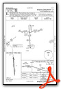
Instrument Approach Procedure (IAP) Charts
Nearby Airports with Instrument Procedures
| ID | Name | Heading / Distance | ||
|---|---|---|---|---|
 |
KAAO | Colonel James Jabara Airport | 252° | 5.4 |
|
3AU | Augusta Municipal Airport | 165° | 6.5 |
|
KBEC | Beech Factory Airport | 225° | 6.8 |
|
KCEA | Cessna Acft Field Airport | 220° | 10.0 |
|
KIAB | Mc Connell AFB Airport | 219° | 11.7 |
|
K50 | Cook Airfield Airport | 193° | 12.9 |
|
KEQA | El Dorado/Capt Jack Thomas Memorial Airport | 089° | 14.1 |
|
KICT | Wichita Dwight D Eisenhower Ntl Airport | 243° | 17.0 |
|
KEWK | Newton-City-County Airport | 335° | 18.6 |
|
KEGT | Wellington Municipal Airport | 206° | 30.0 |
|
47K | Moundridge Municipal Airport | 324° | 31.9 |
|
KWLD | Strother Field Airport | 174° | 36.5 |
Airport Images

By: skydvrboy


