Login
Register


27WI
Fox River Airport
Official FAA Data Effective 2026-02-19 0901Z
VFR Chart of 27WI
Sectional Charts at SkyVector.com
IFR Chart of 27WI
Enroute Charts at SkyVector.com
Location Information for 27WI
Coordinates: N42°45.06' / W88°15.02'Located 02 miles NW of Rochester, Wisconsin on 20 acres of land. View all Airports in Wisconsin.
Estimated Elevation is 822 feet MSL.
Operations Data
|
|
Airport Communications
| CTAF: | 122.900 |
|---|---|
| AWOS-3 at BUU (4.3 SW): | 125.275 262-757-0907 |
| AWOS-3PT at 57C (5.8 NW): | 118.125 262-642-1845 |
| ASOS at ENW (16.6 SE): | 262-652-7730 |
Nearby Navigation Aids
|
| ||||||||||||||||||||||||||||||||||||||||||||||||


Runway 18/36
| Dimensions: | 2506 x 36 feet / 764 x 11 meters RWY ASPH IS 10-15'WIDER LAST 300'EA END. | |
|---|---|---|
| Surface: | Asphalt in Fair Condition | |
| Runway 18 | Runway 36 | |
| Coordinates: | N42°45.26' / W88°15.04' | N42°44.85' / W88°15.01' |
| Elevation: | 822.0 | 822.0 |
| Traffic Pattern: | Left | Left |
| Markings: | Basic in fair condition. | Basic in fair condition. |
| Obstacles: | 54 ft Trees 960 ft from runway, 100 ft right of center | |
Ownership Information
| Ownership: | Privately Owned | |
|---|---|---|
| Owner: | JERRY KAY MEHLHAFF JR. | |
| PO BOX 37 | EMAIL ADDRESS: JERRYMJR@TDS.NET | |
| ROCHESTER, WI 53167 | ||
| 262-534-6315 | ||
| Manager: | JERRY KAY MEHLHAFF JR. | |
| PO BOX 37 | ||
| ROCHESTER, WI 53167 | ||
| 262-534-6315 | ||
Other Remarks
- FOR CD CTC CHICAGO ARTCC AT 630-906-8921.
Nearby Airports with Instrument Procedures
| ID | Name | Heading / Distance | ||
|---|---|---|---|---|
 |
KBUU | Burlington Municipal Airport | 213° | 4.3 |
|
57C | East Troy Municipal Airport | 297° | 6.1 |
|
C02 | Grand Geneva Resort Airport | 217° | 10.2 |
|
KENW | Kenosha Regional Airport | 122° | 17.1 |
|
KUES | Waukesha County Airport | 001° | 17.4 |
|
KRAC | Batten International Airport | 088° | 19.3 |
|
KMKE | General Mitchell International Airport | 052° | 19.5 |
|
10C | Galt Field Airport | 194° | 21.6 |
|
KMWC | Lawrence J Timmerman Airport | 023° | 23.6 |
|
KUGN | Waukegan Ntl Airport | 139° | 26.0 |
|
C81 | Campbell Airport | 162° | 26.7 |
|
61C | Fort Atkinson Municipal Airport | 297° | 28.1 |
Airport Images
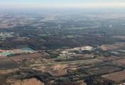
By: james_sm


